MyTopo
Blanchard Ranch Montana US Topo Map
Couldn't load pickup availability
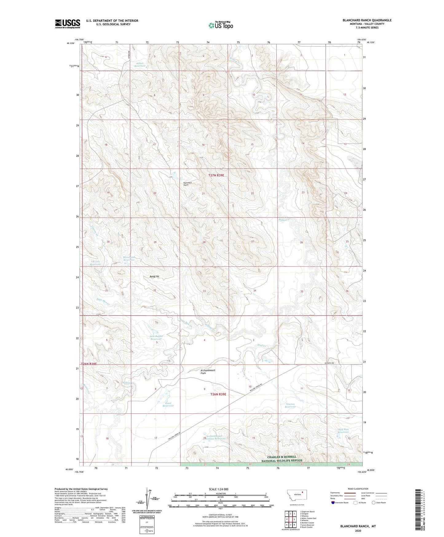
2024 topographic map quadrangle Blanchard Ranch in the state of Montana. Scale: 1:24000. Based on the newly updated USGS 7.5' US Topo map series, this map is in the following counties: Valley. The map contains contour data, water features, and other items you are used to seeing on USGS maps, but also has updated roads and other features. This is the next generation of topographic maps. Printed on high-quality waterproof paper with UV fade-resistant inks.
Quads adjacent to this one:
West: Miller Coulee East
Northwest: Engstrom Ranch
North: Glasgow
Northeast: Whately
East: Wheeler
Southeast: Skunk Coulee
South: Lewis Reservoir
Southwest: Bomber Coulee
This map covers the same area as the classic USGS quad with code o48106a6.
Contains the following named places: 26N39E01CCBC01 Well, 28N39E35ADBA01 Well, Aitken Reservoir, Archambeault Flats, Archambeault Ranch, Archambeault Retention Dam, Archambeault Retention Reservoir, Baldy Pit, Beaver Creek, Blanchard Detention Reservoir Dam, Blanchard Ranch, Blanchard Reservoir, Coyote Creek, Jack Rabbit Reservoir, Mud Creek, Mud Run Reservoir, Newton Reservoir, Road Reservoir, Road Reservoir Dam, Sage Hen Creek, VR-105 Reservoir, Whodiky Dam, Willow Bend School