MyTopo
Goldstone Pass Montana US Topo Map
Couldn't load pickup availability
Also explore the Goldstone Pass Forest Service Topo of this same quad for updated USFS data
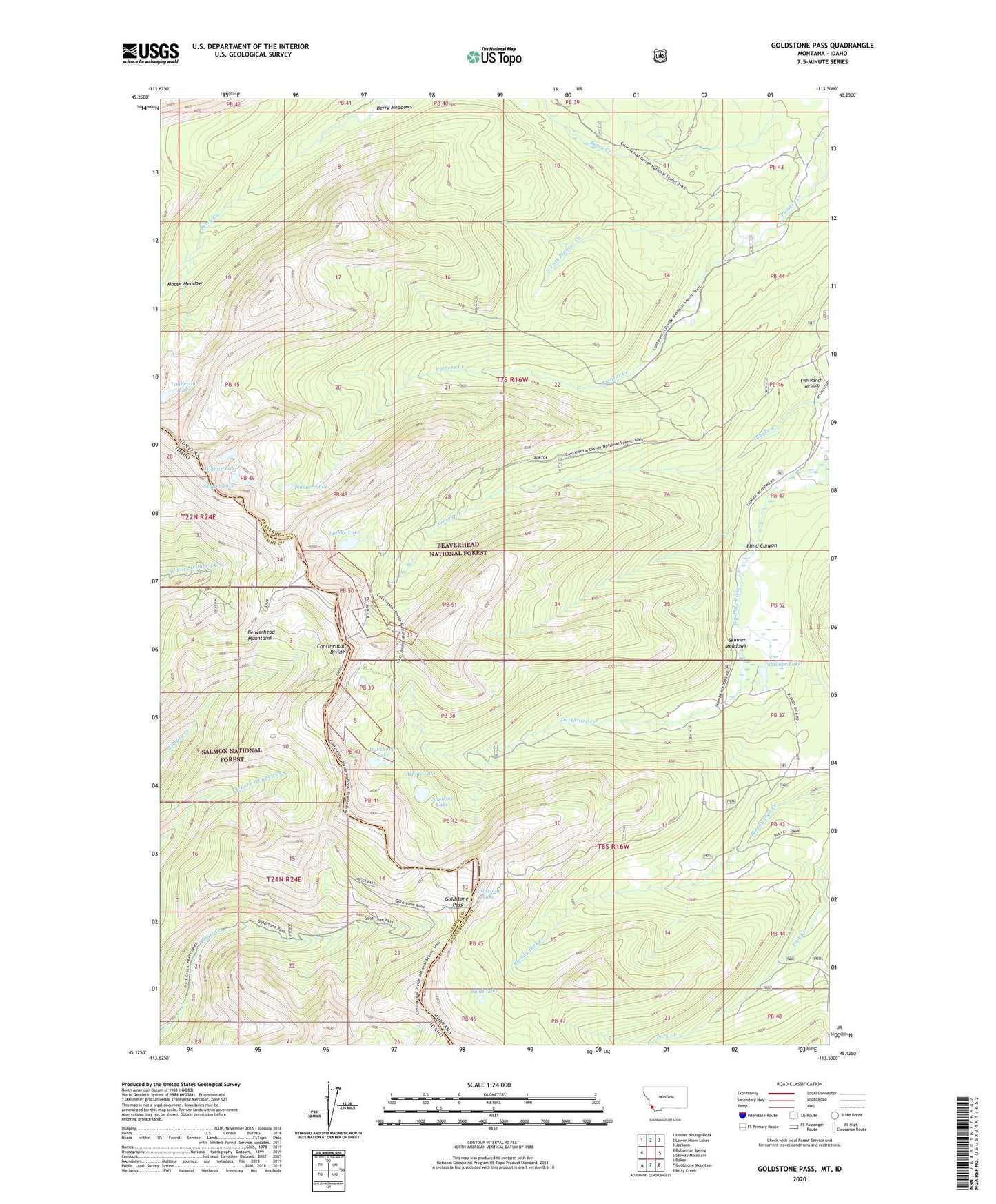
2024 topographic map quadrangle Goldstone Pass in the states of Idaho, Montana. Scale: 1:24000. Based on the newly updated USGS 7.5' US Topo map series, this map is in the following counties: Beaverhead, Lemhi. The map contains contour data, water features, and other items you are used to seeing on USGS maps, but also has updated roads and other features. This is the next generation of topographic maps. Printed on high-quality waterproof paper with UV fade-resistant inks.
Quads adjacent to this one:
West: Bohannon Spring
Northwest: Homer Youngs Peak
North: Lower Miner Lakes
Northeast: Jackson
East: Selway Mountain
Southeast: Kitty Creek
South: Goldstone Mountain
Southwest: Baker
This map covers the same area as the classic USGS quad with code o45113b5.
Contains the following named places: Alpine Lake, Berry Meadows, Blind Canyon, Copper Queen Mine, Cowbone Lake, Darkhorse Creek, Darkhorse Lake, Darkhorse Mine, Goldstone Lake, Goldstone Mine, Goldstone Pass, Highup Lake, HRS Claim Mine, Jahnke Mine, Janhke Lake, Moose Meadow, North Fork Pioneer Creek, Pioneer Lake, Skinner Lake, Skinner Meadows, Skytop Lake, Swift Lake, Timberline Lake