MyTopo
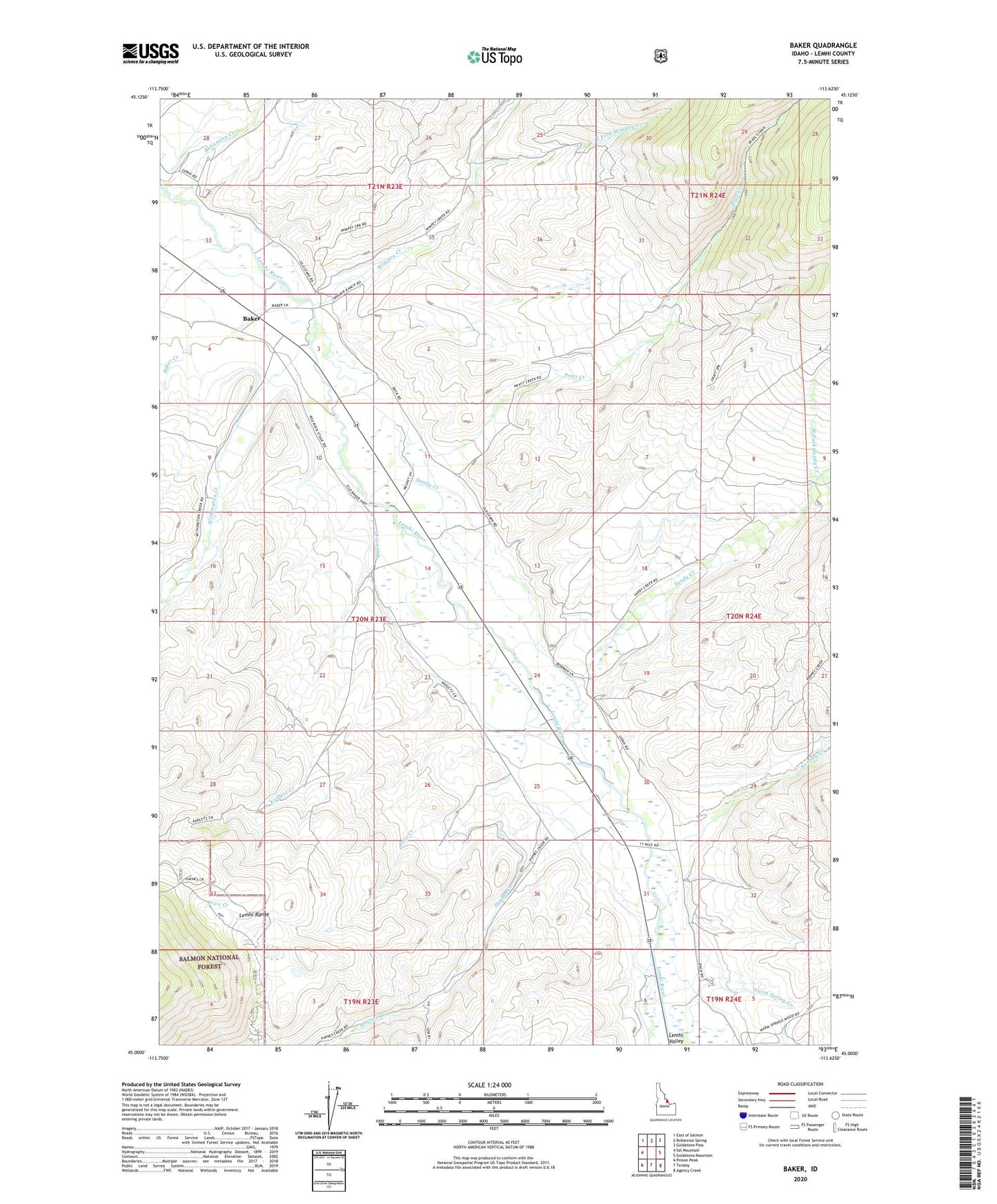
Baker Idaho US Topo Map
Couldn't load pickup availability
Also explore the Baker Forest Service Topo of this same quad for updated USFS data
2024 topographic map quadrangle Baker in the state of Idaho. Scale: 1:24000. Based on the newly updated USGS 7.5' US Topo map series, this map is in the following counties: Lemhi. The map contains contour data, water features, and other items you are used to seeing on USGS maps, but also has updated roads and other features. This is the next generation of topographic maps. Printed on high-quality waterproof paper with UV fade-resistant inks.
Quads adjacent to this one:
West: Sal Mountain
Northwest: East of Salmon
North: Bohannon Spring
Northeast: Goldstone Pass
East: Goldstone Mountain
Southeast: Agency Creek
South: Tendoy
Southwest: Poison Peak
This map covers the same area as the classic USGS quad with code o45113a6.
Contains the following named places: Baker, Baker Creek, Bohannon Creek, East Fork Wimpey Creek, Haynes Creek, Kadletz Creek, Kenney Creek, Pratt Creek, Price Creek, Sandy Creek, Sandy Creek School, Warm Spring Creek, West Fork Sandy Creek, Wimpey Creek, Withington Creek