MyTopo
Greenfield Montana US Topo Map
Couldn't load pickup availability
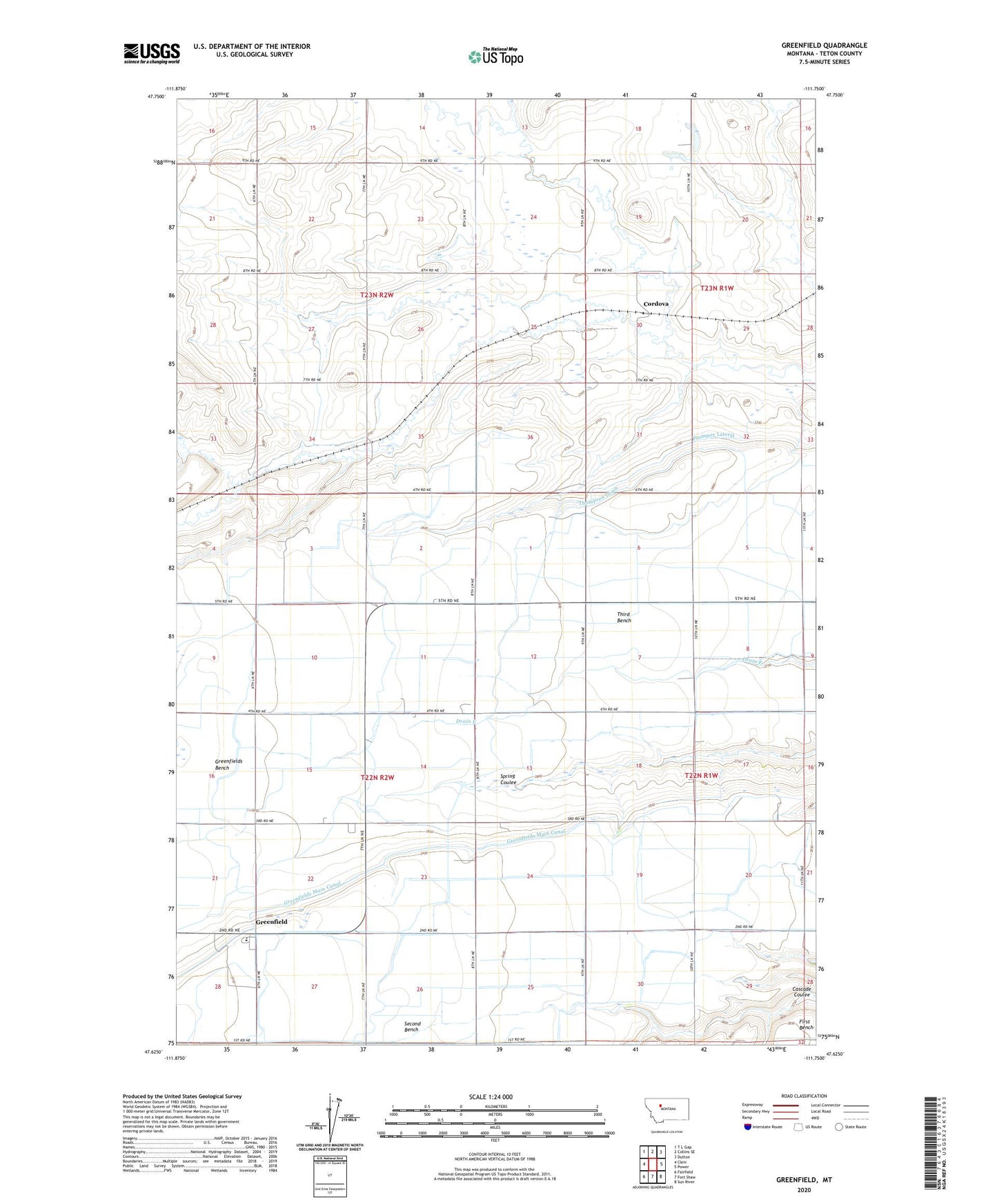
2020 topographic map quadrangle Greenfield in the state of Montana. Scale: 1:24000. Based on the newly updated USGS 7.5' US Topo map series, this map is in the following counties: Teton. The map contains contour data, water features, and other items you are used to seeing on USGS maps, but also has updated roads and other features. This is the next generation of topographic maps. Printed on high-quality waterproof paper with UV fade-resistant inks.
Quads adjacent to this one:
West: Cleiv
Northwest: T L Gap
North: Collins SE
Northeast: Dutton
East: Power
Southeast: Sun River
South: Fort Shaw
Southwest: Fairfield
Contains the following named places: 22N01W29C___01 Well, 22N02W24CCD_01 Well, Cascade Coulee, Cloudy Day Dam, Cook School, Cordova, Cordova Post Office, Fairview School, GM 100 Drain, Greenfield, Greenfield School, Helgeson School, Plummer Lateral, Second Bench, Third Bench, Thompson Drain, Void School