MyTopo
Fairfield Montana US Topo Map
Couldn't load pickup availability
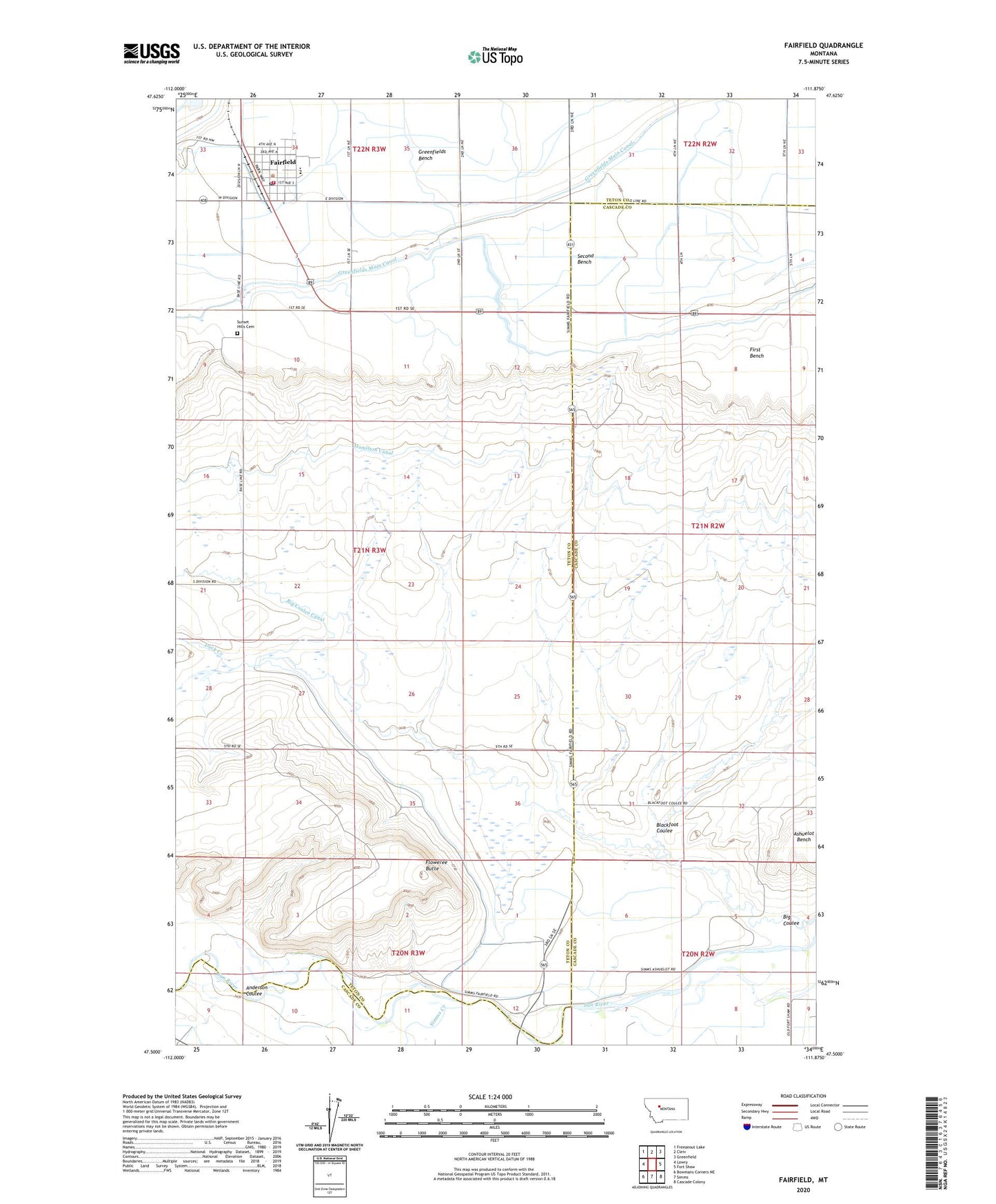
2024 topographic map quadrangle Fairfield in the state of Montana. Scale: 1:24000. Based on the newly updated USGS 7.5' US Topo map series, this map is in the following counties: Teton, Cascade. The map contains contour data, water features, and other items you are used to seeing on USGS maps, but also has updated roads and other features. This is the next generation of topographic maps. Printed on high-quality waterproof paper with UV fade-resistant inks.
Quads adjacent to this one:
West: Lowry
Northwest: Freezeout Lake
North: Cleiv
Northeast: Greenfield
East: Fort Shaw
Southeast: Cascade Colony
South: Simms
Southwest: Bowmans Corners NE
This map covers the same area as the classic USGS quad with code o47111e8.
Contains the following named places: 20N03W04D___01 Well, 20N03W10A___01 Well, 21N02W20C___01 Well, 21N03W03CBBA01 Well, 21N03W03CBCB01 Well, 21N03W03CBCC01 Well, 21N03W04AAAA01 Well, 21N03W04AAAB01 Well, 21N03W04DADD01 Well, 21N03W09AAAA01 Well, 22N03W33DBBB01 Well, 22N03W34ADDD01 Well, 22N03W34CCBB01 Well, 22N03W35BCCC01 Well, 22N03W35C___01 Well, 22N03W35D___01 Well, Anderson Coulee, Assembly of God Church, Big Coulee, Big Coulee Canal, Blackfoot Coulee, Busch Agricultural Resources Elevator, Duck Creek, Fairfield, Fairfield Ambulance, Fairfield Faith Bible Church, Fairfield Medical Office, Fairfield Mennonite Church, Fairfield Mennonite School, Fairfield Police Department, Fairfield Post Office, Fairfield Public Library, Fairfield Public Schools, Fairfield Volunteer Fire Department, Floweree Butte, Genger School, Grace Lutheran Church, Greenfield South Canal, Greenfields Main Canal, Hamilton Canal, Harvest Hills Golf Course, Saint Johns Catholic Church, Simms Creek, Sunset Hills Cemetery, The Church of Jesus Christ of Latter Day Saints, Town of Fairfield, United Church of Christ Congregational