MyTopo
Hafla School Montana US Topo Map
Couldn't load pickup availability
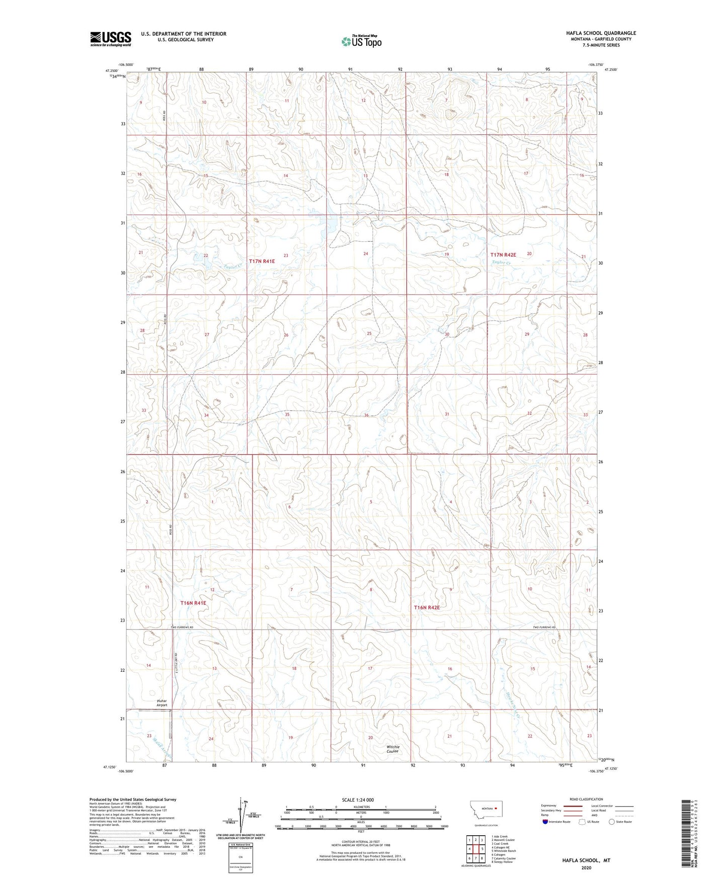
2024 topographic map quadrangle Hafla School in the state of Montana. Scale: 1:24000. Based on the newly updated USGS 7.5' US Topo map series, this map is in the following counties: Garfield. The map contains contour data, water features, and other items you are used to seeing on USGS maps, but also has updated roads and other features. This is the next generation of topographic maps. Printed on high-quality waterproof paper with UV fade-resistant inks.
Quads adjacent to this one:
West: Cohagen NE
Northwest: Ada Creek
North: Maxwell Coulee
Northeast: Coal Creek
East: Whiteside Ranch
Southeast: Sleepy Hollow
South: Calamity Coulee
Southwest: Cohagen
This map covers the same area as the classic USGS quad with code o47106b4.
Contains the following named places: 16N42E06B___01 Well, 16N42E08DCCB01 Well, 16N42E15BAAC01 Well, 17N41E33D___01 Well, 17N41E34B___01 Well, Hafla School, Pluhar Airport, Pluhar School, Ross Dam, Ross Number 2 Dam, Taylor Creek Post Office, Taylor Creek School