MyTopo
Harlowton SW Montana US Topo Map
Couldn't load pickup availability
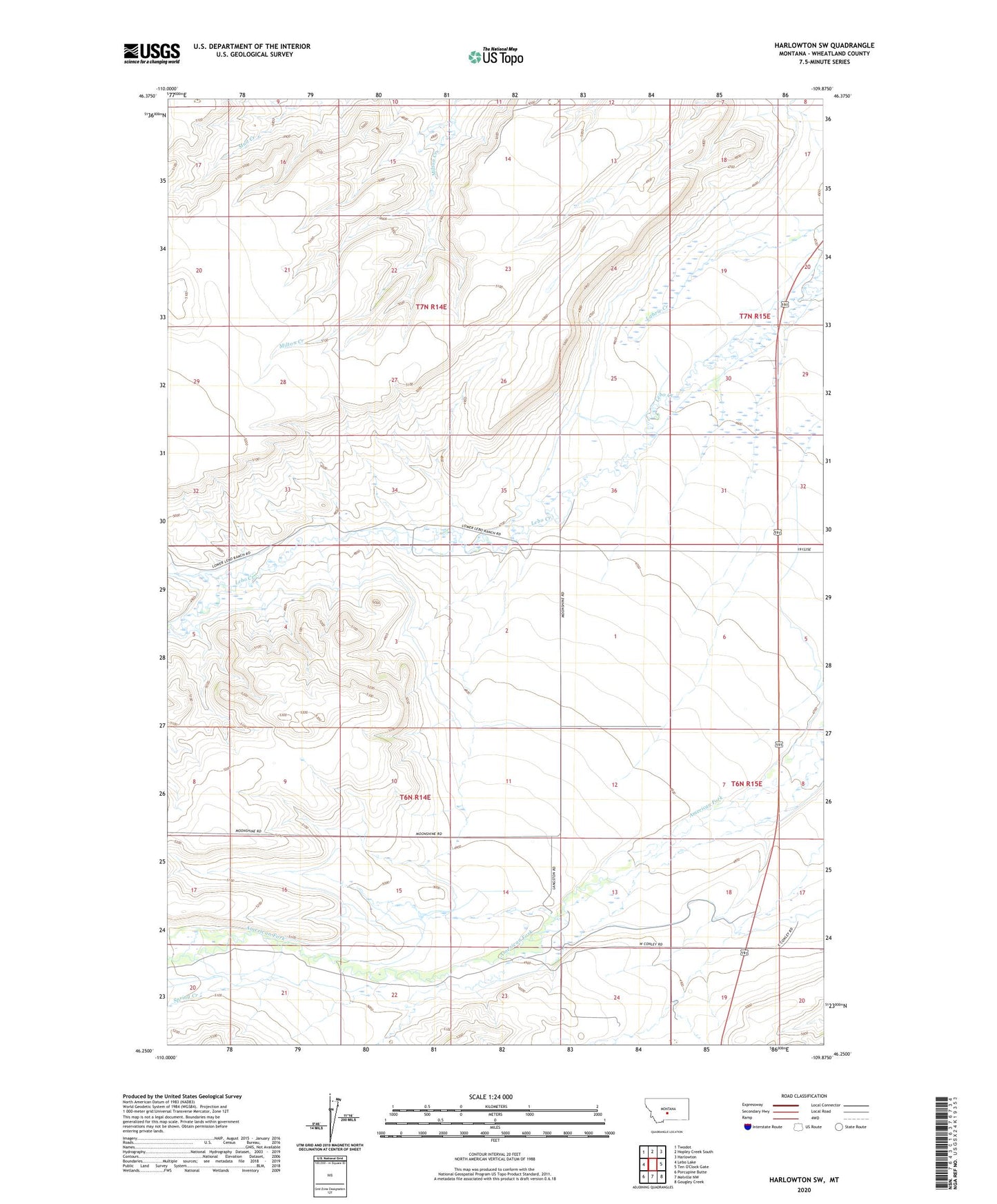
2024 topographic map quadrangle Harlowton SW in the state of Montana. Scale: 1:24000. Based on the newly updated USGS 7.5' US Topo map series, this map is in the following counties: Wheatland. The map contains contour data, water features, and other items you are used to seeing on USGS maps, but also has updated roads and other features. This is the next generation of topographic maps. Printed on high-quality waterproof paper with UV fade-resistant inks.
Quads adjacent to this one:
West: Lebo Lake
Northwest: Twodot
North: Hopley Creek South
Northeast: Harlowton
Southeast: Gougley Creek
South: Melville NW
Southwest: Porcupine Butte
This map covers the same area as the classic USGS quad with code o46109c8.
Contains the following named places: 06N14E01B___01 Well, 06N14E01C___01 Well, 06N14E02D___01 Well, 06N14E04DCAA01 Well, 06N14E09DDCD01 Well, 06N15E07C___01 Well, 06N15E19____01 Well, 07N14E21CCC_01 Well, 07N15E30____01 Well, Spring Creek