MyTopo
Havre NE Montana US Topo Map
Couldn't load pickup availability
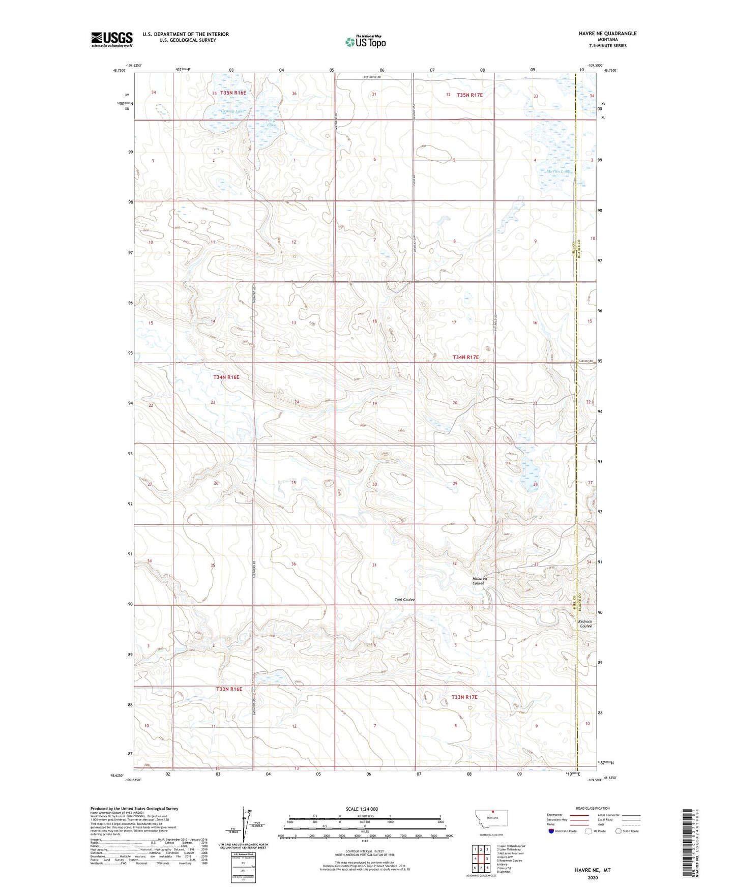
2024 topographic map quadrangle Havre NE in the state of Montana. Scale: 1:24000. Based on the newly updated USGS 7.5' US Topo map series, this map is in the following counties: Hill, Blaine. The map contains contour data, water features, and other items you are used to seeing on USGS maps, but also has updated roads and other features. This is the next generation of topographic maps. Printed on high-quality waterproof paper with UV fade-resistant inks.
Quads adjacent to this one:
West: Havre NW
Northwest: Lake Thibadeau SW
North: Lake Thibadeau
Northeast: McLaren Reservoir
East: Reservoir Coulee
Southeast: Lohman
South: Havre SE
Southwest: Havre
This map covers the same area as the classic USGS quad with code o48109f5.
Contains the following named places: 33N17E06DDAD01 Well, Badger Coulee, Coal Coulee, Dry Lake, Grassy Lake, Mars Dam, Martin Lake, McLaren Coulee, Mister Mito Bars Dam, Mistress Leader Dam