MyTopo
Hendrickson Coulee Montana US Topo Map
Couldn't load pickup availability
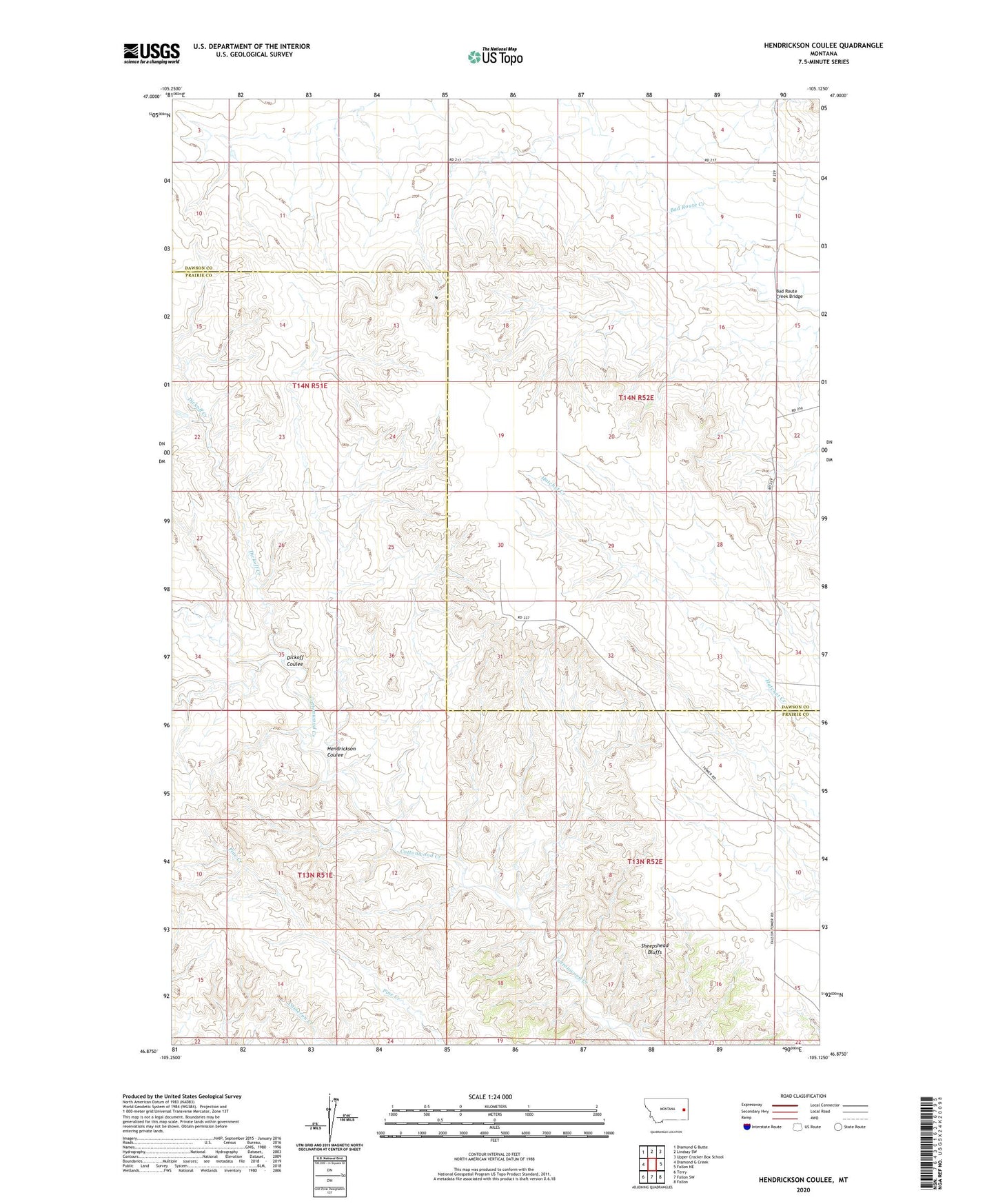
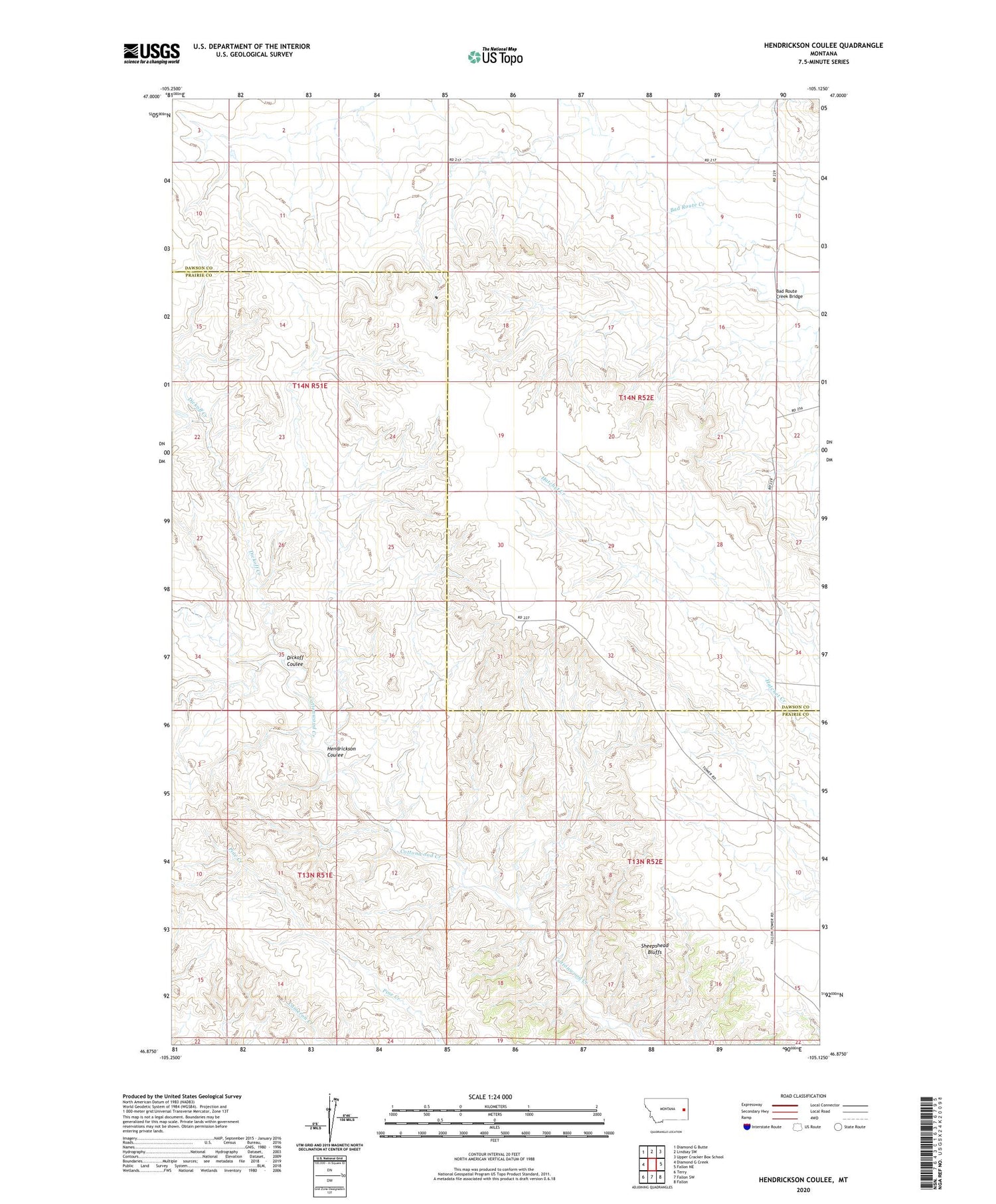
2020 topographic map quadrangle Hendrickson Coulee in the state of Montana. Scale: 1:24000. Based on the newly updated USGS 7.5' US Topo map series, this map is in the following counties: Prairie, Dawson. The map contains contour data, water features, and other items you are used to seeing on USGS maps, but also has updated roads and other features. This is the next generation of topographic maps. Printed on high-quality waterproof paper with UV fade-resistant inks.
Quads adjacent to this one:
West: Diamond G Creek
Northwest: Diamond G Butte
North: Lindsay SW
Northeast: Upper Cracker Box School
East: Fallon NE
Southeast: Fallon
South: Fallon SW
Southwest: Terry
Contains the following named places: 13N52E03BACA01 Well, 13N52E05CACB01 Well, 14N51E11DDDC01 Well, 14N51E26DDAD01 Well, 14N52E08AADA01 Well, 14N52E18CCAB01 Well, 14N52E28DCBD01 Well, Bad Route Creek Bridge, Dickoff Coulee, Dickoff Creek, Echo Ridge School, Hendrickson Coulee, Lincoln School, Mallett School, Nothnagel School, Sheepshead Bluffs