MyTopo
Upper Cracker Box School Montana US Topo Map
Couldn't load pickup availability
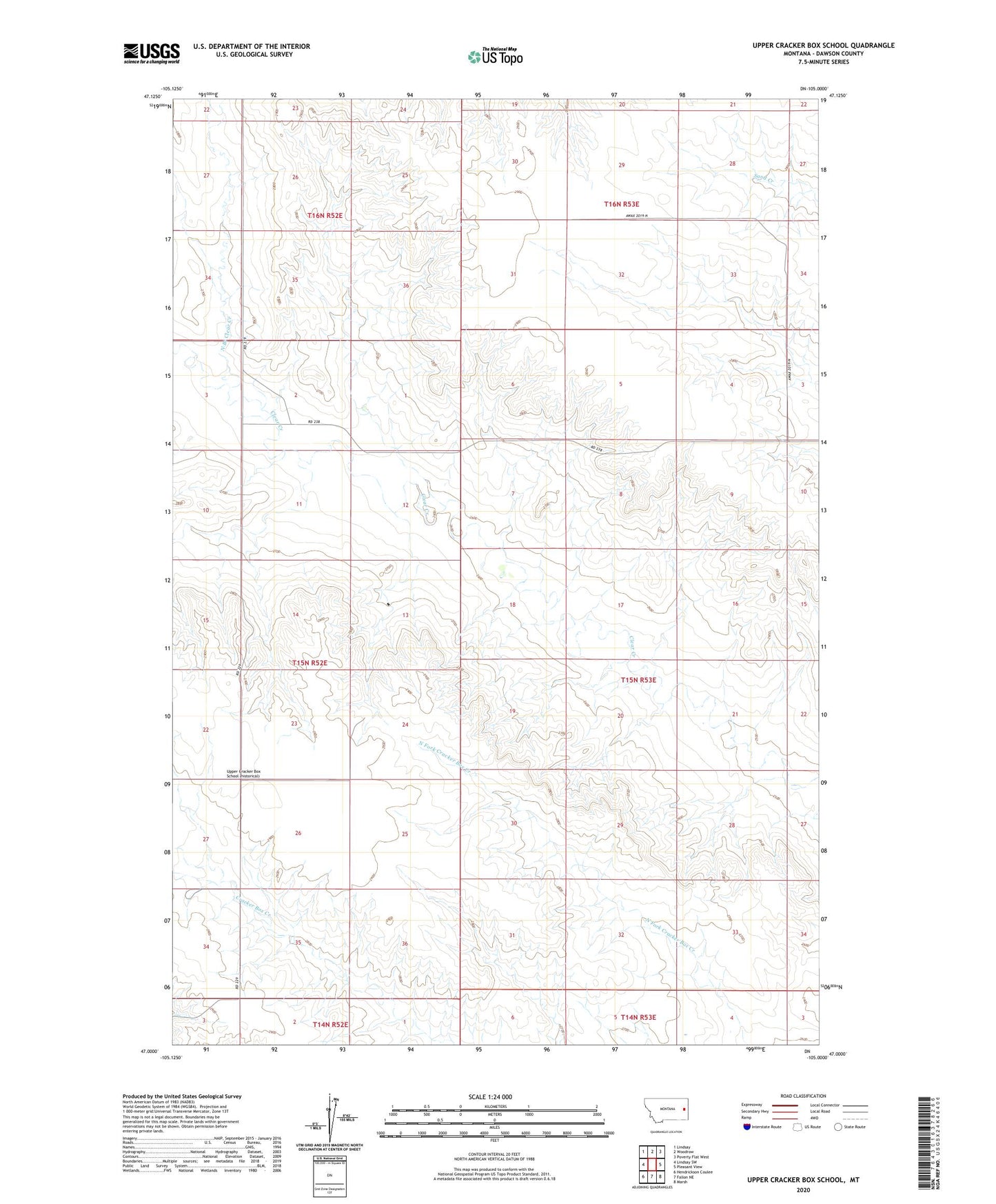
2024 topographic map quadrangle Upper Cracker Box School in the state of Montana. Scale: 1:24000. Based on the newly updated USGS 7.5' US Topo map series, this map is in the following counties: Dawson. The map contains contour data, water features, and other items you are used to seeing on USGS maps, but also has updated roads and other features. This is the next generation of topographic maps. Printed on high-quality waterproof paper with UV fade-resistant inks.
Quads adjacent to this one:
West: Lindsay SW
Northwest: Lindsay
North: Woodrow
Northeast: Poverty Flat West
East: Pleasant View
Southeast: Marsh
South: Fallon NE
Southwest: Hendrickson Coulee
This map covers the same area as the classic USGS quad with code o47105a1.
Contains the following named places: 15N52E01ACD_01 Well, 15N52E24BBD_01 Well, 15N52E24BBD_02 Well, 15N53E04ACB_01 Well, 15N53E07ACC_01 Well, 15N53E20DBA_01 Well, 15N53E31BDC_01 Well, 15N53E33CBC_01 Well, 16N50E36DDBA01 Well, 16N52E27DDD_01 Well, 16N53E28DCB_01 Well, Crackerbox Post Office, Fetter School, North Branch Clear Creek, Sunrise School, Upper Cracker Box School