
MyTopo
Hessler Ridge Montana US Topo Map
Couldn't load pickup availability
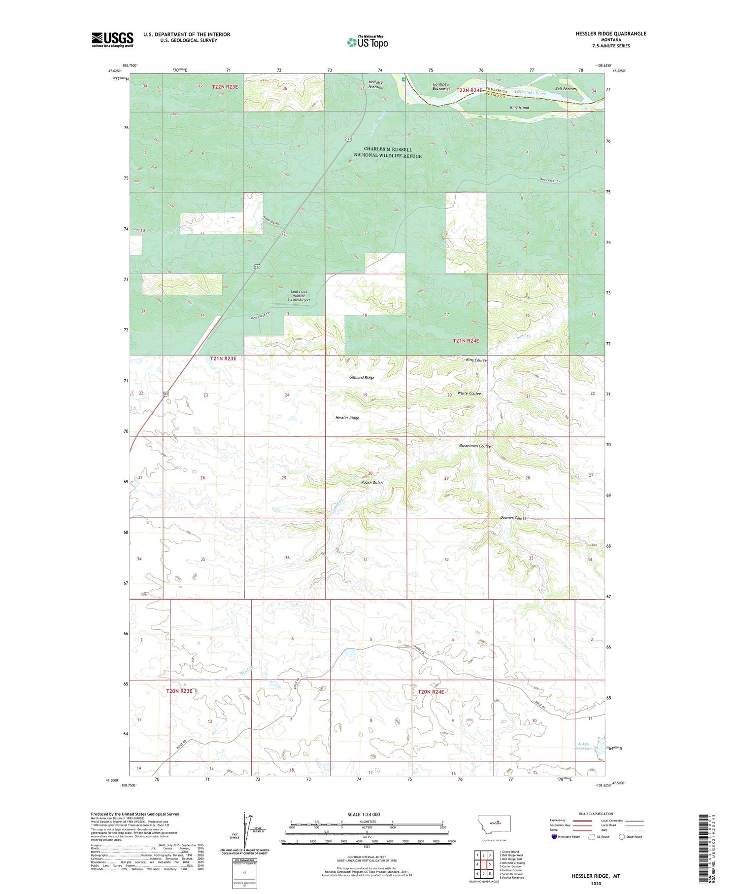
2020 topographic map quadrangle Hessler Ridge in the state of Montana. Scale: 1:24000. Based on the newly updated USGS 7.5' US Topo map series, this map is in the following counties: Fergus, Phillips. The map contains contour data, water features, and other items you are used to seeing on USGS maps, but also has updated roads and other features. This is the next generation of topographic maps. Printed on high-quality waterproof paper with UV fade-resistant inks.
Quads adjacent to this one:
West: Mitchell Crossing
Northwest: Grand Island
North: Bell Ridge West
Northeast: Bell Ridge East
East: Carter Coulee
Southeast: Kachia Reservoir
South: Sloan Reservoir
Southwest: Griffee Coulee
Contains the following named places: 21N23E12AD__01 Well, 21N23E13CBBB01 Well, 21N24E06BB__01 Well, Armells Creek, Bundane School, Cope Dam, Downer Coulee, Fergus Number 1 Dam, Galhand Ridge, Gardipee Bottoms, Hessler Ridge, King Coulee, King Coulee Number 1 Dam, King Island, Mobridge, Musselman Coulee, Roach Gulch, Sagebrush Number 3 Dam, Sand Creek Wildlife Station Airport, White Coulee


