MyTopo
Grand Island Montana US Topo Map
Couldn't load pickup availability
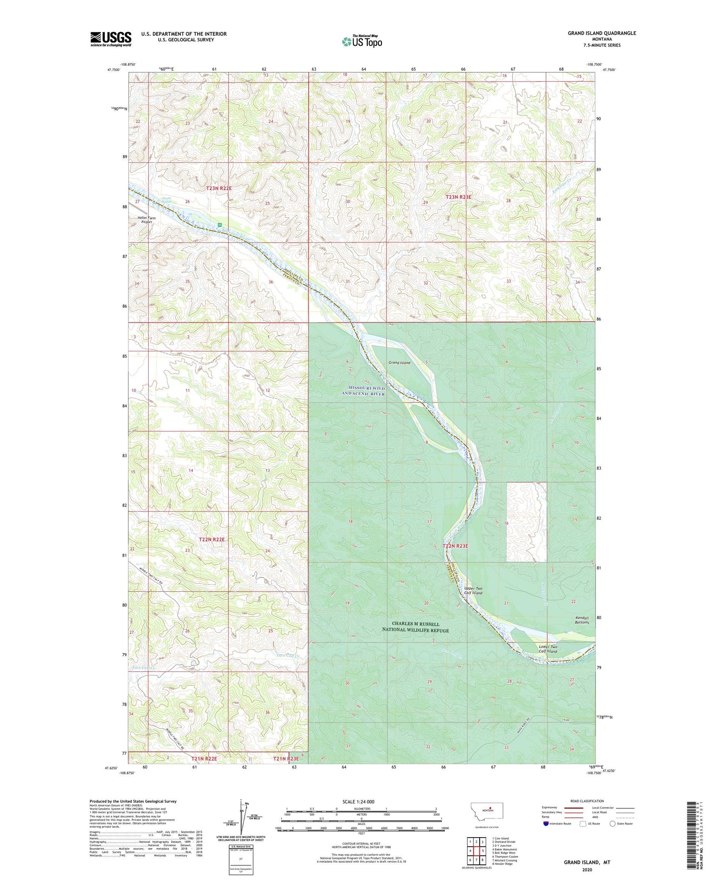
2024 topographic map quadrangle Grand Island in the state of Montana. Scale: 1:24000. Based on the newly updated USGS 7.5' US Topo map series, this map is in the following counties: Fergus, Phillips. The map contains contour data, water features, and other items you are used to seeing on USGS maps, but also has updated roads and other features. This is the next generation of topographic maps. Printed on high-quality waterproof paper with UV fade-resistant inks.
Quads adjacent to this one:
West: Baker Monument
Northwest: Cow Island
North: Shetland Divide
Northeast: D Y Junction
East: Bell Ridge West
Southeast: Hessler Ridge
South: Mitchell Crossing
Southwest: Thompson Coulee
This map covers the same area as the classic USGS quad with code o47108f7.
Contains the following named places: 22N22E22AA__01 Well, 22N22E25DD__01 Well, 22N23E08DB__01 Well, Antelope Creek, Delos Post Office, Fortress Butte, Grand Island, Hideaway Coulee, Kendall Bottoms, Lower Two Calf Island, Picotts Rapids, Reed Coulee, Two Calf Creek, Upper Two Calf Island