MyTopo
Mitchell Crossing Montana US Topo Map
Couldn't load pickup availability
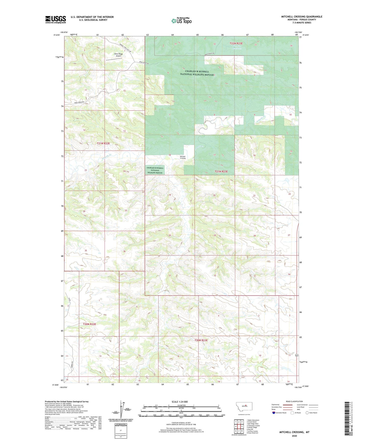
2024 topographic map quadrangle Mitchell Crossing in the state of Montana. Scale: 1:24000. Based on the newly updated USGS 7.5' US Topo map series, this map is in the following counties: Fergus. The map contains contour data, water features, and other items you are used to seeing on USGS maps, but also has updated roads and other features. This is the next generation of topographic maps. Printed on high-quality waterproof paper with UV fade-resistant inks.
Quads adjacent to this one:
West: Thompson Coulee
Northwest: Baker Monument
North: Grand Island
Northeast: Bell Ridge West
East: Hessler Ridge
Southeast: Sloan Reservoir
South: Griffee Coulee
Southwest: Roy NW
This map covers the same area as the classic USGS quad with code o47108e7.
Contains the following named places: 20N23E03AA__01 Well, 20N23E03ADCC01 Well, 20N23E04CC__01 Well, 21N23E18DA__01 Well, 21N23E22CDCC01 Well, Bundane Post Office, Fargo Coulee, Flat Top Reservoir, Indian Butte, Indian Butte School, Knox Ridge, Knox Ridge Airport, Mitchell Crossing