MyTopo
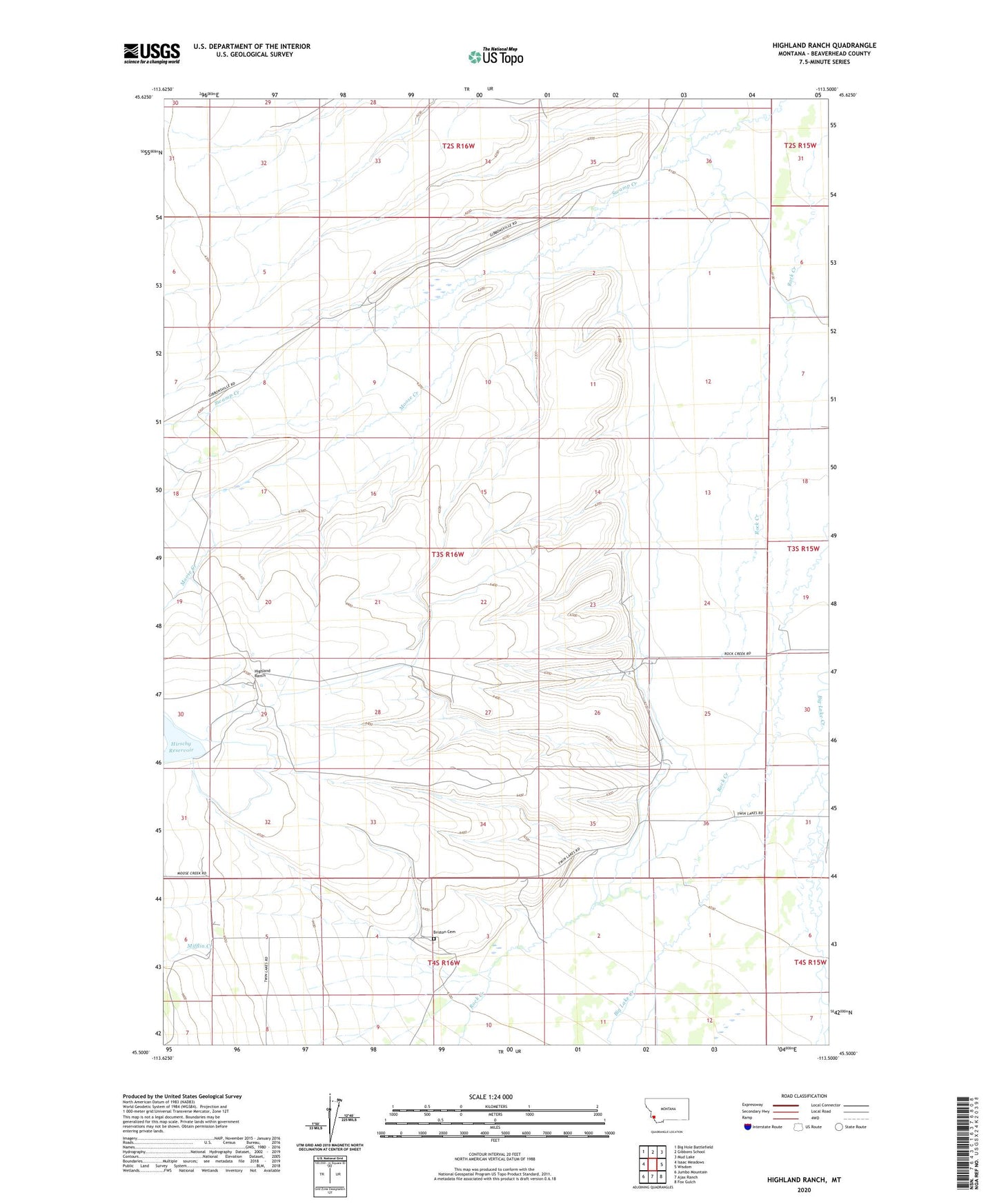
Highland Ranch Montana US Topo Map
Couldn't load pickup availability
Also explore the Highland Ranch Forest Service Topo of this same quad for updated USFS data
2024 topographic map quadrangle Highland Ranch in the state of Montana. Scale: 1:24000. Based on the newly updated USGS 7.5' US Topo map series, this map is in the following counties: Beaverhead. The map contains contour data, water features, and other items you are used to seeing on USGS maps, but also has updated roads and other features. This is the next generation of topographic maps. Printed on high-quality waterproof paper with UV fade-resistant inks.
Quads adjacent to this one:
West: Isaac Meadows
Northwest: Big Hole Battlefield
North: Gibbons School
Northeast: Mud Lake
East: Wisdom
Southeast: Fox Gulch
South: Ajax Ranch
Southwest: Jumbo Mountain
This map covers the same area as the classic USGS quad with code o45113e5.
Contains the following named places: 03S16W09ABBC01 Well, 03S16W31DDAD01 Well, 03S16W31DDDD01 Well, 03S16W36ACDA01 Well, 03S16W36ACDD01 Well, 04S16W03CBBB01 Well, 04S16W06DAAA01 Well, 04S16W06DAAD01 Well, Alps Mine, Briston Cemetery, Briston Post Office, Briston School, Highland Ranch, Hirschy Dam, Hirschy Reservoir, Mifflin Creek, Moose Creek, Nelson, R Willey