MyTopo
Gibbons School Montana US Topo Map
Couldn't load pickup availability
Also explore the Gibbons School Forest Service Topo of this same quad for updated USFS data
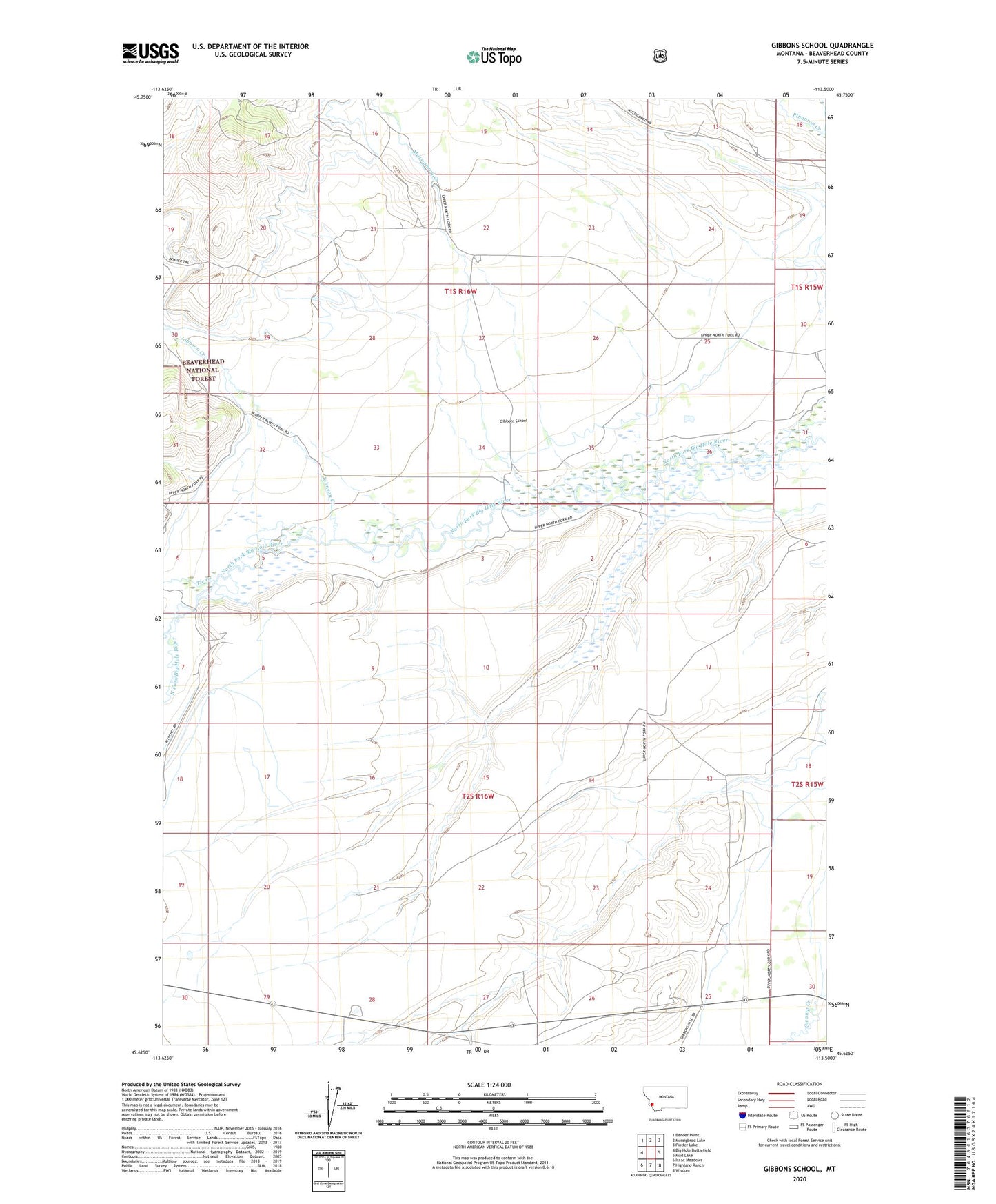
2024 topographic map quadrangle Gibbons School in the state of Montana. Scale: 1:24000. Based on the newly updated USGS 7.5' US Topo map series, this map is in the following counties: Beaverhead. The map contains contour data, water features, and other items you are used to seeing on USGS maps, but also has updated roads and other features. This is the next generation of topographic maps. Printed on high-quality waterproof paper with UV fade-resistant inks.
Quads adjacent to this one:
West: Big Hole Battlefield
Northwest: Bender Point
North: Mussigbrod Lake
Northeast: Pintler Lake
East: Mud Lake
Southeast: Wisdom
South: Highland Ranch
Southwest: Isaac Meadows
This map covers the same area as the classic USGS quad with code o45113f5.
Contains the following named places: 01S16W16BDAD01 Well, 01S16W22CDAB01 Well, 01S16W34BCCB01 Well, 01S16W34DBDD01 Well, 02S16W07DAAD01 Well, 59761, Eastern Pacific Mine, Fred Else, Gallup Ranch, Gibbons, Gibbons Post Office, Gibbons School, Johnson Creek, L'Else, M Heggelund, Mussigbrod Creek, O Heggelund, Parsons Ranch, Ray Bacon, Ritsche, Thompson Creek, Tie Creek, Tope Ranch