MyTopo
Hilldale Colony Montana US Topo Map
Couldn't load pickup availability
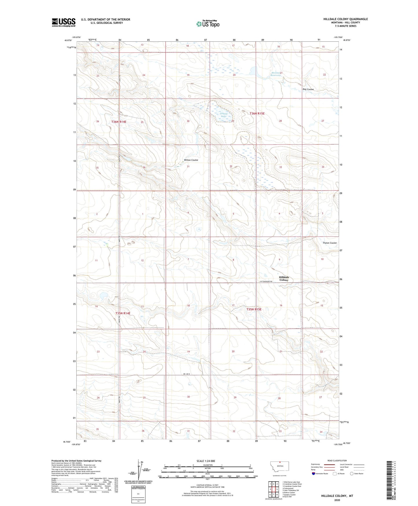
2024 topographic map quadrangle Hilldale Colony in the state of Montana. Scale: 1:24000. Based on the newly updated USGS 7.5' US Topo map series, this map is in the following counties: Hill. The map contains contour data, water features, and other items you are used to seeing on USGS maps, but also has updated roads and other features. This is the next generation of topographic maps. Printed on high-quality waterproof paper with UV fade-resistant inks.
Quads adjacent to this one:
West: Cottonwood
Northwest: Wild Horse Lake East
North: Creedman Coulee West
Northeast: Creedman Coulee East
East: Lake Thibadeau SW
Southeast: Havre NW
South: Quigley Coulee
Southwest: Kiehns Coulee
This map covers the same area as the classic USGS quad with code o48109g7.
Contains the following named places: 34N14E25CCBB01 Well, 35N15E09CDCA01 Well, 36N15E22CBAC01 Well, Amos Post Office, Amos School, Apogee Dam, Couch Coulee Number 3 Dam, Dog Coulee, Grassy Lake, Hilldale Colony, Hilldale Colony Census Designated Place, Hilldale Colony School, McLean Dam, McLean Reservoir, Perigee Dam, Wild Horse Lake Division, Willow Coulee