MyTopo
Holland Peak Montana US Topo Map
Couldn't load pickup availability
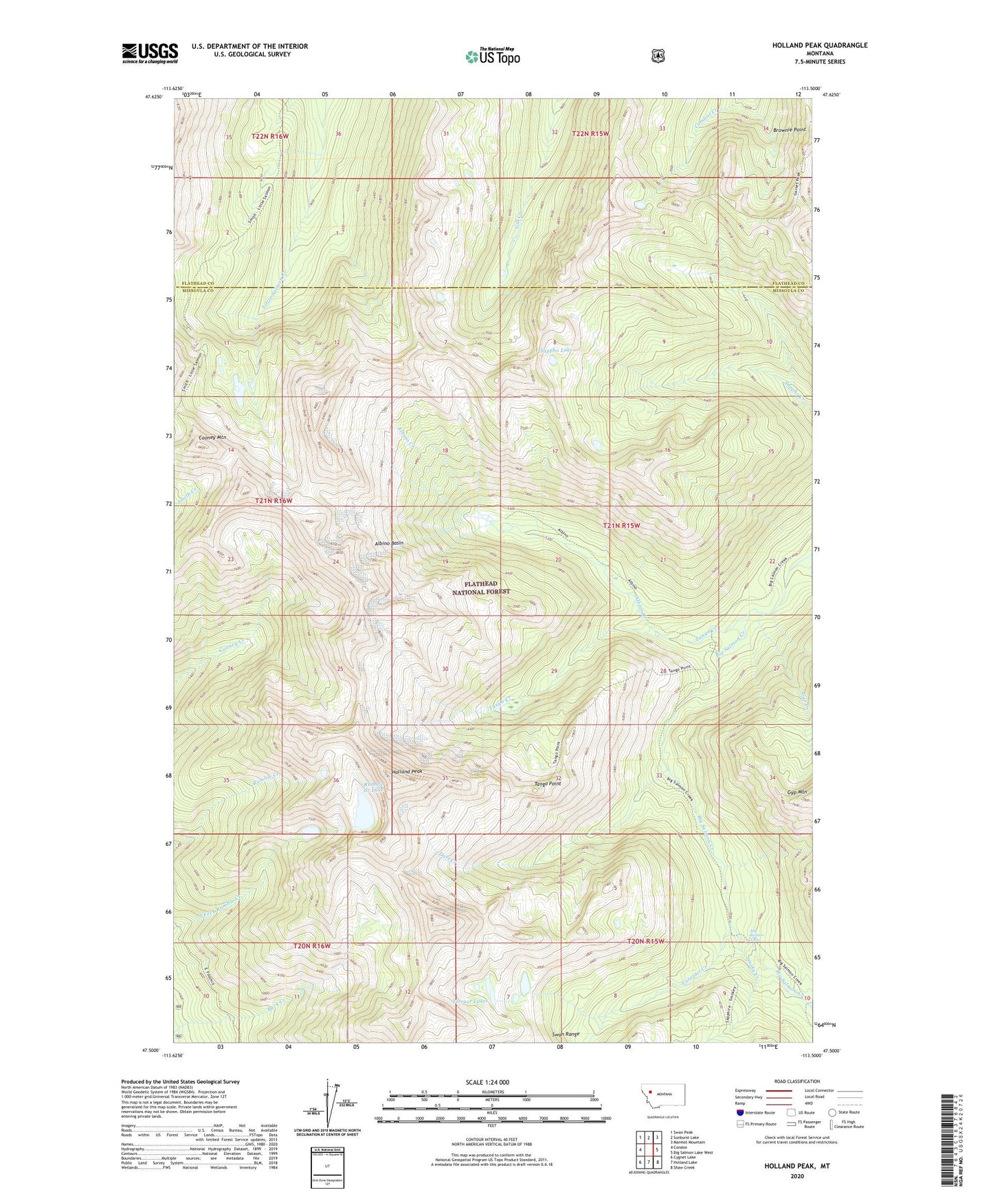
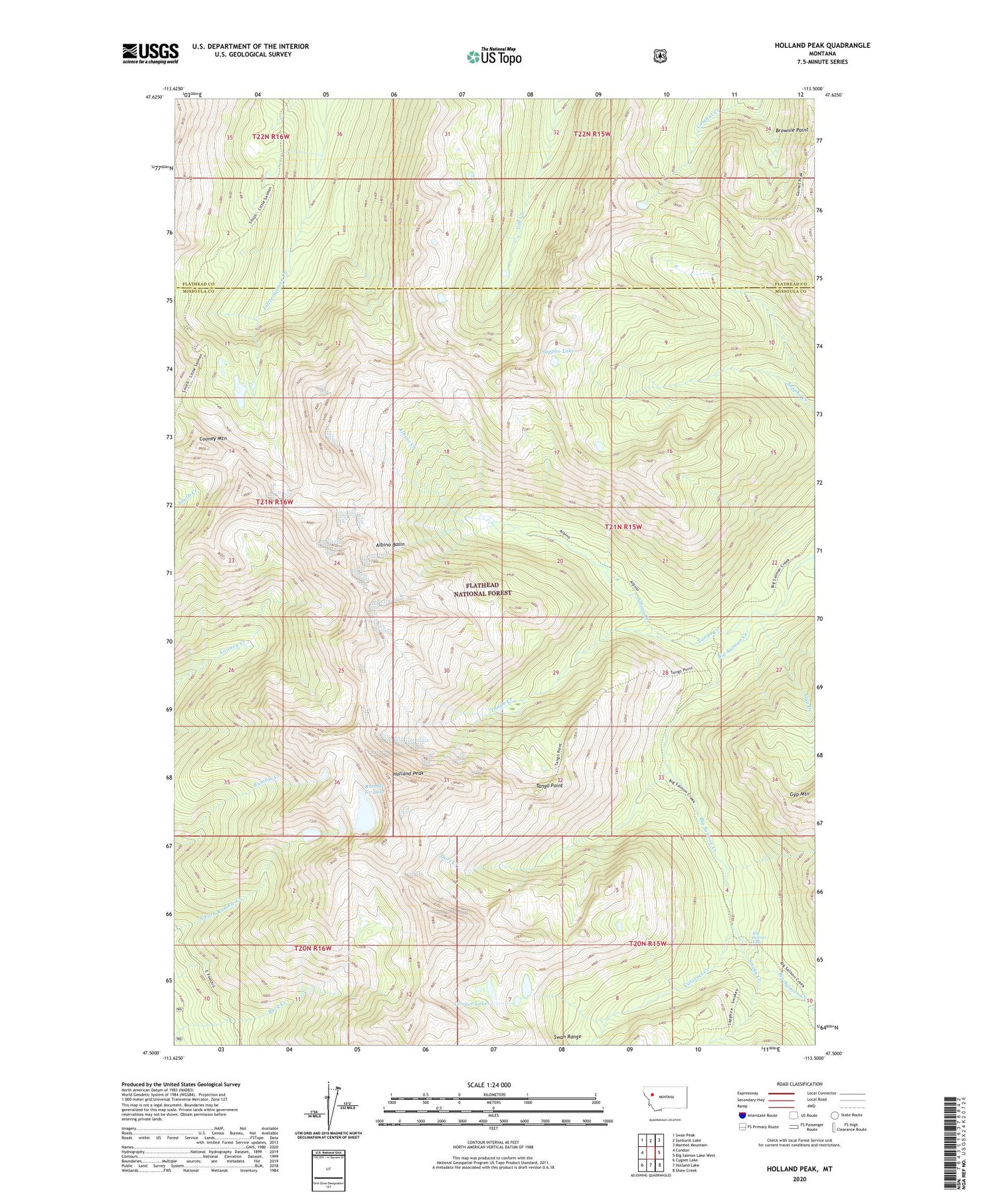
2020 topographic map quadrangle Holland Peak in the state of Montana. Scale: 1:24000. Based on the newly updated USGS 7.5' US Topo map series, this map is in the following counties: Missoula, Flathead, Lake. The map contains contour data, water features, and other items you are used to seeing on USGS maps, but also has updated roads and other features. This is the next generation of topographic maps. Printed on high-quality waterproof paper with UV fade-resistant inks.
Quads adjacent to this one:
West: Condon
Northwest: Swan Peak
North: Sunburst Lake
Northeast: Marmot Mountain
East: Big Salmon Lake West
Southeast: Shaw Creek
South: Holland Lake
Southwest: Cygnet Lake
Contains the following named places: Albino Basin, Albino Creek, Big Salmon Falls, Cataract Creek, Cooney Mountain, Dart Creek, Foothills Trail, Gyp Creek, Holland Peak, Pendant Creek, Rumble Creek Lake, Sappho Lake, Smith Creek Pass, Smith Creek Trail, Smoky Creek, Tango Creek, Tango Point, Terrace Lakes