MyTopo
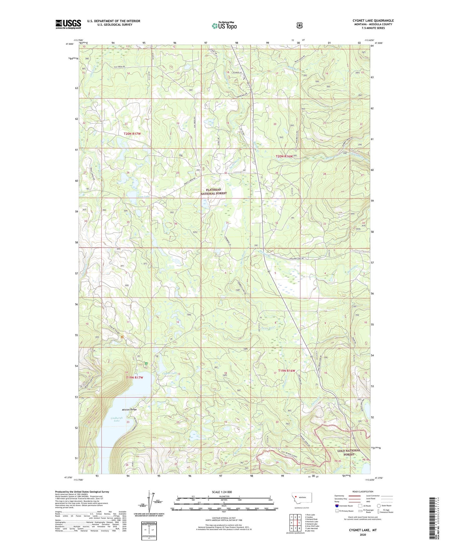
Cygnet Lake Montana US Topo Map
Couldn't load pickup availability
Also explore the Cygnet Lake Forest Service Topo of this same quad for updated USFS data
2024 topographic map quadrangle Cygnet Lake in the state of Montana. Scale: 1:24000. Based on the newly updated USGS 7.5' US Topo map series, this map is in the following counties: Missoula. The map contains contour data, water features, and other items you are used to seeing on USGS maps, but also has updated roads and other features. This is the next generation of topographic maps. Printed on high-quality waterproof paper with UV fade-resistant inks.
Quads adjacent to this one:
West: Hemlock Lake
Northwest: Peck Lake
North: Condon
Northeast: Holland Peak
East: Holland Lake
Southeast: Lake Inez
South: Lake Marshall
Southwest: Gray Wolf Lake
This map covers the same area as the classic USGS quad with code o47113d6.
Contains the following named places: 19N16W05ABCC01 Well, 19N16W05ABCC02 Well, 19N16W06BDBA01 Well, 19N16W07DBDD01 Well, 19N16W21AADA01 Well, 19N16W21ABAB01 Well, 19N16W21ABC_01 Well, 20N16W18DCDB01 Well, 20N16W20BCCB01 Well, 20N16W20CCCB01 Well, 20N16W29BCBB01 Well, 20N16W32ABCA01 Well, 20N16W32BCDA01 Well, 20N17W36BAAA01 Well, 20N17W36BAAB01 Well, Barber Creek, Beaver Creek, Buck Creek, Cygnet Lake, Elbow Lookout Tower, Gordon Ranch, Holland Creek, Hultman 33 Ranch, Kraft Creek, Lairds, Lindbergh Campground, Lindbergh Lake, Loon Lake, Pierce Creek, Pierce Lake, South Fork Barber Creek, Stoner Lake, Summit Lake, Swan Valley School, Windfall Creek