MyTopo
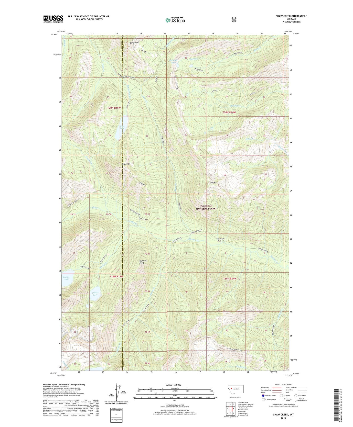
Shaw Creek Montana US Topo Map
Couldn't load pickup availability
Also explore the Shaw Creek Forest Service Topo of this same quad for updated USFS data
2024 topographic map quadrangle Shaw Creek in the state of Montana. Scale: 1:24000. Based on the newly updated USGS 7.5' US Topo map series, this map is in the following counties: Powell, Missoula. The map contains contour data, water features, and other items you are used to seeing on USGS maps, but also has updated roads and other features. This is the next generation of topographic maps. Printed on high-quality waterproof paper with UV fade-resistant inks.
Quads adjacent to this one:
West: Holland Lake
Northwest: Holland Peak
North: Big Salmon Lake West
Northeast: Big Salmon Lake East
East: Una Mountain
Southeast: Crimson Peak
South: Morrell Lake
Southwest: Lake Inez
This map covers the same area as the classic USGS quad with code o47113d4.
Contains the following named places: Big Knife Lakes, Cluster Creek, Doctor Creek, Doctor Lake, Feline Creek, George Creek, Holland Gordon Trail, Koessler Lake, Lena Lake, Lena Peak, Lick Creek, Shamrock Point, Shaw Creek, Shaw Creek Guard Station, Shaw Mountain, Shirttail Park, Some Creek, Trio Mountain