MyTopo
Hubert Hill Montana US Topo Map
Couldn't load pickup availability
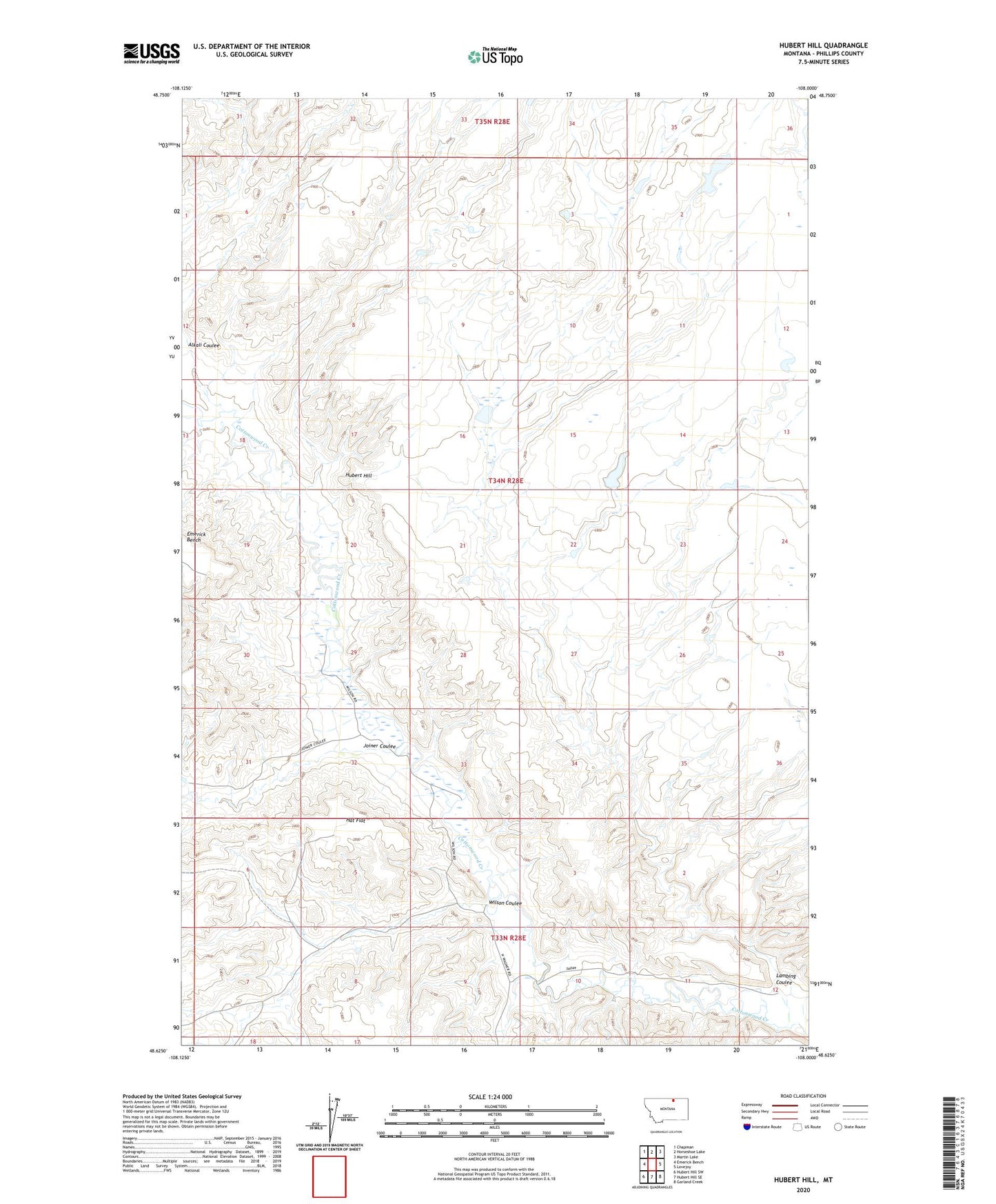
2024 topographic map quadrangle Hubert Hill in the state of Montana. Scale: 1:24000. Based on the newly updated USGS 7.5' US Topo map series, this map is in the following counties: Phillips. The map contains contour data, water features, and other items you are used to seeing on USGS maps, but also has updated roads and other features. This is the next generation of topographic maps. Printed on high-quality waterproof paper with UV fade-resistant inks.
Quads adjacent to this one:
West: Emerick Bench
Northwest: Chapman
North: Horseshoe Lake
Northeast: Martin Lake
East: Lovejoy
Southeast: Garland Creek
South: Hubert Hill SE
Southwest: Hubert Hill SW
This map covers the same area as the classic USGS quad with code o48108f1.
Contains the following named places: Alkali Coulee, Hat Flat, Hubert Hill, Joiner Coulee, Lambing Coulee, PR-110 Dam, Simple Simon Dam, Wilson Coulee