MyTopo
Hubert Hill SW Montana US Topo Map
Couldn't load pickup availability
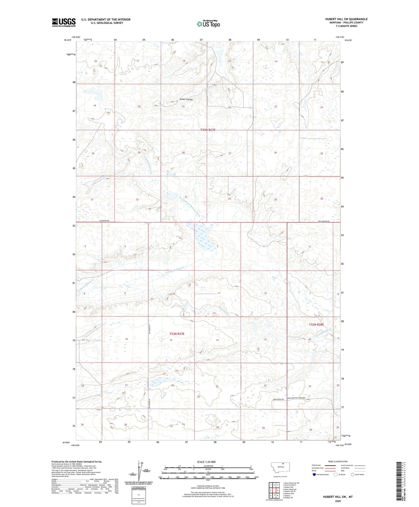
2024 topographic map quadrangle Hubert Hill SW in the state of Montana. Scale: 1:24000. Based on the newly updated USGS 7.5' US Topo map series, this map is in the following counties: Phillips. The map contains contour data, water features, and other items you are used to seeing on USGS maps, but also has updated roads and other features. This is the next generation of topographic maps. Printed on high-quality waterproof paper with UV fade-resistant inks.
Quads adjacent to this one:
West: Down Reservoir
Northwest: Down Reservoir NE
North: Emerick Bench
Northeast: Hubert Hill
East: Hubert Hill SE
Southeast: Dodson NE
South: Dodson
Southwest: Dodson Dam
This map covers the same area as the classic USGS quad with code o48108e2.
Contains the following named places: 32N27E25BB__01 Well, Boothe Dam, Long View School, Matulka Dam, Plethora Dam, PR-56 Dam, PR-98 Dam, Rolling Prairie School, Valley View School