MyTopo
Jefferson City Montana US Topo Map
Couldn't load pickup availability
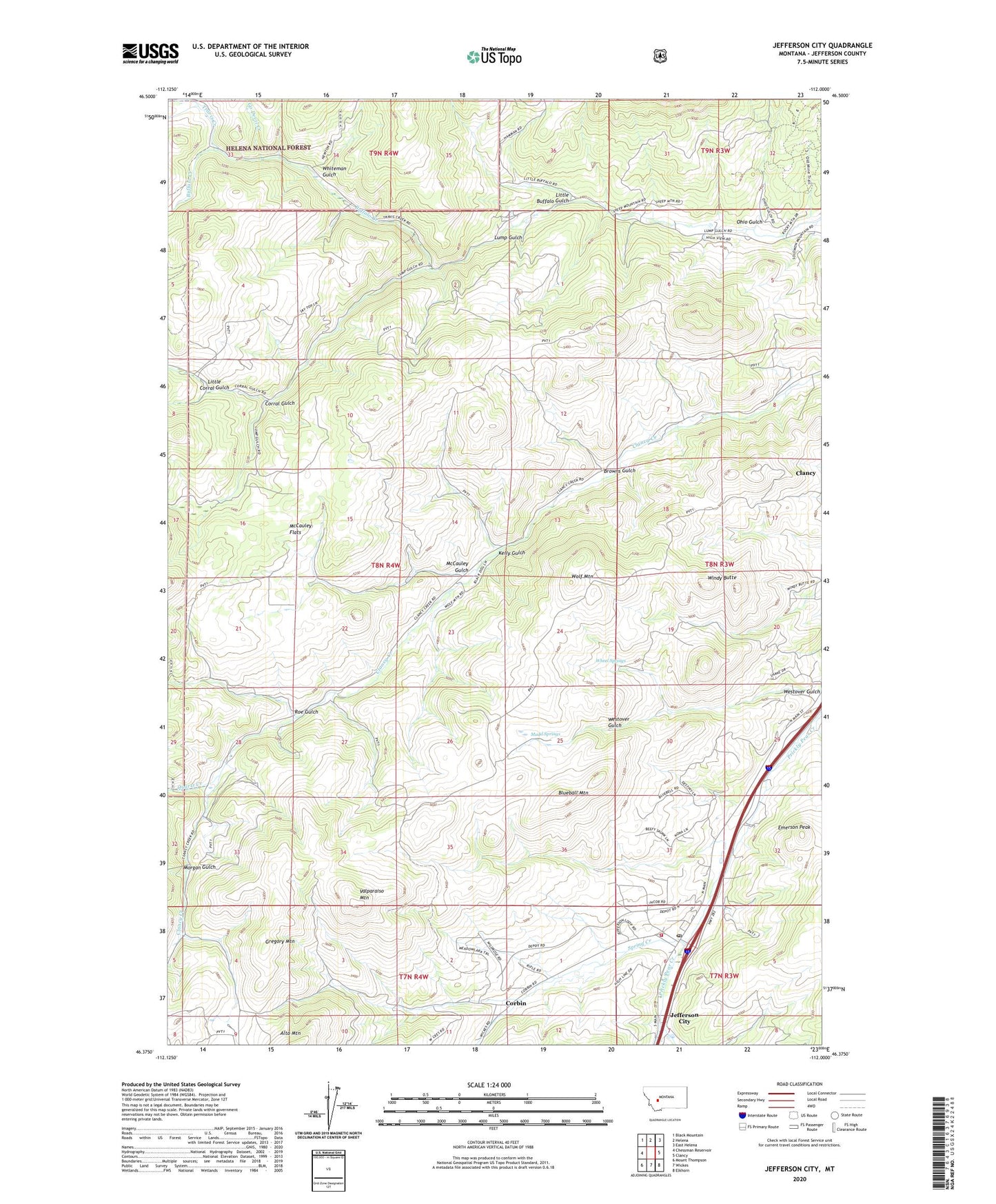
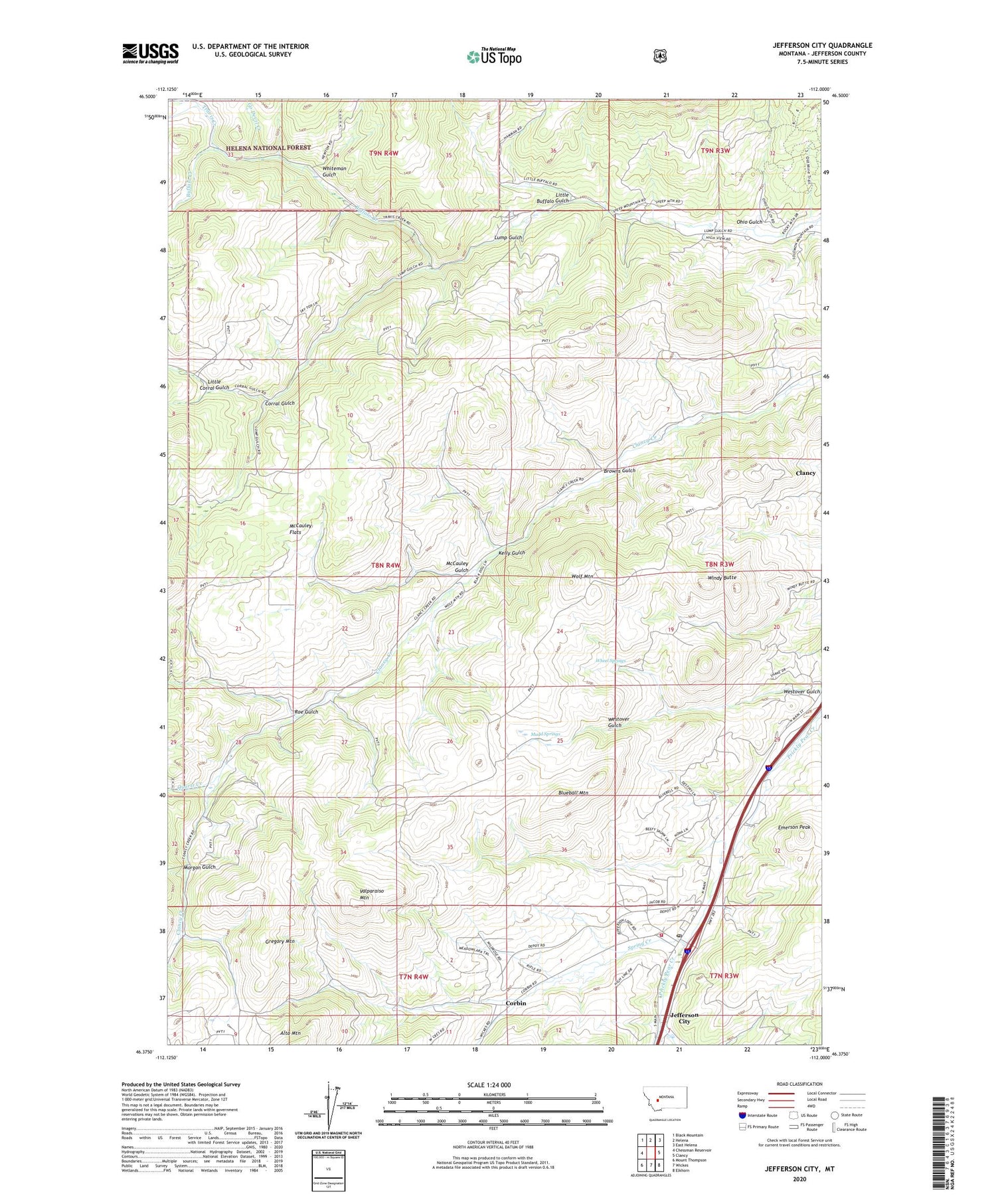
2020 topographic map quadrangle Jefferson City in the state of Montana. Scale: 1:24000. Based on the newly updated USGS 7.5' US Topo map series, this map is in the following counties: Jefferson. The map contains contour data, water features, and other items you are used to seeing on USGS maps, but also has updated roads and other features. This is the next generation of topographic maps. Printed on high-quality waterproof paper with UV fade-resistant inks.
Quads adjacent to this one:
West: Chessman Reservoir
Northwest: Black Mountain
North: Helena
Northeast: East Helena
East: Clancy
Southeast: Elkhorn
South: Wickes
Southwest: Mount Thompson
Contains the following named places: 10N04W11DCAB01 Well, Alta Post Office, Beavertown Creek, Bertha Mine, Black Jack Mine, Blueball Mountain, Browns Gulch, Buffalo Creek, Clancy Census Designated Place, Concentrator, Corbin, Corbin Post Office, Corral Gulch, Emerson Peak, Free Coinage Mine, Freighters Historical Marker, Go Devil Creek, Gregory, Gregory Mine, Gregory Mountain, Gregory Post Office, Hartwell, Jefferson, Jefferson City, Jefferson City Census Designated Place, Jefferson City Fire Company, Jefferson City Post Office, Jefferson City Rest Area, Kelly Gulch, Little Buffalo Gulch, Little Corral Gulch, Little Nellie Mine, Longeway, McCauley Flats, McCauley Gulch, Minnesota Mine, Morgan Gulch, Mudd Springs, North Fork Travis Creek, O K Mine, Ohio Gulch, Quartz Creek, Rarus Mine, Roe Gulch, Roosevelt Mine, SE SE Section 6 Mine, Spring Creek, Superior/Jubilee Mine, SW SE Section 32 Mine, Travis Creek, Valparaiso Mountain, Wheel Springs, Whiteman Gulch, Windy Butte, Wolf Mountain