MyTopo
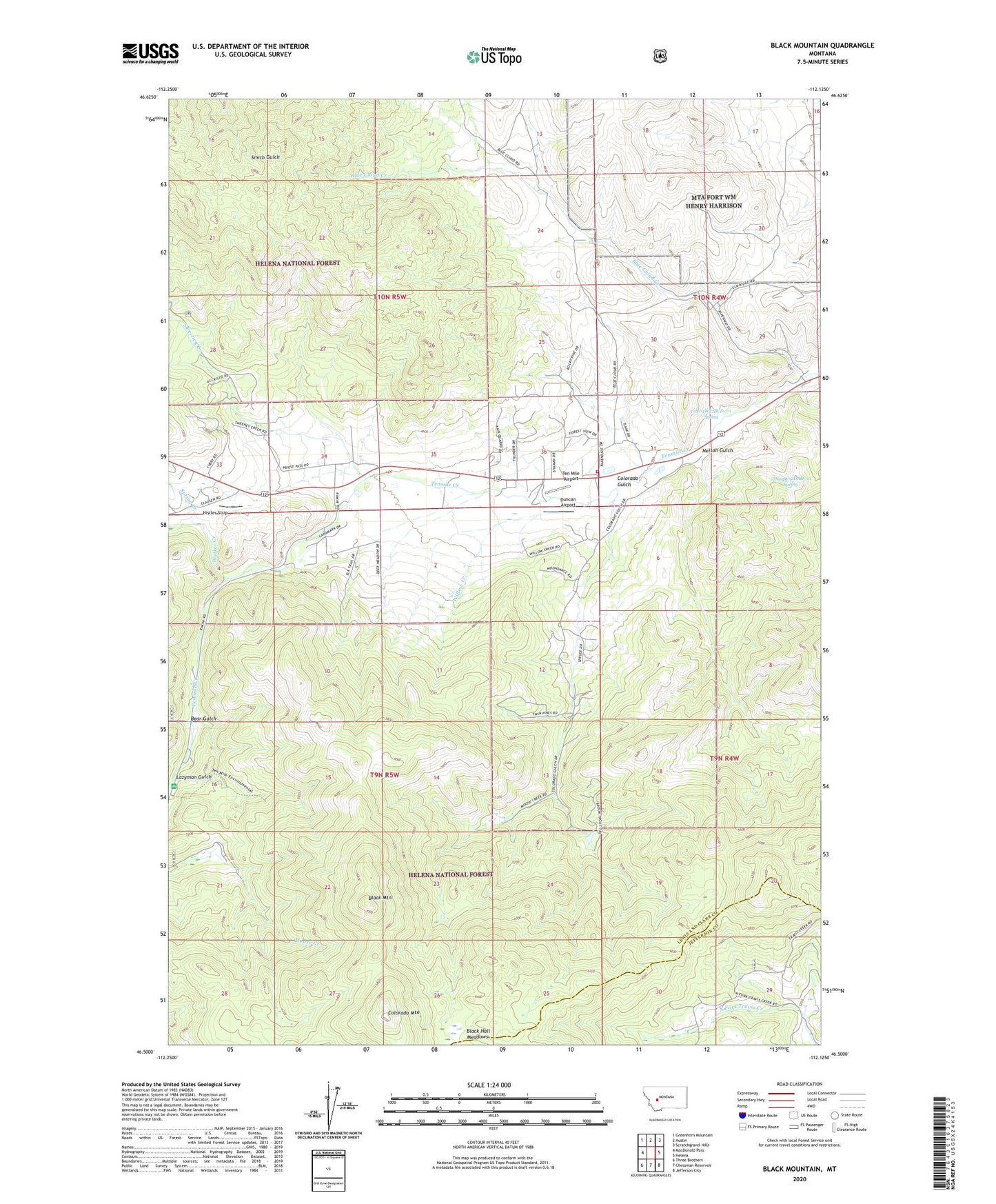
Black Mountain Montana US Topo Map
Couldn't load pickup availability
Also explore the Black Mountain Forest Service Topo of this same quad for updated USFS data
2024 topographic map quadrangle Black Mountain in the state of Montana. Scale: 1:24000. Based on the newly updated USGS 7.5' US Topo map series, this map is in the following counties: Lewis and Clark, Jefferson. The map contains contour data, water features, and other items you are used to seeing on USGS maps, but also has updated roads and other features. This is the next generation of topographic maps. Printed on high-quality waterproof paper with UV fade-resistant inks.
Quads adjacent to this one:
West: MacDonald Pass
Northwest: Greenhorn Mountain
North: Austin
Northeast: Scratchgravel Hills
East: Helena
Southeast: Jefferson City
South: Chessman Reservoir
Southwest: Three Brothers
This map covers the same area as the classic USGS quad with code o46112e2.
Contains the following named places: 09N05W03AACC01 Well, 09N05W03ABCB01 Well, 09N05W03ADBB01 Well, 09N05W12ABDA01 Well, 09N05W12ACAD01 Well, 09N05W12CCDA01 Well, 09N05W13ACDB01 Well, 09N05W16BABB01 Well, 09N05W21ACBA01 Well, 10N04W32BCD_01 Spring, 10N04W32DAD_01 Spring, 10N05W33ABD_01 Well, 10N05W36CBBB01 Well, 10N05W36DADD01 Well, 59601, Baxendale Post Office, Baxendale Rural Fire District, Baxendale School, Bear Gulch, Black Mountain, Blue Cloud, Blue Cloud Creek, Colorado Gulch, Colorado Mountain, Duncan Airport, Gold Bar, Grunenfelder Mine, Harrison Quarry, Isaak Mine, Kesslers, Lazyman Gulch, NE NE Section 25 Mine, NE SE Section 8 Mine, Nelson Gulch, Nistler Helena Airport, NW SE Section 18 Mine, Red Mountain Heliport, Silver Coin Mine, Silver Coin North Mine, Spring Creek, Stemwinder Mine, SW NE Section 31 Mine, Sweeney Creek, Sweeney Creek Ecology Trail, Ten Mile Airport, Tenmile Campground, Wades, Walker Creek, Willow Creek