MyTopo
Kelley Montana US Topo Map
Couldn't load pickup availability
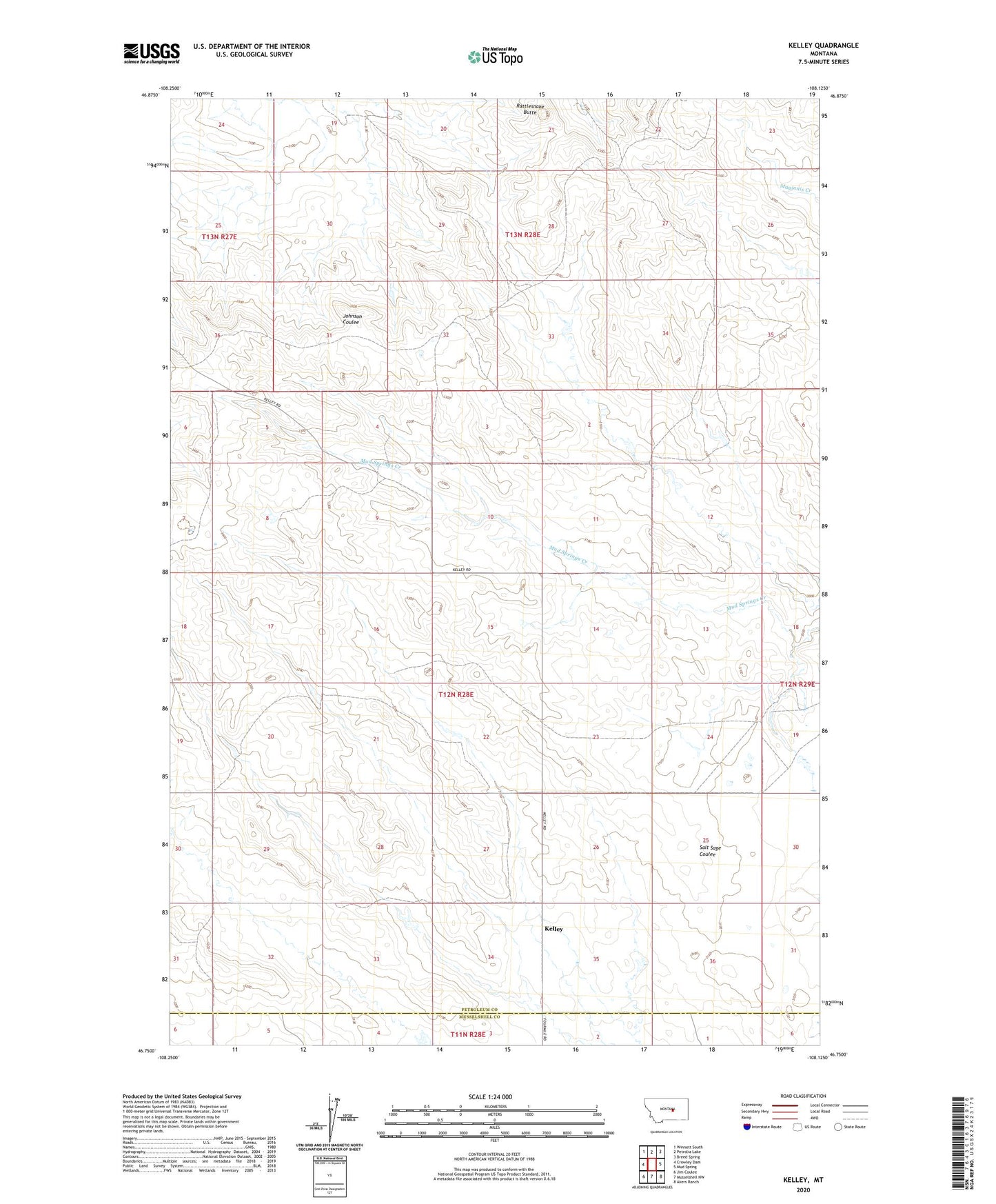
2024 topographic map quadrangle Kelley in the state of Montana. Scale: 1:24000. Based on the newly updated USGS 7.5' US Topo map series, this map is in the following counties: Petroleum, Musselshell. The map contains contour data, water features, and other items you are used to seeing on USGS maps, but also has updated roads and other features. This is the next generation of topographic maps. Printed on high-quality waterproof paper with UV fade-resistant inks.
Quads adjacent to this one:
West: Crowley Dam
Northwest: Winnett South
North: Petrolia Lake
Northeast: Breed Spring
East: Mud Spring
Southeast: Akers Ranch
South: Musselshell NW
Southwest: Jim Coulee
This map covers the same area as the classic USGS quad with code o46108g2.
Contains the following named places: 12N28E06DADA01 Well, 12N28E09AABC01 Well, 12N28E13DB__01 Well, 12N28E29CCD_01 Well, 13N28E31CCC_01 Well, Burgeton Post Office, Castle Rock School, Dixon School, Flannigan School, Goffena Number 4 Dam, Hodges School, Howard Coulee Number 1 Dam, Kelley, Kelley Post Office, Kocer School, Mackrill School, Rattlesnake Butte, Rattlesnake Butte Oil Field, Rocking Chair Butte School, Seminary Number 10 Dam, Sheldon School