MyTopo
Kelly Hills Montana US Topo Map
Couldn't load pickup availability
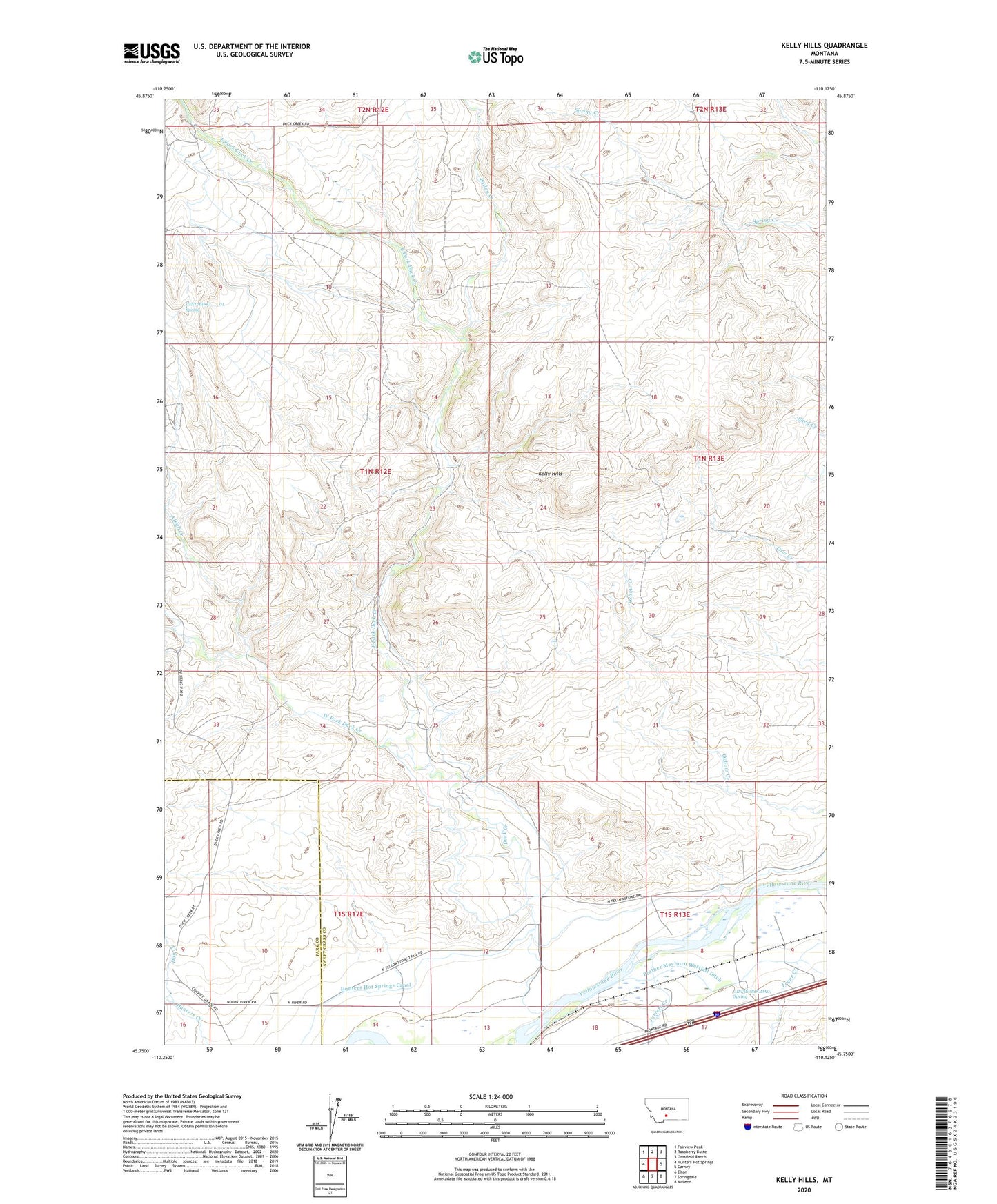
2020 topographic map quadrangle Kelly Hills in the state of Montana. Scale: 1:24000. Based on the newly updated USGS 7.5' US Topo map series, this map is in the following counties: Sweet Grass, Park. The map contains contour data, water features, and other items you are used to seeing on USGS maps, but also has updated roads and other features. This is the next generation of topographic maps. Printed on high-quality waterproof paper with UV fade-resistant inks.
Quads adjacent to this one:
West: Hunters Hot Springs
Northwest: Fairview Peak
North: Raspberry Butte
Northeast: Grosfield Ranch
East: Carney
Southeast: McLeod
South: Springdale
Southwest: Elton
Contains the following named places: 01N12E09C___01 Spring, 01S13E08DCDA01 Spring, 01S13E08DDBA01 Well, 01S13E09ABBB01 Well, 01S13E09BBCD01 Well, 01S13E17BBCA01 Well, Alkali Creek, Bailey Creek, Boe Ranch, Carney Ranch, Chris Boe Ranch, Clark Ranch, Dog Creek, Duck Creek, Duck Creek School, East Fork Duck Creek, Fetter Ranch, Fryer Creek, Gage Pioneer Memorial, Gages Station, Hunters Hot Springs Canal, Jarrett Creek, Jarrett Ranch, Kelly Hills, Laubach Ranch, Long Horn A Ranch, Lowell Creek, Old Kelly Homestead, Sioux Crossing, West Fork Duck Creek