MyTopo
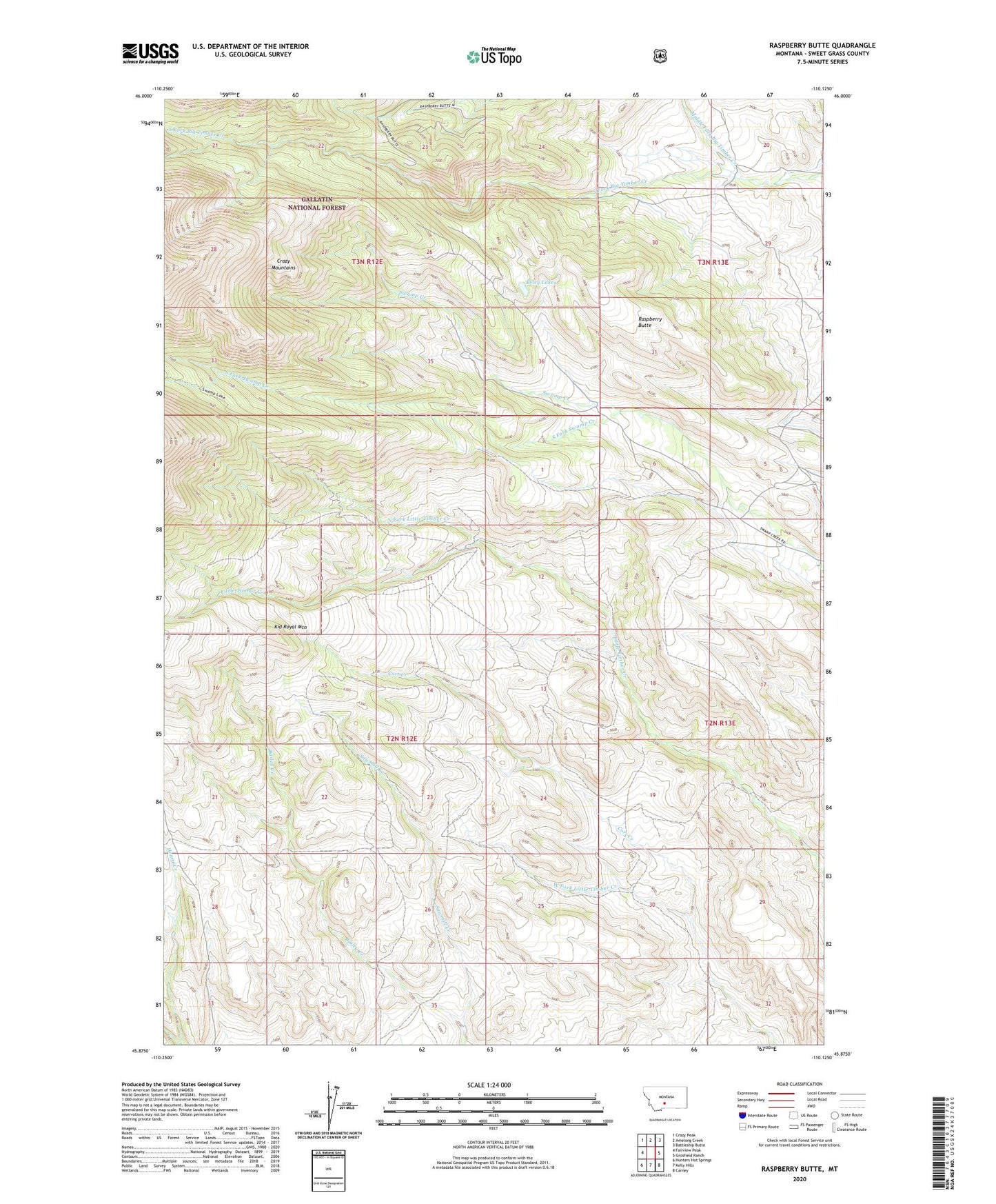
Raspberry Butte Montana US Topo Map
Couldn't load pickup availability
Also explore the Raspberry Butte Forest Service Topo of this same quad for updated USFS data
2024 topographic map quadrangle Raspberry Butte in the state of Montana. Scale: 1:24000. Based on the newly updated USGS 7.5' US Topo map series, this map is in the following counties: Sweet Grass. The map contains contour data, water features, and other items you are used to seeing on USGS maps, but also has updated roads and other features. This is the next generation of topographic maps. Printed on high-quality waterproof paper with UV fade-resistant inks.
Quads adjacent to this one:
West: Fairview Peak
Northwest: Crazy Peak
North: Amelong Creek
Northeast: Battleship Butte
East: Grosfield Ranch
Southeast: Carney
South: Kelly Hills
Southwest: Hunters Hot Springs
This map covers the same area as the classic USGS quad with code o45110h2.
Contains the following named places: Beley Homestead, Beley Lakes, Berland Homestead, Clay Morris Homestead, Cort Creek, Dooley Homestead, Dugout Ranch, Grosfield Homestead, Hauge Homestead, Henry Creek, Kid Royal Mountain, Larson Homestead, Middle Fork Big Timber Creek, Morris Ranch, North Fork Little Timber Creek, Raspberry Butte, Sawmill Creek, Shook Homestead, South Fork Swamp Creek, Swamp Creek School