MyTopo
Hunters Hot Springs Montana US Topo Map
Couldn't load pickup availability
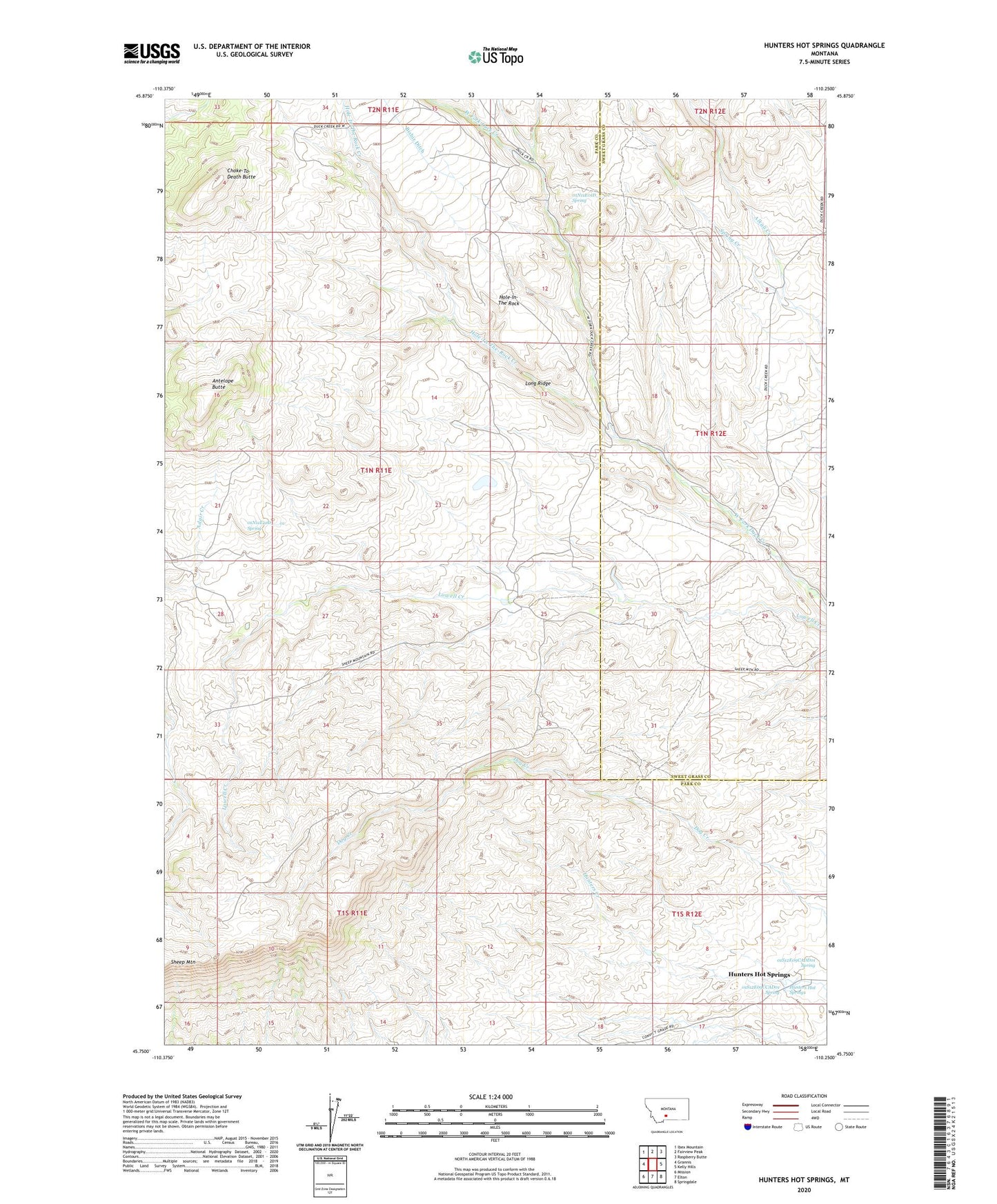
2024 topographic map quadrangle Hunters Hot Springs in the state of Montana. Scale: 1:24000. Based on the newly updated USGS 7.5' US Topo map series, this map is in the following counties: Park, Sweet Grass. The map contains contour data, water features, and other items you are used to seeing on USGS maps, but also has updated roads and other features. This is the next generation of topographic maps. Printed on high-quality waterproof paper with UV fade-resistant inks.
Quads adjacent to this one:
West: Grannis
Northwest: Ibex Mountain
North: Fairview Peak
Northeast: Raspberry Butte
East: Kelly Hills
Southeast: Springdale
South: Elton
Southwest: Mission
This map covers the same area as the classic USGS quad with code o45110g3.
Contains the following named places: 01N11E01D___01 Spring, 01N11E21D___01 Spring, 01S11E01A___01 Well, 01S12E09CADD01 Spring, 01S12E09CCAD01 Spring, Antelope Butte, Bishir Ranch, Carney Ranch, Choke-To-Death Butte, Green School, Hole-In-The Rock, Hole-In-The-Rock Creek, Hunters Hot Springs, Hunters Hot Springs Post Office, Hunters School, Krezelock Ranch, Long Ridge, Martel Homestead, Murphy Sheep Sheds, Prevost Homestead, Roebecker Homestead, Sheep Mountain, Sheep Mountain Ranch, Spring Creek