MyTopo
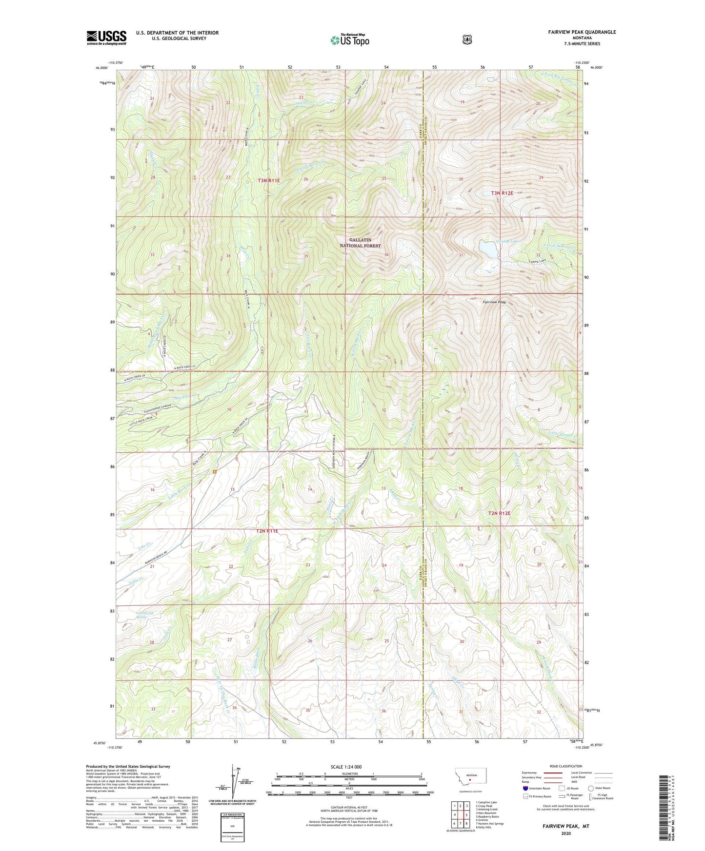
Fairview Peak Montana US Topo Map
Couldn't load pickup availability
Also explore the Fairview Peak Forest Service Topo of this same quad for updated USFS data
2024 topographic map quadrangle Fairview Peak in the state of Montana. Scale: 1:24000. Based on the newly updated USGS 7.5' US Topo map series, this map is in the following counties: Park, Sweet Grass. The map contains contour data, water features, and other items you are used to seeing on USGS maps, but also has updated roads and other features. This is the next generation of topographic maps. Printed on high-quality waterproof paper with UV fade-resistant inks.
Quads adjacent to this one:
West: Ibex Mountain
Northwest: Campfire Lake
North: Crazy Peak
Northeast: Amelong Creek
East: Raspberry Butte
Southeast: Kelly Hills
South: Hunters Hot Springs
Southwest: Grannis
This map covers the same area as the classic USGS quad with code o45110h3.
Contains the following named places: 02N11E28B___01 Spring, Alder Creek, Bennett Homestead, Bishir Ditch, Bishir Sawmill, Cole Homestead, Cole Ranch, East Fork Rock Creek, Fairview Peak, Gerard Homestead, Gilbert Homestead, Heups Homestead, Holland Homestead, Payne Homestead, Rock Creek Camp Ground, Smeller Creek, Southerd Homestead, Swamp Lake, Trainer Homestead