MyTopo
Kila Montana US Topo Map
Couldn't load pickup availability
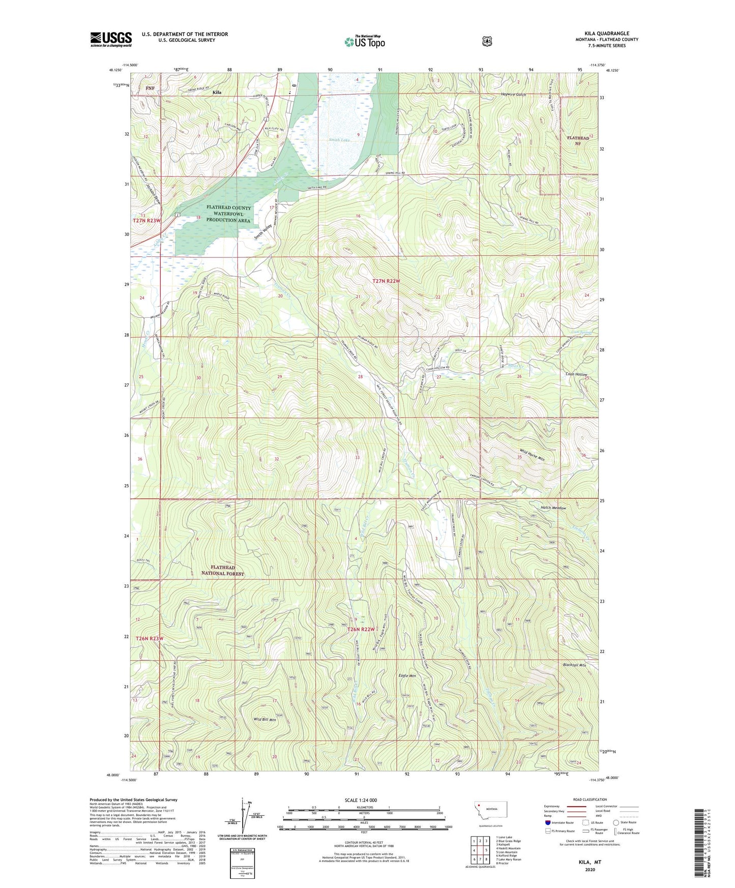
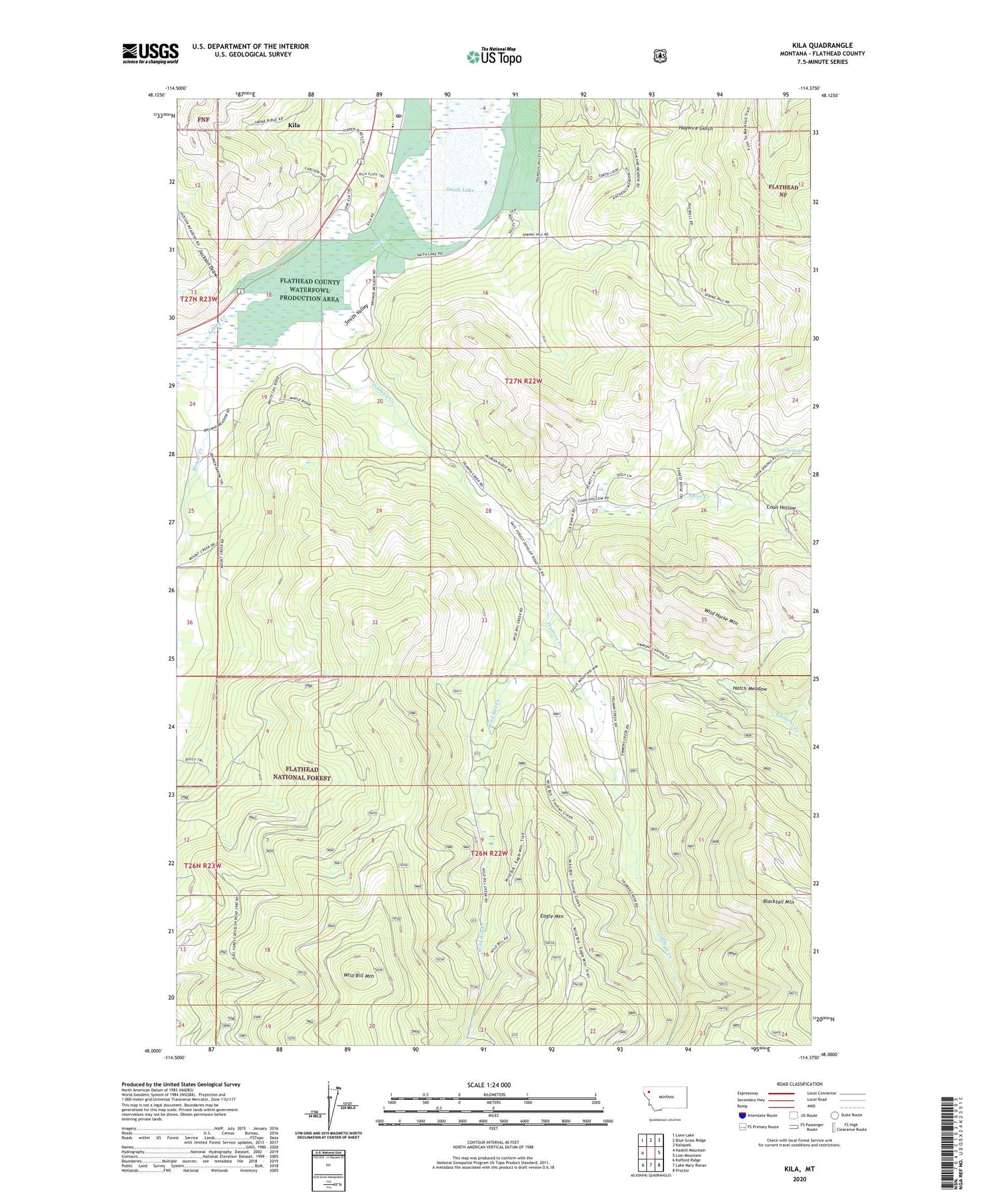
2020 topographic map quadrangle Kila in the state of Montana. Scale: 1:24000. Based on the newly updated USGS 7.5' US Topo map series, this map is in the following counties: Flathead. The map contains contour data, water features, and other items you are used to seeing on USGS maps, but also has updated roads and other features. This is the next generation of topographic maps. Printed on high-quality waterproof paper with UV fade-resistant inks.
Quads adjacent to this one:
West: Haskill Mountain
Northwest: Lone Lake
North: Blue Grass Ridge
Northeast: Kalispell
East: Lion Mountain
Southeast: Proctor
South: Lake Mary Ronan
Southwest: Kofford Ridge
Contains the following named places: Bales Creek, C M Quarter Circle Ranch, Coon Hollow, Coon Springs, Eagle Mountain, Emmons Creek, Hatch Meadow, Jackson Draw, Kila, Kila Campground, Kila Census Designated Place, Kila Post Office, Kila School, Mount Creek, Murray Post Office, Norden Cabin, Smith Lake, Smith Lake Fishing Access Site, Smith Lake Waterfowl Production Area, Truman Cabin, Truman Creek, Wild Bill Creek, Wild Bill Mountain, Wild Horse Mountain