MyTopo
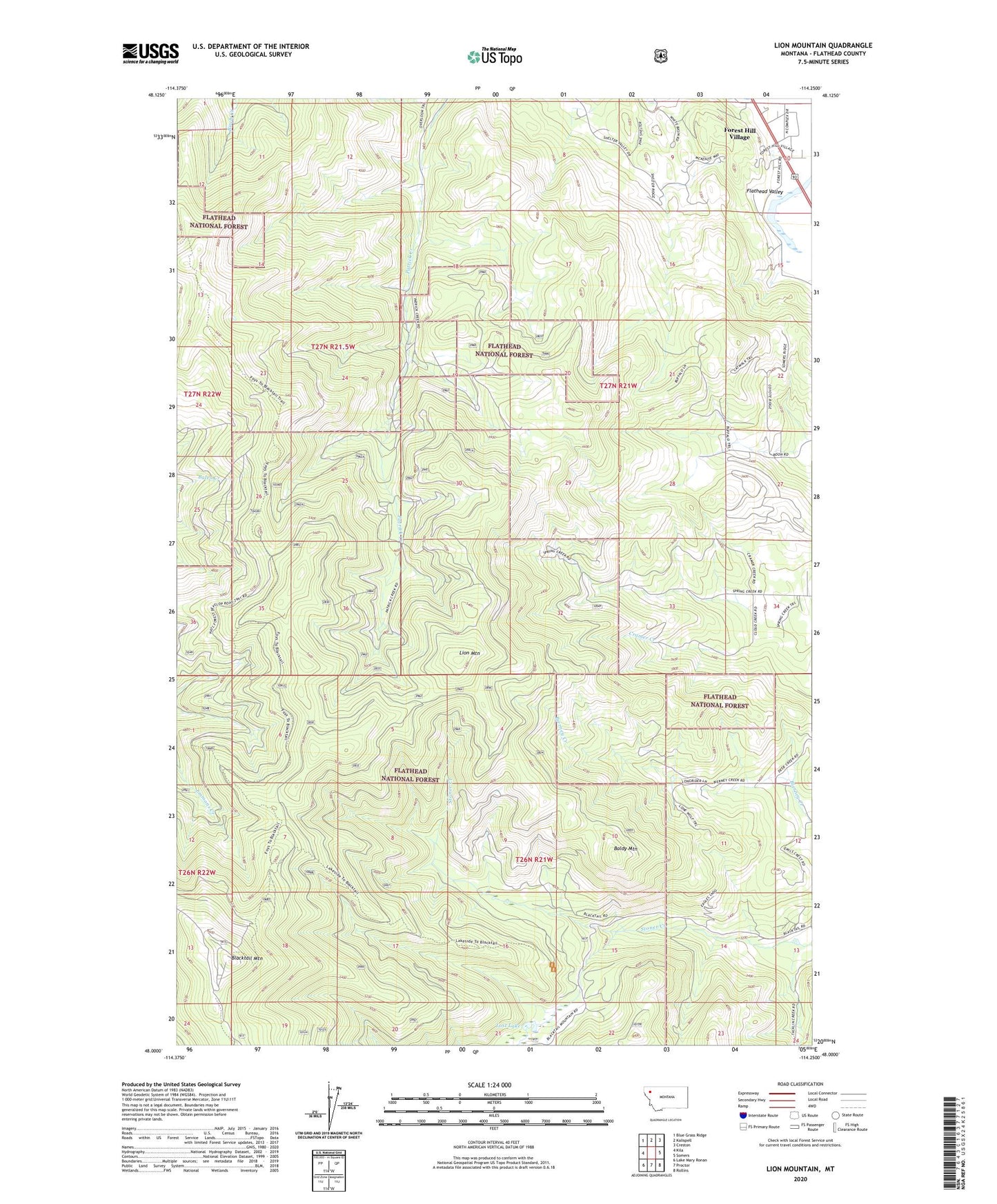
Lion Mountain Montana US Topo Map
Couldn't load pickup availability
Also explore the Lion Mountain Forest Service Topo of this same quad for updated USFS data
2024 topographic map quadrangle Lion Mountain in the state of Montana. Scale: 1:24000. Based on the newly updated USGS 7.5' US Topo map series, this map is in the following counties: Flathead. The map contains contour data, water features, and other items you are used to seeing on USGS maps, but also has updated roads and other features. This is the next generation of topographic maps. Printed on high-quality waterproof paper with UV fade-resistant inks.
Quads adjacent to this one:
West: Kila
Northwest: Blue Grass Ridge
North: Kalispell
Northeast: Creston
East: Somers
Southeast: Rollins
South: Proctor
Southwest: Lake Mary Ronan
This map covers the same area as the classic USGS quad with code o48114a3.
Contains the following named places: Baldy Mountain, Blacktail Mountain, Blacktail Mountain Lookout Tower, Blacktail Ski Area, Cramer Creek, Forest Hill Village, Forest Hill Village Census Designated Place, Forest Park School, KALS-FM (Kalispell), KCFW-TV (Kalispell), KOFI-FM (Kalispell), Lion Mountain, Lost Lake