MyTopo
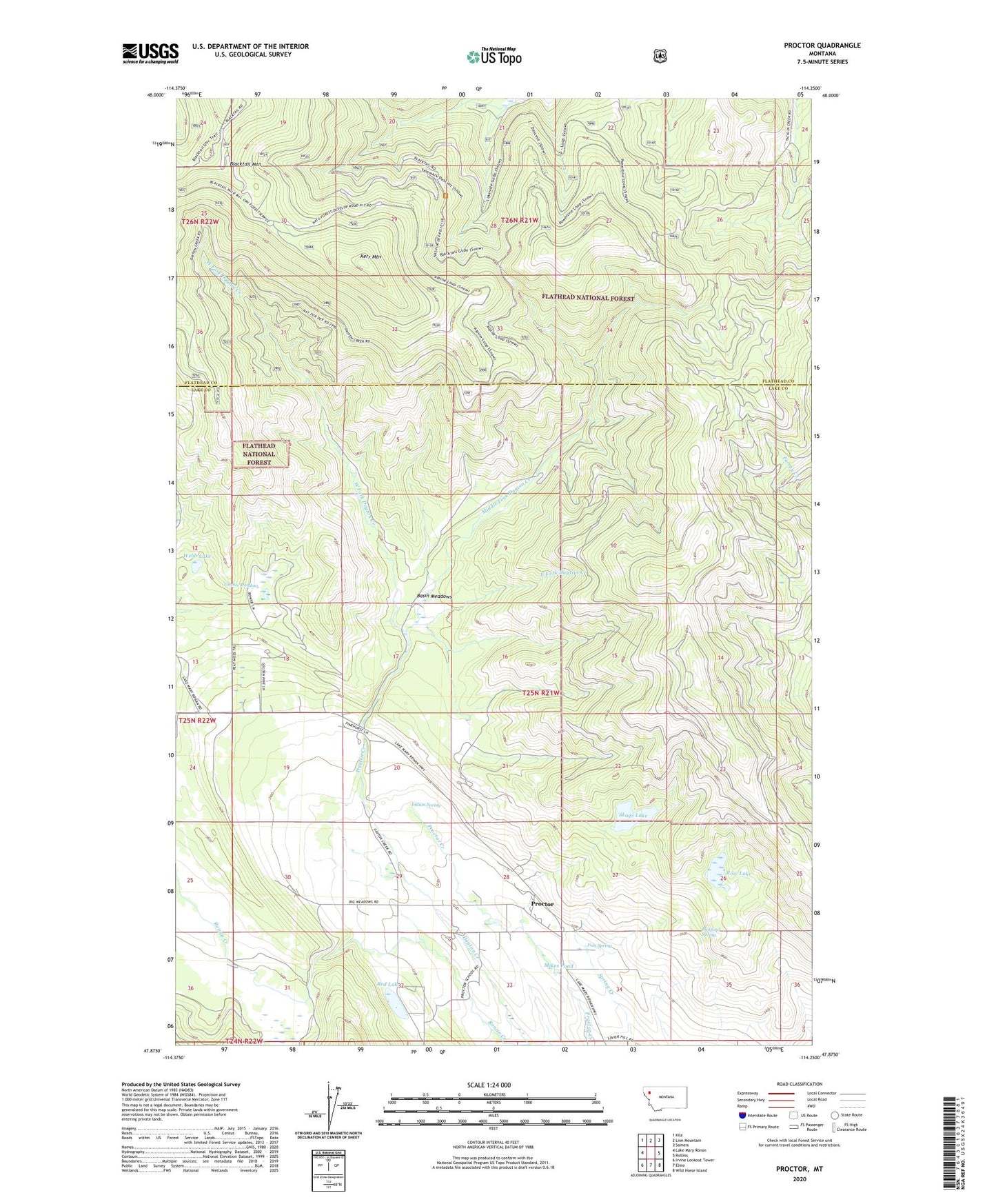
Proctor Montana US Topo Map
Couldn't load pickup availability
Also explore the Proctor Forest Service Topo of this same quad for updated USFS data
2024 topographic map quadrangle Proctor in the state of Montana. Scale: 1:24000. Based on the newly updated USGS 7.5' US Topo map series, this map is in the following counties: Lake, Flathead. The map contains contour data, water features, and other items you are used to seeing on USGS maps, but also has updated roads and other features. This is the next generation of topographic maps. Printed on high-quality waterproof paper with UV fade-resistant inks.
Quads adjacent to this one:
West: Lake Mary Ronan
Northwest: Kila
North: Lion Mountain
Northeast: Somers
East: Rollins
Southeast: Wild Horse Island
South: Elmo
Southwest: Irvine Lookout Tower
This map covers the same area as the classic USGS quad with code o47114h3.
Contains the following named places: Basin Meadows, Bickford Spring, Big 4 Mine, East Fork Dayton Creek, Foss Spring, Grants Meadow, Indian Spring, Jumbo Mine, Kerr Mountain, Middle Fork Dayton Creek, Mikes Pond, Proctor, Proctor Post Office, Proctor School, Red Lake, Ronan Creek, Row Lake, Skags Lake, Spring Creek, Webb Lake, West Fork Dayton Creek, ZIP Code: 59929