
MyTopo
Lake Theboe Montana US Topo Map
Couldn't load pickup availability
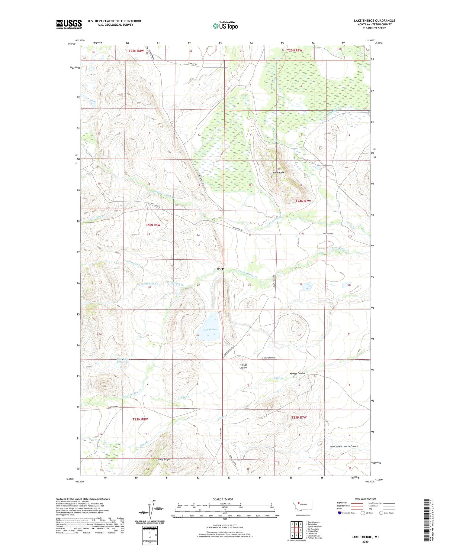
2020 topographic map quadrangle Lake Theboe in the state of Montana. Scale: 1:24000. Based on the newly updated USGS 7.5' US Topo map series, this map is in the following counties: Teton. The map contains contour data, water features, and other items you are used to seeing on USGS maps, but also has updated roads and other features. This is the next generation of topographic maps. Printed on high-quality waterproof paper with UV fade-resistant inks.
Quads adjacent to this one:
West: Ear Mountain
Northwest: Cave Mountain
North: Twin Lakes
Northeast: Bynum Reservoir
East: Watson Flats
Southeast: Pishkun Reservoir
South: Split Rock Lake
Southwest: Castle Reef
Contains the following named places: Bellview School, Bowman Ranch, Deep Can Dam, Durr Ranch, Jefferson Creek, John Lane Dam, John Lane Reservoir, Kade Creek, Kings Creek, Lake Theboe, Lake Theboe Dam, Lane Ranch, Little Deep Creek, North Coulee, North Jefferson Creek, Pine Butte, Salmond Ranch, Saypo, Saypo Post Office, Saypo School, South Jefferson Creek, Ward Ranch, Yeager Ranch


