MyTopo
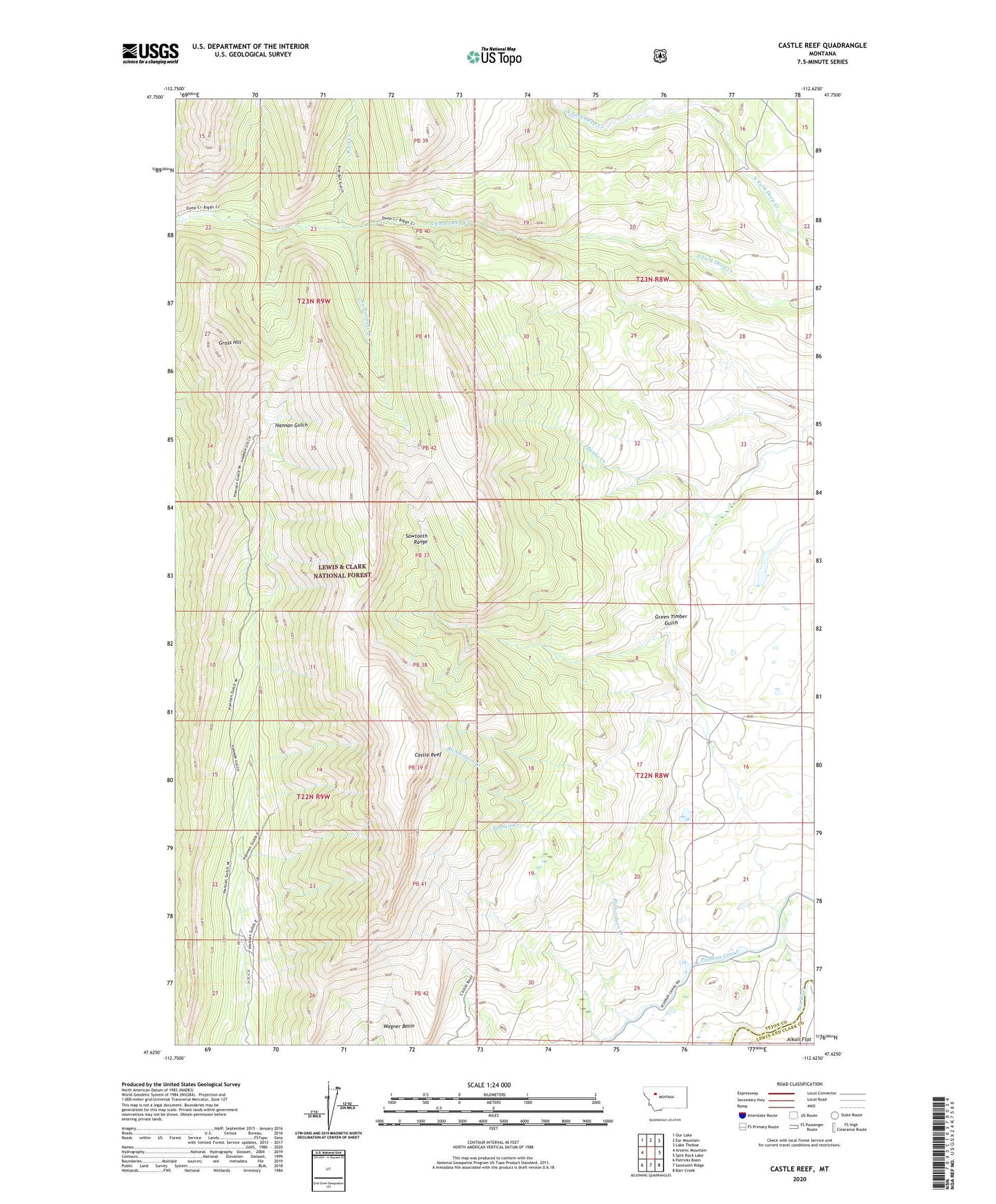
Castle Reef Montana US Topo Map
Couldn't load pickup availability
Also explore the Castle Reef Forest Service Topo of this same quad for updated USFS data
2024 topographic map quadrangle Castle Reef in the state of Montana. Scale: 1:24000. Based on the newly updated USGS 7.5' US Topo map series, this map is in the following counties: Teton, Lewis and Clark. The map contains contour data, water features, and other items you are used to seeing on USGS maps, but also has updated roads and other features. This is the next generation of topographic maps. Printed on high-quality waterproof paper with UV fade-resistant inks.
Quads adjacent to this one:
West: Arsenic Mountain
Northwest: Our Lake
North: Ear Mountain
Northeast: Lake Theboe
East: Split Rock Lake
Southeast: Barr Creek
South: Sawtooth Ridge
Southwest: Patricks Basin
This map covers the same area as the classic USGS quad with code o47112f6.
Contains the following named places: Castle Reef, Davy High Ranch, Elizabeth Post Office, Erosion Creek, Falls Creek, Francis Creek, Grass Hill, Green Timber Gulch, Kellogg Ranch, No Business Creek, Rain Creek, Richardson Creek, Wagner Basin