MyTopo
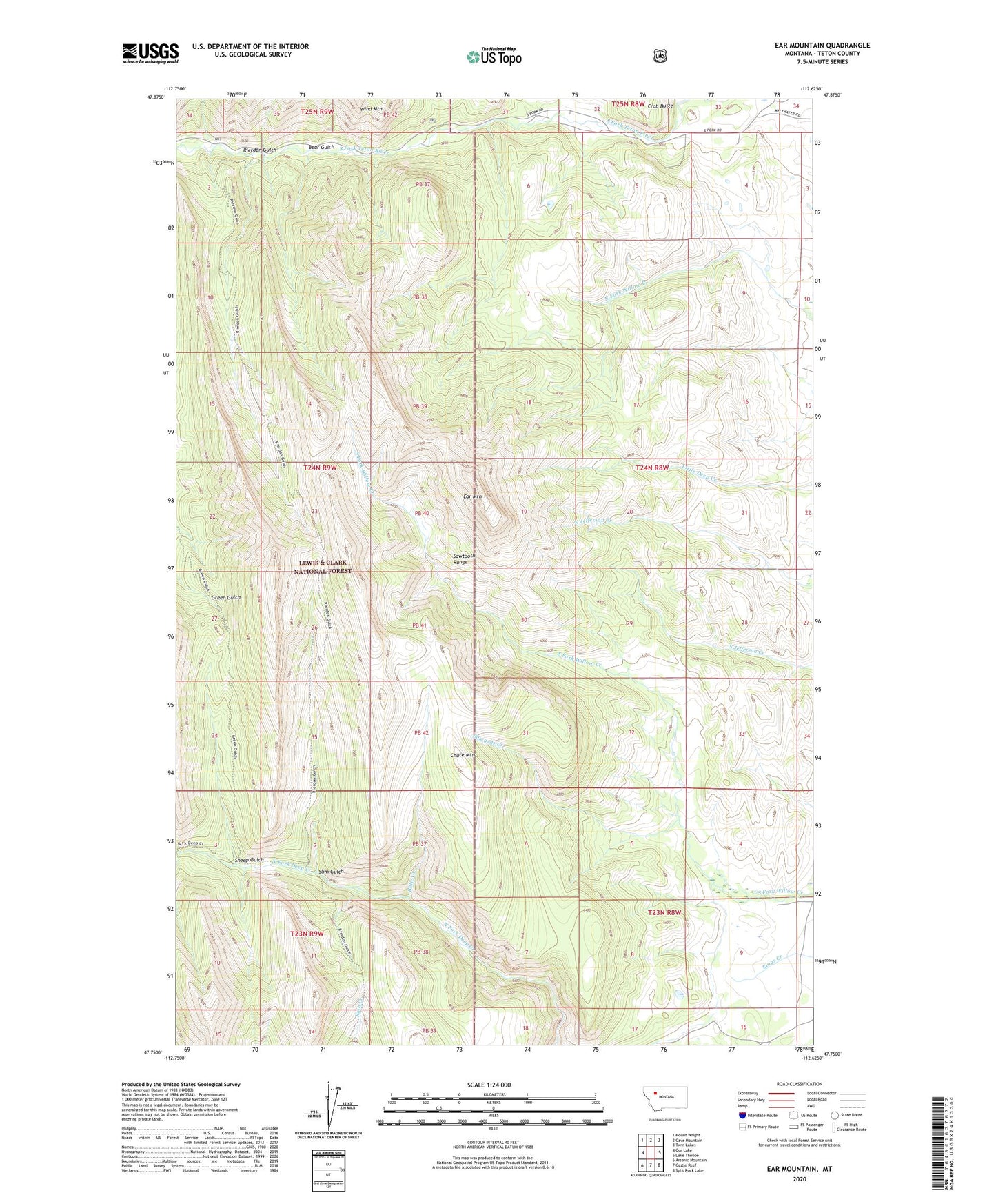
Ear Mountain Montana US Topo Map
Couldn't load pickup availability
Also explore the Ear Mountain Forest Service Topo of this same quad for updated USFS data
2024 topographic map quadrangle Ear Mountain in the state of Montana. Scale: 1:24000. Based on the newly updated USGS 7.5' US Topo map series, this map is in the following counties: Teton. The map contains contour data, water features, and other items you are used to seeing on USGS maps, but also has updated roads and other features. This is the next generation of topographic maps. Printed on high-quality waterproof paper with UV fade-resistant inks.
Quads adjacent to this one:
West: Our Lake
Northwest: Mount Wright
North: Cave Mountain
Northeast: Twin Lakes
East: Lake Theboe
Southeast: Split Rock Lake
South: Castle Reef
Southwest: Arsenic Mountain
This map covers the same area as the classic USGS quad with code o47112g6.
Contains the following named places: Bear Gulch, Bearing Tree, Billie Creek, Chute Mountain, Ear Mountain, Ear Mountain Ranger Station, Ear Mountain State Game Refuge, Edwards Creek, Gleason Resort, Rierdon Gulch, Sheep Gulch, Slim Gulch