MyTopo
Lavina Montana US Topo Map
Couldn't load pickup availability
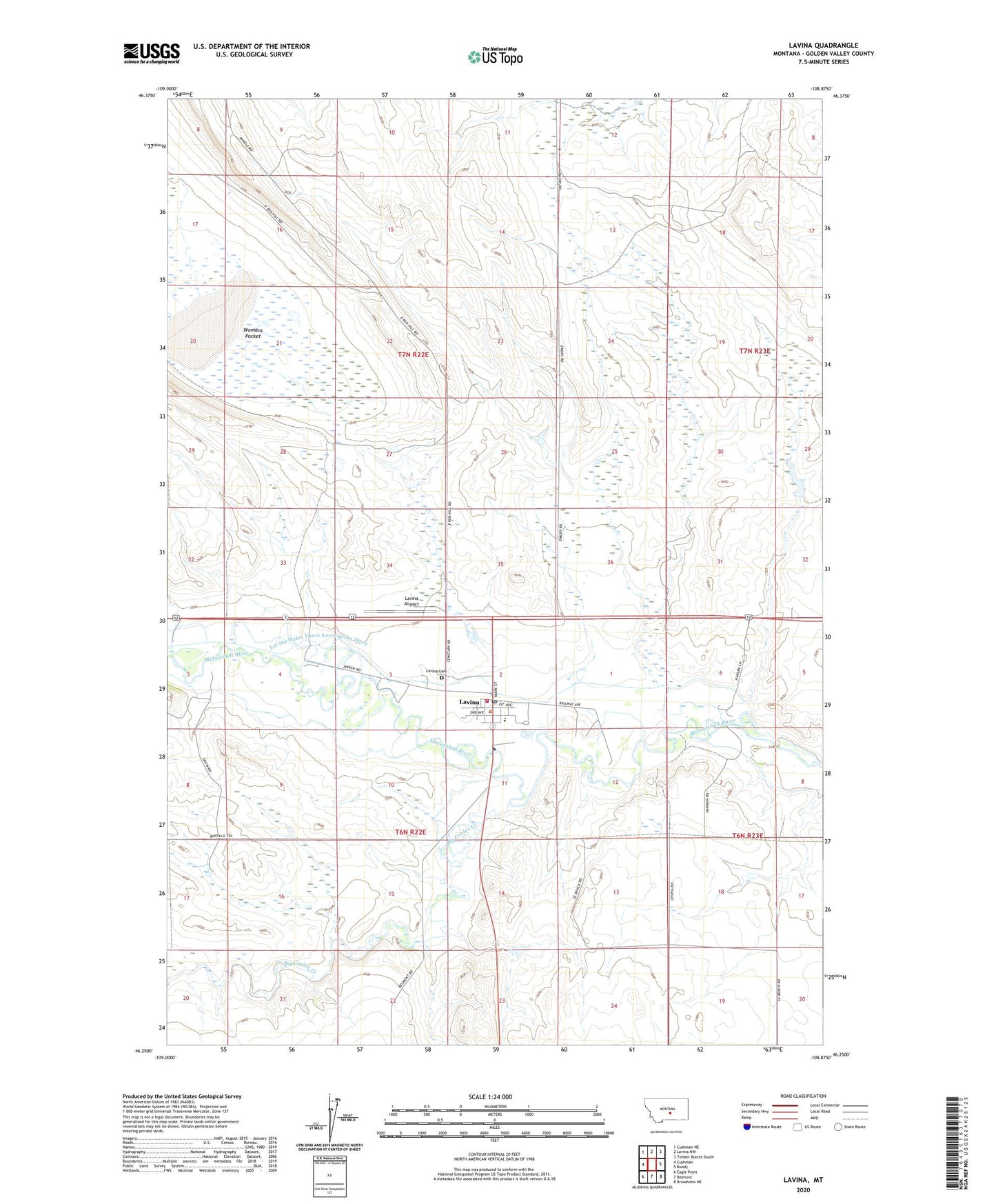
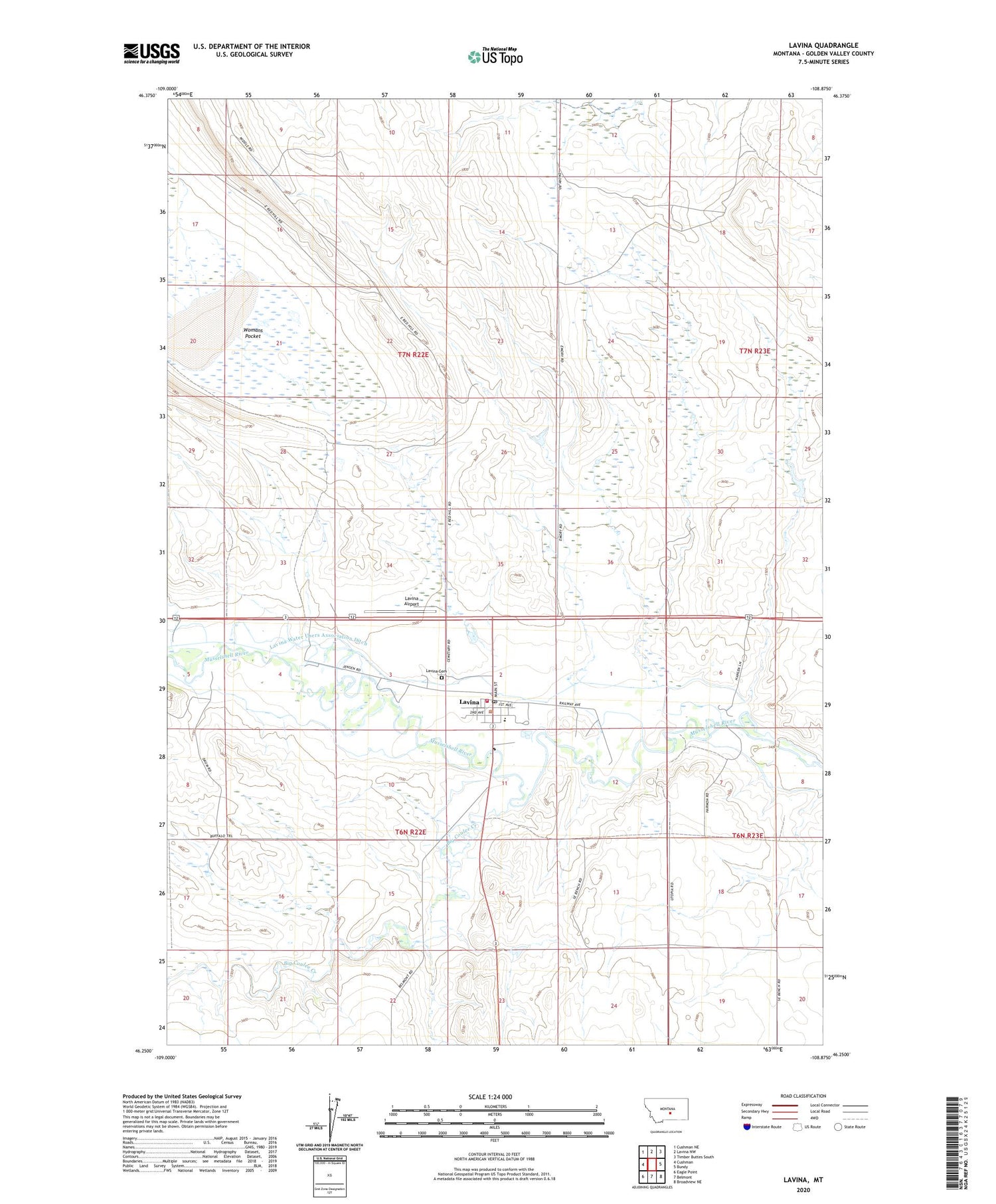
2020 topographic map quadrangle Lavina in the state of Montana. Scale: 1:24000. Based on the newly updated USGS 7.5' US Topo map series, this map is in the following counties: Golden Valley. The map contains contour data, water features, and other items you are used to seeing on USGS maps, but also has updated roads and other features. This is the next generation of topographic maps. Printed on high-quality waterproof paper with UV fade-resistant inks.
Quads adjacent to this one:
West: Cushman
Northwest: Cushman NE
North: Lavina NW
Northeast: Timber Buttes South
East: Bundy
Southeast: Broadview NE
South: Belmont
Southwest: Eagle Point
Contains the following named places: 06N22E02CACB01 Well, 06N22E02DD__01 Well, 06N22E11A___01 Well, 06N23E18CCC_01 Well, 06N23E20CBBB01 Well, 06N46E04DBCA01 Well, 07N22E25B___01 Well, 07N22E25BADA01 Well, 07N22E27CA__01 Well, Big Coulee Creek, Dry Lake, Fivemile Creek, Holy Trinity Lutheran Church, Lavina, Lavina Airport, Lavina Cemetery, Lavina City Park, Lavina Methodist Church, Lavina Post Office, Lavina Public School, Lavina Volunteer Fire Department and Emergency Medical Services, Lavina Water Users Association Ditch, Saint Josephs Catholic Church, Town of Lavina, Womans Pocket