MyTopo
Timber Buttes South Montana US Topo Map
Couldn't load pickup availability
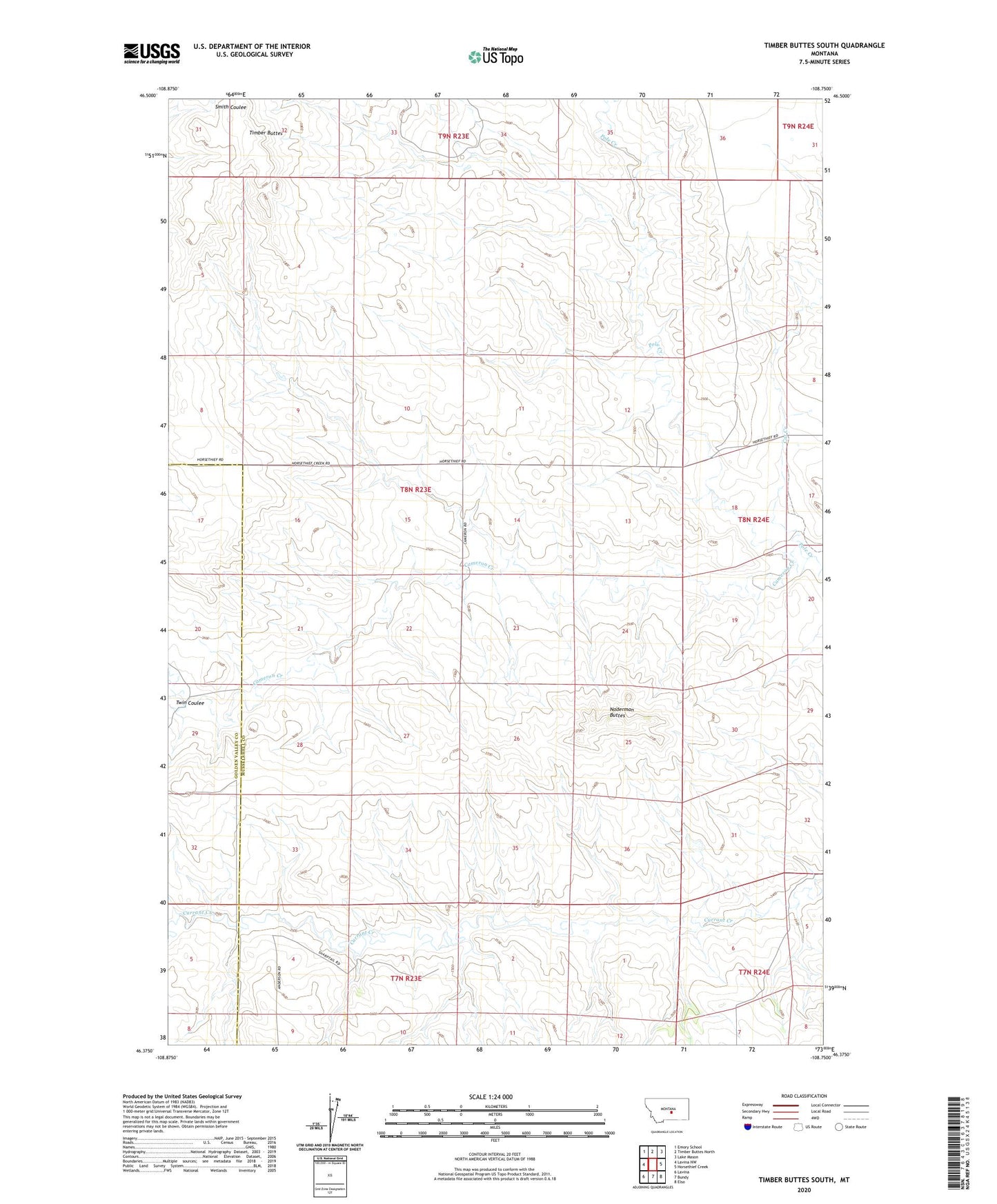
2024 topographic map quadrangle Timber Buttes South in the state of Montana. Scale: 1:24000. Based on the newly updated USGS 7.5' US Topo map series, this map is in the following counties: Musselshell, Golden Valley. The map contains contour data, water features, and other items you are used to seeing on USGS maps, but also has updated roads and other features. This is the next generation of topographic maps. Printed on high-quality waterproof paper with UV fade-resistant inks.
Quads adjacent to this one:
West: Lavina NW
Northwest: Emory School
North: Timber Buttes North
Northeast: Lake Mason
East: Horsethief Creek
Southeast: Elso
South: Bundy
Southwest: Lavina
This map covers the same area as the classic USGS quad with code o46108d7.
Contains the following named places: 08N23E12DBC_01 Well, 08N23E21CDCA01 Well, 08N23E23CCCC01 Well, 08N24E19ACDD01 Well, 09N23E33DDAB01 Well, Cameron Creek, Cat Creek, Naderman Buttes, Pole Creek, Timber Buttes, Twin Coulee