MyTopo
Lignite Creek Montana US Topo Map
Couldn't load pickup availability
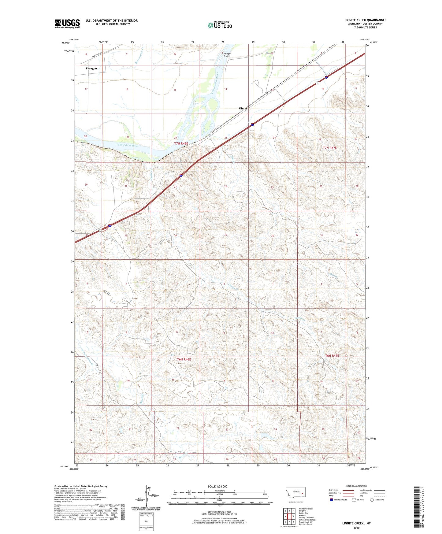
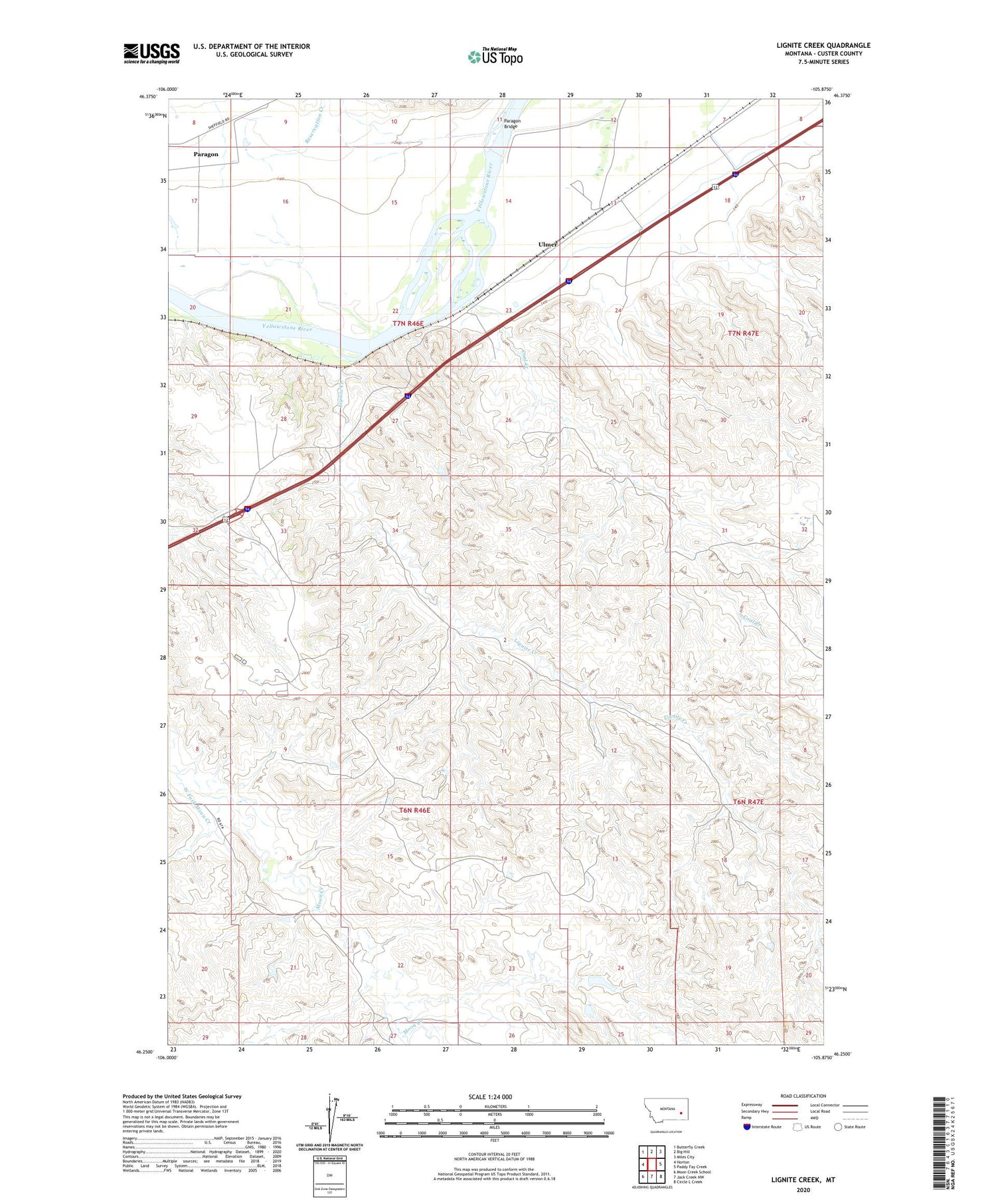
2020 topographic map quadrangle Lignite Creek in the state of Montana. Scale: 1:24000. Based on the newly updated USGS 7.5' US Topo map series, this map is in the following counties: Custer. The map contains contour data, water features, and other items you are used to seeing on USGS maps, but also has updated roads and other features. This is the next generation of topographic maps. Printed on high-quality waterproof paper with UV fade-resistant inks.
Quads adjacent to this one:
West: Horton
Northwest: Butterfly Creek
North: Big Hill
Northeast: Miles City
East: Paddy Fay Creek
Southeast: Circle L Creek
South: Jack Creek NW
Southwest: Moon Creek School
Contains the following named places: 06N46E04CDB_01 Well, 06N46E04DCA_01 Well, 06N46E12ABDA01 Well, 06N46E22CDBA01 Well, 07N46E12DBC_01 Well, 07N46E24ACBD01 Well, 07N47E31CCAA01 Well, Coal Creek, Fort Keogh Livestock and Range Research Station, Lignite, Lignite Creek, Miles City Air Force Station, Paragon Bridge, Reservation Creek, Ulmer, West Fork Moon Creek