MyTopo
Butterfly Creek Montana US Topo Map
Couldn't load pickup availability
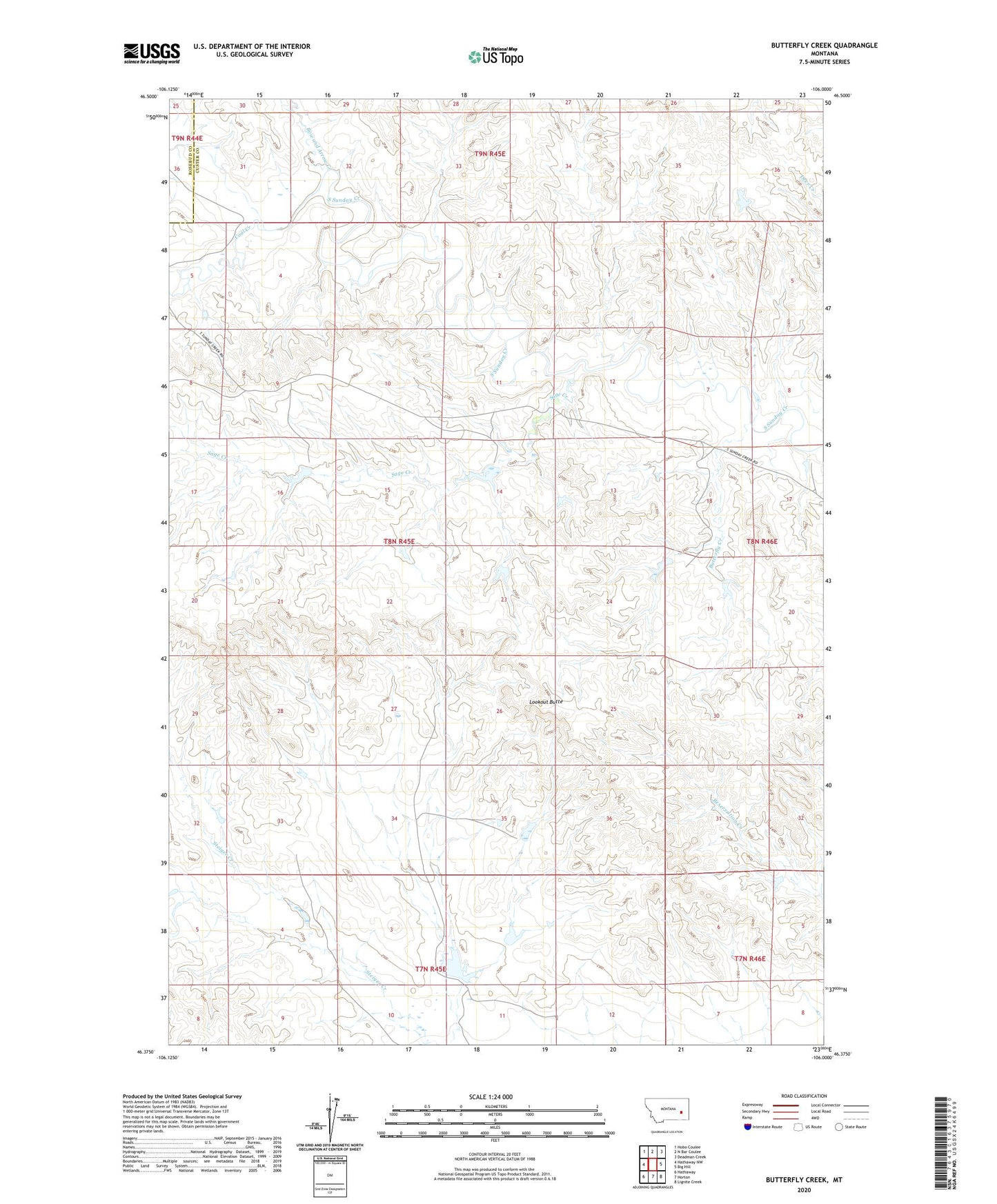
2024 topographic map quadrangle Butterfly Creek in the state of Montana. Scale: 1:24000. Based on the newly updated USGS 7.5' US Topo map series, this map is in the following counties: Custer, Rosebud. The map contains contour data, water features, and other items you are used to seeing on USGS maps, but also has updated roads and other features. This is the next generation of topographic maps. Printed on high-quality waterproof paper with UV fade-resistant inks.
Quads adjacent to this one:
West: Hathaway NW
Northwest: Hobo Coulee
North: N Bar Coulee
Northeast: Deadman Creek
East: Big Hill
Southeast: Lignite Creek
South: Horton
Southwest: Hathaway
This map covers the same area as the classic USGS quad with code o46106d1.
Contains the following named places: 08N45E28ACAB01 Well, Bow and Arrow Creek, Brewer Number 3 Dam, Butterfly Creek, Clark Dam, Coal Creek, French Number 1 Dam, French Number 12 Dam, French Number 2 Dam, French Number 5 Dam, French Number 8 Dam, Heckmiller Number 1 Dam, Larson Number 2 Dam, Larson Number 3 Dam, Lookout Butte, Sage Creek