MyTopo
Horton Montana US Topo Map
Couldn't load pickup availability
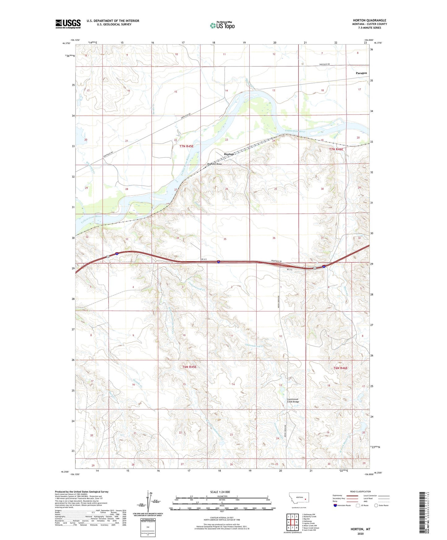
2024 topographic map quadrangle Horton in the state of Montana. Scale: 1:24000. Based on the newly updated USGS 7.5' US Topo map series, this map is in the following counties: Custer. The map contains contour data, water features, and other items you are used to seeing on USGS maps, but also has updated roads and other features. This is the next generation of topographic maps. Printed on high-quality waterproof paper with UV fade-resistant inks.
Quads adjacent to this one:
West: Hathaway
Northwest: Hathaway NW
North: Butterfly Creek
Northeast: Big Hill
East: Lignite Creek
Southeast: Jack Creek NW
South: Moon Creek School
Southwest: Miller Creek NW
This map covers the same area as the classic USGS quad with code o46106c1.
Contains the following named places: 07N45E24CDDD01 Well, 07N46E19DADA01 Well, Clermont, Cottonwood Creek, Cottonwood Creek Bridge, Dry Creek, Horton, Horton Post Office, Lockie Number 1 Dam, Lockie Number 5 Dam, Lockie Number 6 Dam, Monarch Number 3 Dam, Moon Creek, Paragon, Reynold Draw, Sadie, Sadie Post Office, Steiger Creek, Swede Creek, West Fork Cottonwood Creek, Whitetail Creek, Whitetail Dam