MyTopo
Lisk Creek Montana US Topo Map
Couldn't load pickup availability
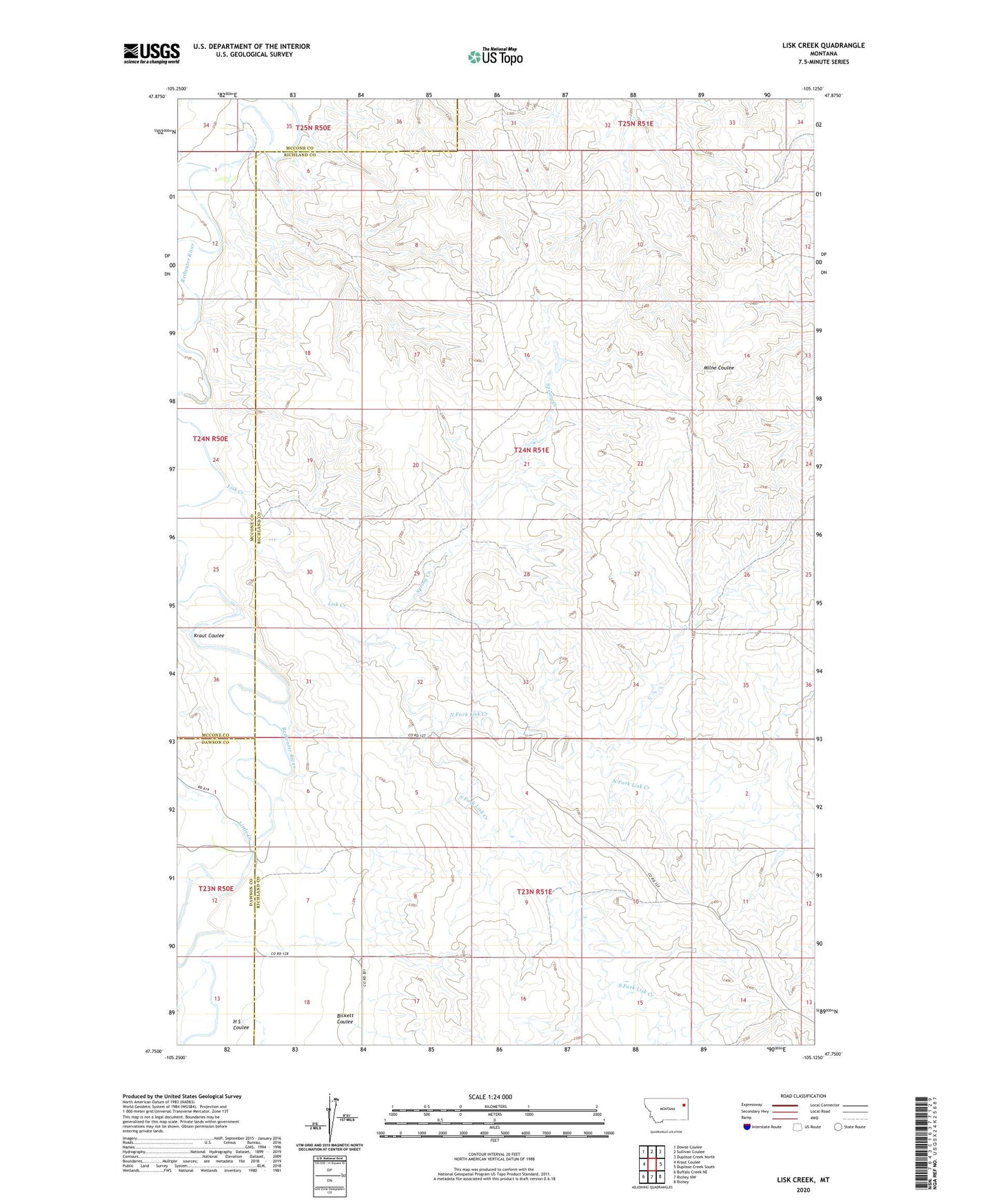
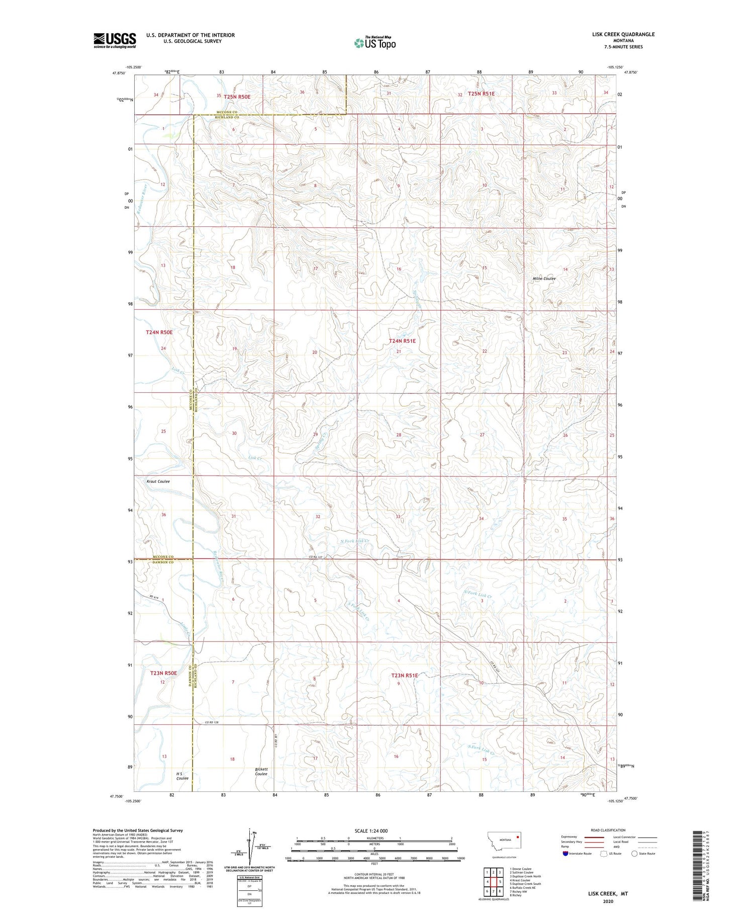
2020 topographic map quadrangle Lisk Creek in the state of Montana. Scale: 1:24000. Based on the newly updated USGS 7.5' US Topo map series, this map is in the following counties: Richland, McCone, Dawson. The map contains contour data, water features, and other items you are used to seeing on USGS maps, but also has updated roads and other features. This is the next generation of topographic maps. Printed on high-quality waterproof paper with UV fade-resistant inks.
Quads adjacent to this one:
West: Kraut Coulee
Northwest: Dowse Coulee
North: Sullivan Coulee
Northeast: Duplisse Creek North
East: Duplisse Creek South
Southeast: Richey
South: Richey NW
Southwest: Buffalo Creek NE
Contains the following named places: 23N51E04ABBB01 Well, 23N51E04ABBC01 Well, 23N51E04ABBC02 Well, 24N51E08CBCD01 Well, 24N51E18D___01 Well, 25N50E35DBAA01 Well, 25N50E36CBBB01 Well, Bickett Coulee, H S Coulee, Kraut Coulee, Lisk Creek, Little Creek, North Fork Lisk Creek, South Fork Lisk Creek, Spring Creek, Wolf Creek