MyTopo
Richey Montana US Topo Map
Couldn't load pickup availability
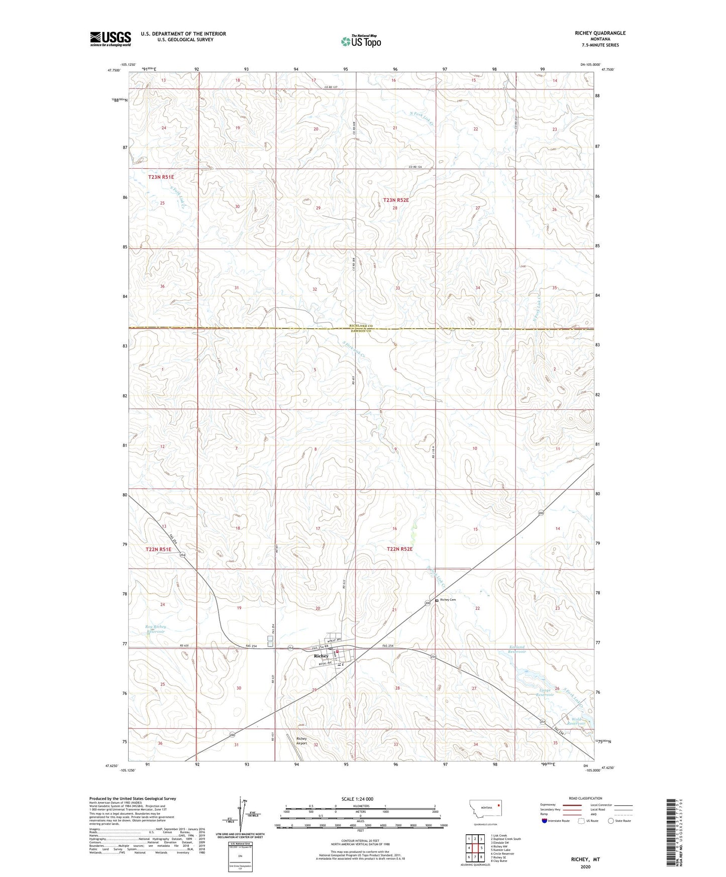
2024 topographic map quadrangle Richey in the state of Montana. Scale: 1:24000. Based on the newly updated USGS 7.5' US Topo map series, this map is in the following counties: Dawson, Richland. The map contains contour data, water features, and other items you are used to seeing on USGS maps, but also has updated roads and other features. This is the next generation of topographic maps. Printed on high-quality waterproof paper with UV fade-resistant inks.
Quads adjacent to this one:
West: Richey NW
Northwest: Lisk Creek
North: Duplisse Creek South
Northeast: Elmdale SW
East: Kuester Lake
Southeast: Clay Butte
South: Richey SE
Southwest: Circle Reservoir
This map covers the same area as the classic USGS quad with code o47105f1.
Contains the following named places: 22N51E01ADDA01 Well, 22N52E04CABD01 Well, 22N52E06BACA01 Well, 22N52E14BACD01 Well, 22N52E17BACC01 Well, 22N52E20DC__01 Well, 22N52E28B___01 Well, 22N52E30ABBD01 Well, 22N52E30ABBD02 Well, 22N52E30ADDC01 Well, 22N52E30DCCD01 Well, 22N52E33ABBA01 Well, 23N52E14DCCD01 Well, 23N52E15DDCA01 Well, 23N52E20DABD01 Well, 23N52E22BDDC01 Well, 23N52E27BBAD01 Well, 23N52E28AAAC01 Well, 23N52E29CDDC01 Well, 23N52E32DCDA01 Well, 23N52E32DCDB01 Well, 23N52E34AADD01 Well, 59259, American Lutheran Church of Richey, Christian and Missionary Alliance Church, Christian Science Church, Ding-A-Ling Dam, Farmers Elevator, Keeland Reservoir, Lisk School, Longs Reservoir, Richey, Richey Airport, Richey Ambulance Service, Richey Cemetery, Richey Community Park, Richey Historical Marker, Richey Historical Museum, Richey Post Office, Richey Public Library, Richey Public Schools, Richey Rest Area, Richey Trailer Court, Richey Volunteer Fire Department, Roy Richey Dam, Roy Richey Reservoir, Saint Frances De Sales Catholic Church, Senner Number 1 Dam, Town of Richey, United Methodist Church, Wold Dam