MyTopo
Little Bear Lake Montana US Topo Map
Couldn't load pickup availability
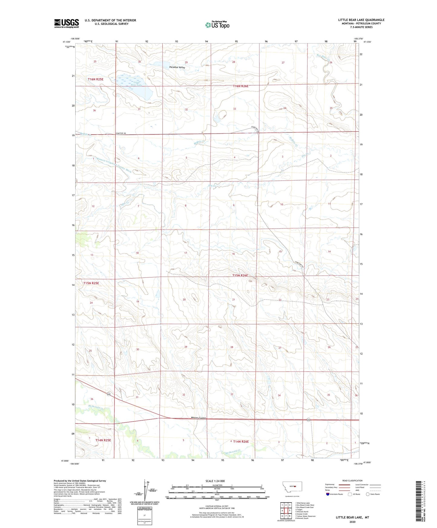
2024 topographic map quadrangle Little Bear Lake in the state of Montana. Scale: 1:24000. Based on the newly updated USGS 7.5' US Topo map series, this map is in the following counties: Petroleum. The map contains contour data, water features, and other items you are used to seeing on USGS maps, but also has updated roads and other features. This is the next generation of topographic maps. Printed on high-quality waterproof paper with UV fade-resistant inks.
Quads adjacent to this one:
West: Teigen
Northwest: Wild Horse Lake
North: Dry Blood Creek West
Northeast: Dry Blood Creek East
East: Winnett North
Southeast: Winnett South
South: Yellow Water Reservoir
Southwest: Snoose Creek
This map covers the same area as the classic USGS quad with code o47108a4.
Contains the following named places: 14N26E02CAD_01 Well, 15N25E24DBD_01 Well, Brady Number 1 Dam, Dry Creek, Little Bear Lake, Payola Dam, Schellenberger School, US Number 37 Dam, US Number 38 Dam, Whites Coulee, Wilson School