MyTopo
Locate Montana US Topo Map
Couldn't load pickup availability
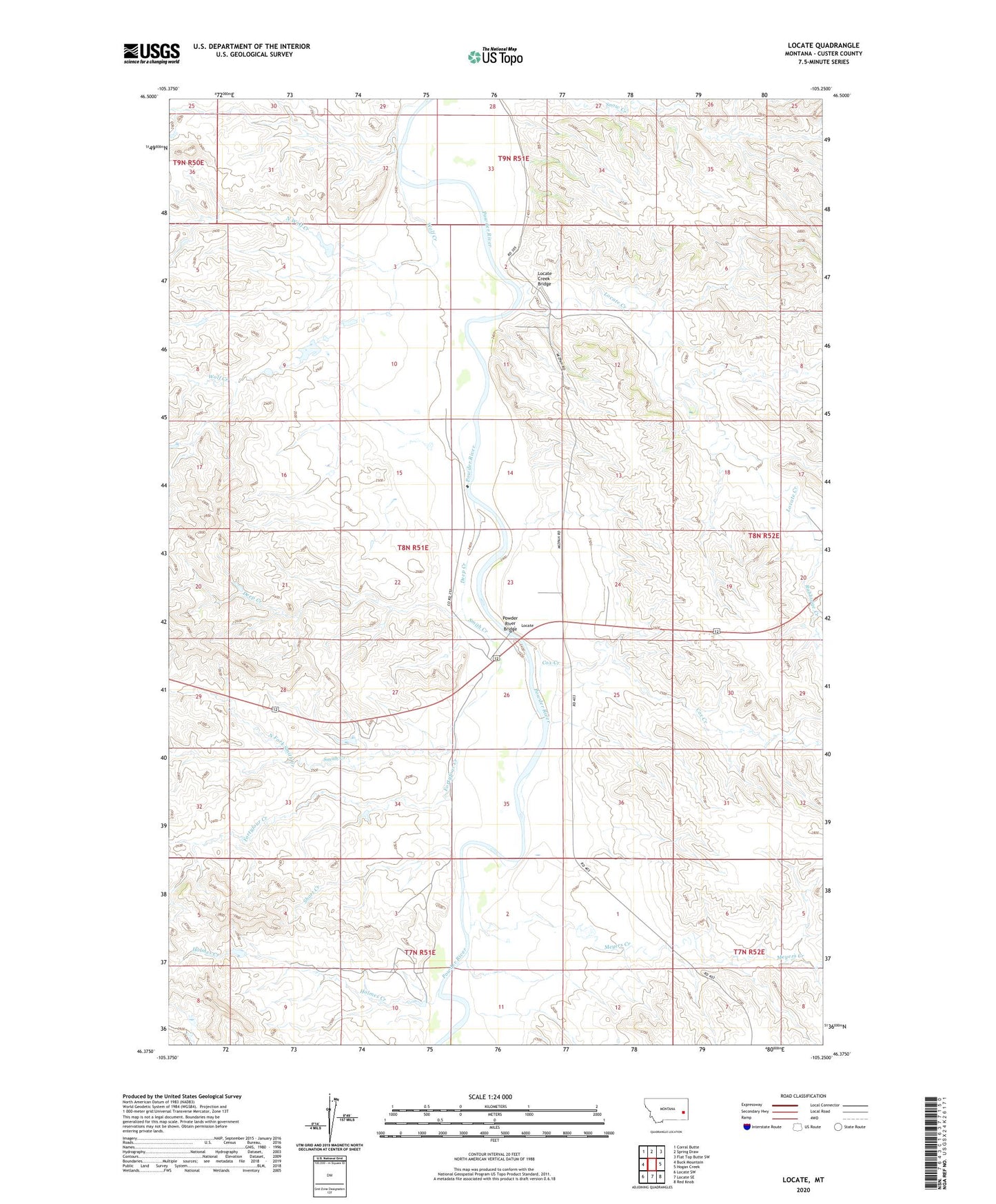
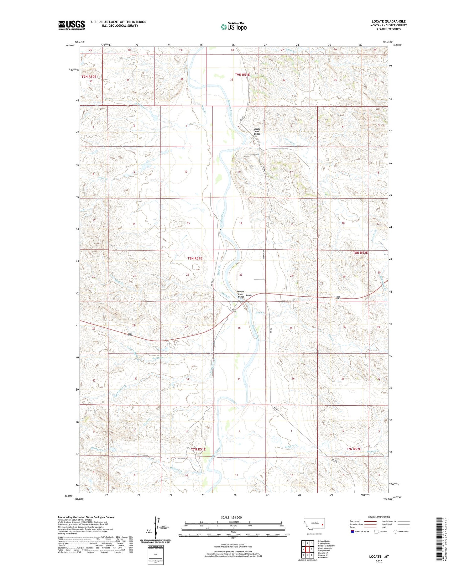
2020 topographic map quadrangle Locate in the state of Montana. Scale: 1:24000. Based on the newly updated USGS 7.5' US Topo map series, this map is in the following counties: Custer. The map contains contour data, water features, and other items you are used to seeing on USGS maps, but also has updated roads and other features. This is the next generation of topographic maps. Printed on high-quality waterproof paper with UV fade-resistant inks.
Quads adjacent to this one:
West: Buck Mountain
Northwest: Corral Butte
North: Spring Draw
Northeast: Flat Top Butte SW
East: Hogan Creek
Southeast: Red Knob
South: Locate SE
Southwest: Locate SW
Contains the following named places: 08N51E09ACAC01 Well, 08N51E10DDAA01 Well, 08N51E10DDAD01 Well, 08N51E14CBBD01 Well, 08N51E14DC__01 Well, 08N51E15ABDA01 Well, 08N51E22DD__01 Well, 08N51E23DD__01 Well, 08N51E25BACA01 Well, 08N51E26BBBA01 Well, 08N51E26CC__01 Well, 08N51E33CACB01 Well, 08N53E33AABA01 Well, Bixler Number 2 Dam, Bixler Number 5 Dam, Cox Creek, Deep Creek, Fortyfour Creek, Griffin Number 2 Dam, Holmes Creek, Holmes Flowing Well, Locate, Locate Creek, Locate Creek Bridge, Locate Post Office, Locate School, Meyers Creek, North Fork Smith Creek, North Wolf Creek, Odegard Number 2 Dam, Powder River Bridge, Powder River Historical Marker, Rabbidge Creek, Short Creek, Smith Creek, Wolf Creek