MyTopo
Lookout Pass Montana US Topo Map
Couldn't load pickup availability
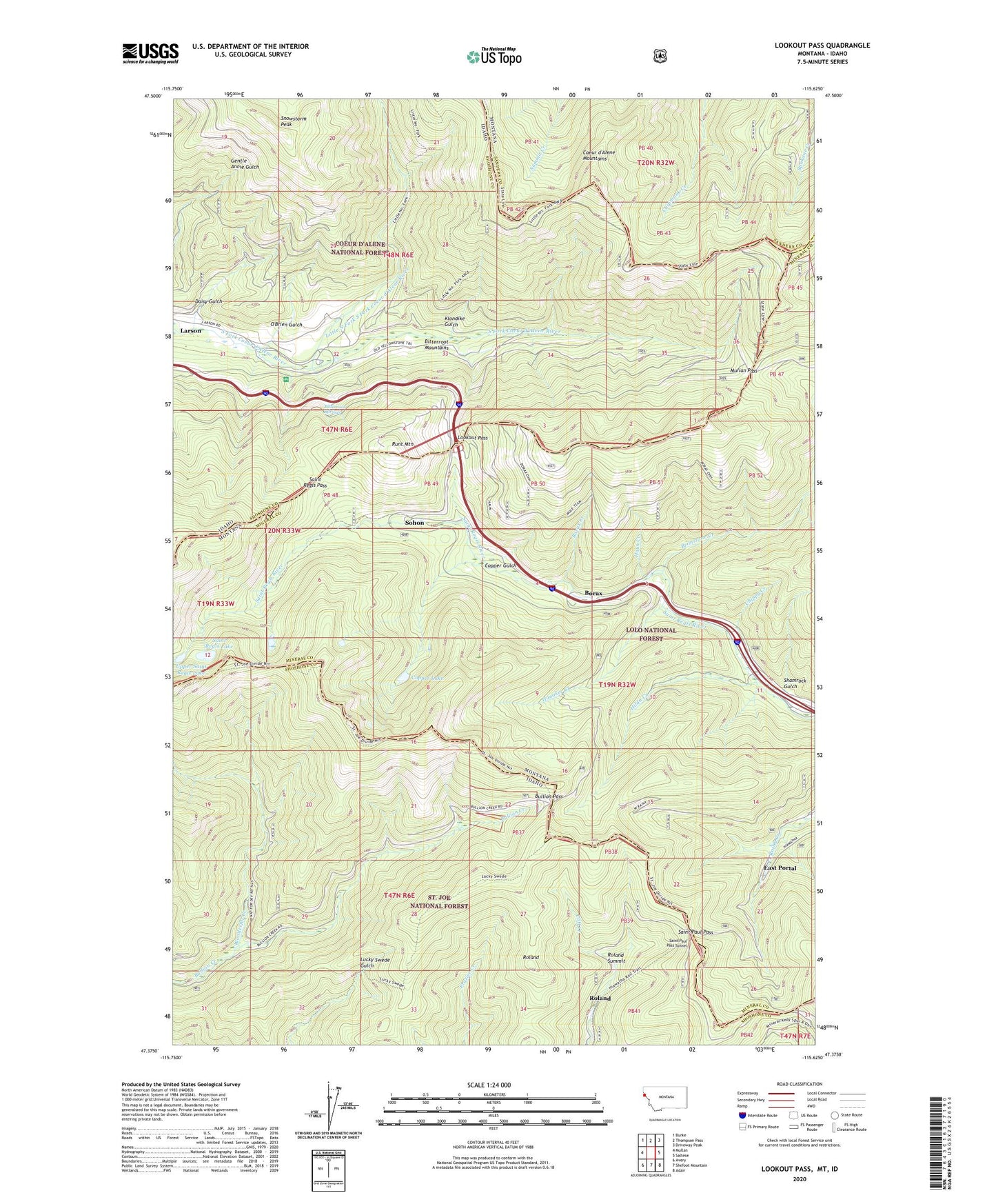
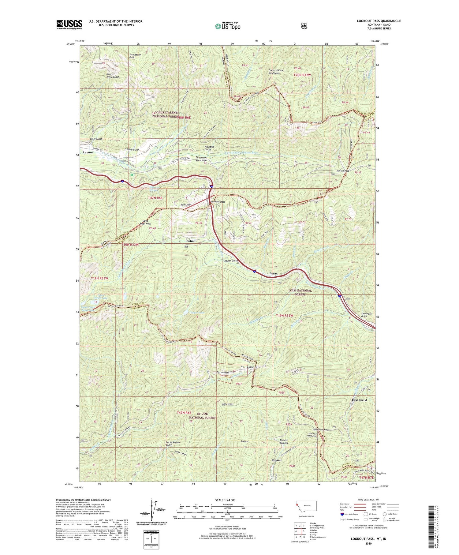
2020 topographic map quadrangle Lookout Pass in the states of Idaho, Montana. Scale: 1:24000. Based on the newly updated USGS 7.5' US Topo map series, this map is in the following counties: Mineral, Shoshone, Sanders. The map contains contour data, water features, and other items you are used to seeing on USGS maps, but also has updated roads and other features. This is the next generation of topographic maps. Printed on high-quality waterproof paper with UV fade-resistant inks.
Quads adjacent to this one:
West: Mullan
Northwest: Burke
North: Thompson Pass
Northeast: Driveway Peak
East: Saltese
Southeast: Adair
South: Shefoot Mountain
Southwest: Avery
Contains the following named places: Beacon Light Mines, Bitterroot Mountains, Bitterroot Springs, Borax, Borax Creek, Borax School, Brimstone Creek, Bullion, Bullion Mine, Bullion Pass, Chippy Creek, Copper Gulch, Copper Lake, Daisy Gulch, Denemora Mine, Denna Mora Campground, Denna Mora Creek, Dorsey, East Portal, Hanaker Creek, Haun Creek, Hilda Creek, Holacaust Historical Marker, Klondike Gulch, Larson, Little North Fork South Fork Coeur d'Alene River, Lookout, Lookout Pass, Lookout Pass Ski Area, Lucky Calumet Mine, Lucky Swede Mine, Mullan Hatchery, Mullan Pass, Mullan Road Historical Marker, O'Brien Gulch, Pottsville, Rattlesnake Creek, Roland, Roland Point, Roland Summit, Runt Mountain, Safety Spur, Saint Paul Pass, Saint Paul Pass Tunnel, Saint Regis Lake, Saint Regis Pass, Saltese Rest Area, Shamrock Gulch, Shoshone Park, Shoshone Park Recreation Area, Sildex/Amazon-Dixie Mine, Sildix, Slidex Mine, Snowstorm Mine, Snowstorm Mines, Snowstorm Peak, Sohon, Tammany, Upper Amazon-Dixie Mine, Upper Saint Regis Lake, Wonderful Creek, Wonderful Mine