MyTopo
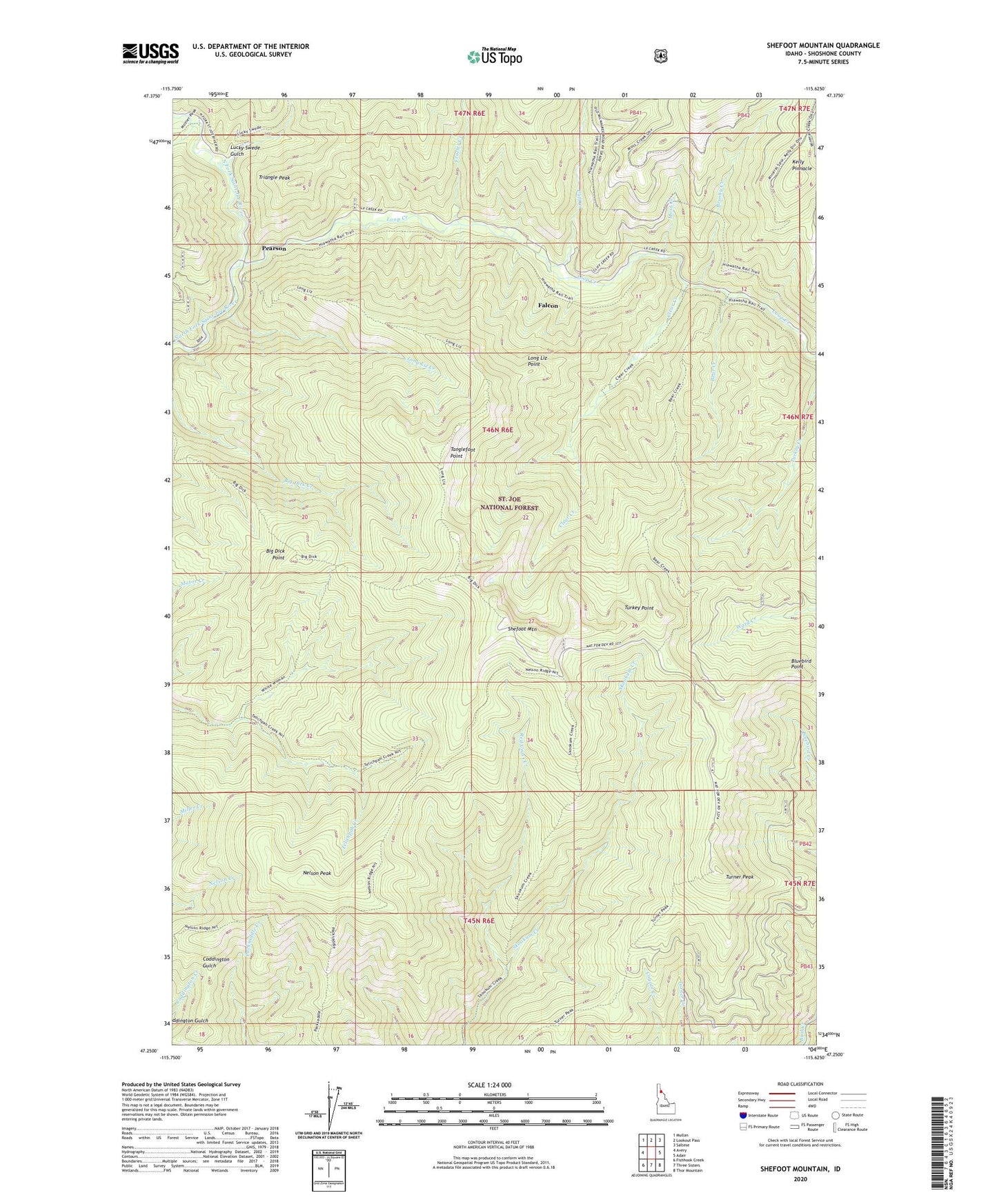
Shefoot Mountain Idaho US Topo Map
Couldn't load pickup availability
Also explore the Shefoot Mountain Forest Service Topo of this same quad for updated USFS data
2024 topographic map quadrangle Shefoot Mountain in the state of Idaho. Scale: 1:24000. Based on the newly updated USGS 7.5' US Topo map series, this map is in the following counties: Shoshone. The map contains contour data, water features, and other items you are used to seeing on USGS maps, but also has updated roads and other features. This is the next generation of topographic maps. Printed on high-quality waterproof paper with UV fade-resistant inks.
Quads adjacent to this one:
West: Avery
Northwest: Mullan
North: Lookout Pass
Northeast: Saltese
East: Adair
Southeast: Thor Mountain
South: Three Sisters
Southwest: Fishhook Creek
This map covers the same area as the classic USGS quad with code o47115c6.
Contains the following named places: Bear Creek, Big Dick Point, Bluebird Point, Bogle, Brushy Creek, Clear Creek, Cliff Creek, Falcon, Frazier Creek, Kelly Pinnacle, Long Liz Creek, Long Liz Point, Loop Creek, Lucky Swede Gulch, Moss Creek, Mozier Creek, Nelson Peak, Nelson Peak Trail, Old North Star Mine, Pearson, Red Cross Creek, Shefoot Mountain, Tanglefoot Point, Triangle Peak, Turkey Point, Turner Peak