MyTopo
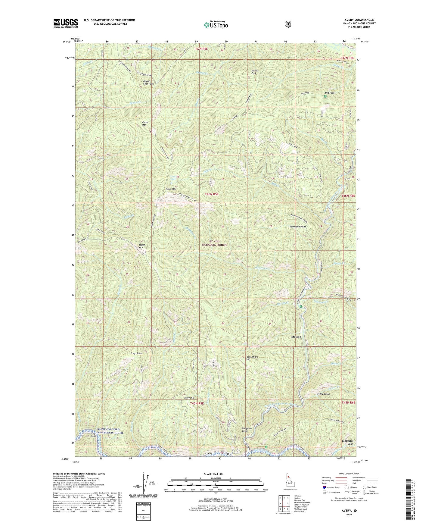
Avery Idaho US Topo Map
Couldn't load pickup availability
Also explore the Avery Forest Service Topo of this same quad for updated USFS data
2024 topographic map quadrangle Avery in the state of Idaho. Scale: 1:24000. Based on the newly updated USGS 7.5' US Topo map series, this map is in the following counties: Shoshone. The map contains contour data, water features, and other items you are used to seeing on USGS maps, but also has updated roads and other features. This is the next generation of topographic maps. Printed on high-quality waterproof paper with UV fade-resistant inks.
Quads adjacent to this one:
West: Mastodon Mountain
Northwest: Wallace
North: Mullan
Northeast: Lookout Pass
East: Shefoot Mountain
Southeast: Three Sisters
South: Fishhook Creek
Southwest: Hoyt Mountain
This map covers the same area as the classic USGS quad with code o47115c7.
Contains the following named places: Arid Peak, Arid Ridge Trail, Avery, Avery Creek, Avery Elementary - Junior High School, Avery Guard Station, Avery Hill, Avery Post Office, Benchmark Hill, Big Dick Creek, Cedar Lake, Cedar Mountain, Cedar Mountain Trail, Fortynine Gulch, Glen Creek, Hammond Creek, Hammond Point, Jitney Gulch, Kyle, Kyle Creek, Kyle Creek Trail, Marcus Cook Peak, Miller Creek, Motor Creek, Mozier Peak, Nelson Creek, North Fork Saint Joe River, Rye Creek, Setzer Creek, Stetson, Stetson Creek, Storm Creek, Storm Mountain, Telichpah Campground, Telichpah Creek, Theriault Creek, Trego Gulch, Trego Point, Trego Point Trail