MyTopo
Lost River Montana US Topo Map
Couldn't load pickup availability
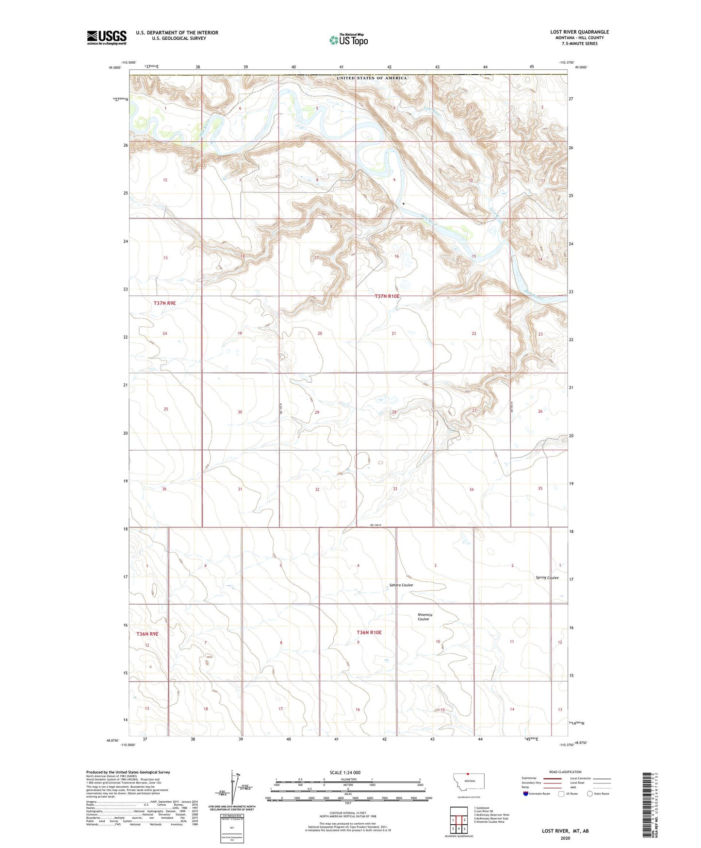
2024 topographic map quadrangle Lost River in the state of Montana. Scale: 1:24000. Based on the newly updated USGS 7.5' US Topo map series, this map is in the following counties: Hill. The map contains contour data, water features, and other items you are used to seeing on USGS maps, but also has updated roads and other features. This is the next generation of topographic maps. Printed on high-quality waterproof paper with UV fade-resistant inks.
Quads adjacent to this one:
West: Goldstone
East: Lost River NE
Southeast: Ninemile Coulee West
South: McKinnsey Reservoir East
Southwest: McKinnsey Reservoir West
This map covers the same area as the classic USGS quad with code o48110h4.
Contains the following named places: 36N10E06DDCC01 Well, 37N10E34AAAB01 Well, Fairchild Post Office, Lost River, Sahara Coulee