MyTopo
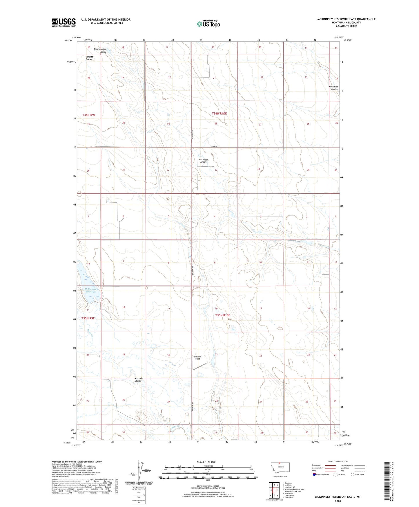
McKinnsey Reservoir East Montana US Topo Map
Couldn't load pickup availability
2024 topographic map quadrangle McKinnsey Reservoir East in the state of Montana. Scale: 1:24000. Based on the newly updated USGS 7.5' US Topo map series, this map is in the following counties: Hill. The map contains contour data, water features, and other items you are used to seeing on USGS maps, but also has updated roads and other features. This is the next generation of topographic maps. Printed on high-quality waterproof paper with UV fade-resistant inks.
Quads adjacent to this one:
West: McKinnsey Reservoir West
Northwest: Goldstone
North: Lost River
Northeast: Lost River NE
East: Ninemile Coulee West
Southeast: Gildford NE
South: Gildford NW
Southwest: Rudyard NE
This map covers the same area as the classic USGS quad with code o48110g4.
Contains the following named places: 35N10E04CBCD01 Well, 36N10E21BDBA01 Well, 36N10E32DAAA01 Well, Capricorn Dam, Hausman Post Office, Hutchinson Airport, Libra Dam, Lincolns Field, Mariner School, McKinnsey Reservoir, McKinnsey Reservoir Dam, Miranda Coulee