MyTopo
Lower Crow Reservoir Montana US Topo Map
Couldn't load pickup availability
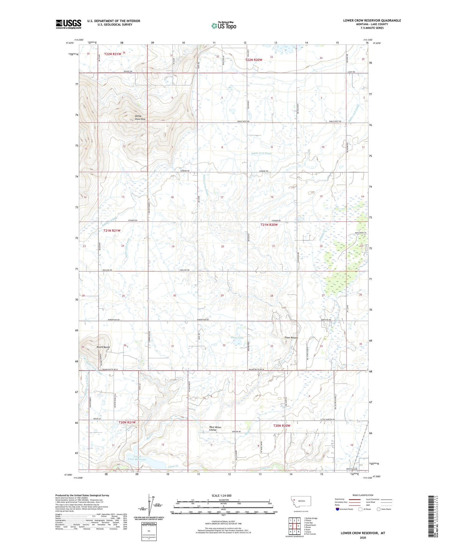
2024 topographic map quadrangle Lower Crow Reservoir in the state of Montana. Scale: 1:24000. Based on the newly updated USGS 7.5' US Topo map series, this map is in the following counties: Lake. The map contains contour data, water features, and other items you are used to seeing on USGS maps, but also has updated roads and other features. This is the next generation of topographic maps. Printed on high-quality waterproof paper with UV fade-resistant inks.
Quads adjacent to this one:
West: Round Butte
Northwest: Buffalo Bridge
North: Polson
Northeast: East Bay
East: Ronan
Southeast: Fort Connah
South: Charlo
Southwest: Sloan
This map covers the same area as the classic USGS quad with code o47114e2.
Contains the following named places: 20N20W03CCA_01 Well, 20N20W04BAA_01 Well, 20N20W05BBA_01 Well, 20N20W05DDD_01 Well, 20N20W07AAAD01 Well, 20N20W07ABDC01 Well, 20N20W07ABDD01 Well, 20N21W01AAA_01 Well, 20N21W02BCD_01 Well, 21N20W05CBBB01 Well, 21N20W09AAAB01 Well, 21N20W15BAA_01 Well, 21N20W17BCC_01 Well, 21N20W19BCB_01 Well, 21N20W20AADA01 Well, 21N20W21ADD_01 Well, 21N20W22BABA01 Well, 21N20W23BDD_01 Well, 21N20W27BBCC01 Well, 21N20W28BBA_01 Well, 21N20W31AABB01 Well, 21N20W33AAA_01 Well, 21N20W35CDC_01 Well, 21N21W02AAD_01 Well, 21N21W25BBB_01 Well, 21N21W26DAD_01 Well, 21N21W36CBA_01 Well, 22N20W31CDD_01 Well, Crow Dam, Flathead Division, Lower Crow Reservoir, Mission Mountain Country Club, Mud Creek, Pablo 10A Canal, Pablo 13A Canal, Pablo 31 A 07 Canal, Pablo 37A Canal, Pablo 37A4 Canal, Pablo 37Aa Canal, Pablo 50A Canal, Pablo 53A Canal, Pablo 71A Canal, Pablo 7oA Canal, Pablo A Canal, Pablo District, Round Butte, Sloan Buttes, Sloan Lake, Stinger Creek, Valley View Hills, West Miller Coulee