MyTopo
Buffalo Bridge Montana US Topo Map
Couldn't load pickup availability
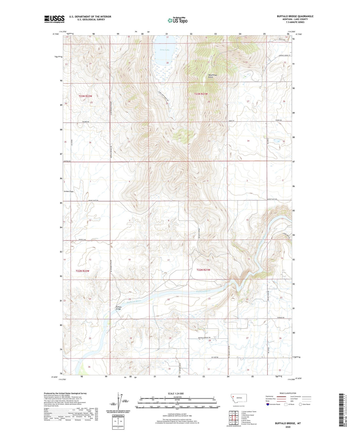
2024 topographic map quadrangle Buffalo Bridge in the state of Montana. Scale: 1:24000. Based on the newly updated USGS 7.5' US Topo map series, this map is in the following counties: Lake. The map contains contour data, water features, and other items you are used to seeing on USGS maps, but also has updated roads and other features. This is the next generation of topographic maps. Printed on high-quality waterproof paper with UV fade-resistant inks.
Quads adjacent to this one:
West: Irvine Hill
Northwest: Irvine Lookout Tower
North: Elmo
Northeast: Wild Horse Island
East: Polson
Southeast: Lower Crow Reservoir
South: Round Butte
Southwest: Oliver Point
This map covers the same area as the classic USGS quad with code o47114f3.
Contains the following named places: 22N21W07ABC_01 Well, 22N21W09BCB_01 Well, 22N21W09BCBC01 Well, 22N21W17AAC_01 Well, 22N21W26ABB_01 Well, 22N21W28ACD_01 Well, 22N21W28DDDC01 Well, 22N21W28DDDD01 Well, 22N21W29ADD_01 Well, 22N21W30CBBA01 Well, 22N21W32ABAB01 Well, 22N21W35ABB_01 Well, 22N22W01CAA_01 Well, 22N22W01CAAA01 Well, 22N22W12ACD_01 Well, 22N22W13AAD_01 Well, 22N22W13ABD_01 Well, 22N22W24DAAA01 Well, 22N22W26DDDD01 Well, 23N21W19CBC_01 Well, 23N21W20BCB_01 Well, 23N21W23BCAA01 Well, 23N21W23CDC_01 Well, 23N21W26BAC_01 Well, 23N21W34AAAA01 Well, 23N21W34ADD_01 Well, 23N21W35BBA_01 Well, 23N22W25DBC_01 Well, 23N22W36CAA_01 Well, Buffalo Bridge, Loon Lake, Norrisvale Post Office, Pablo 31 A Canal, Radio Post Office, Radio School, Spring Valley, Spring Valley School, Valley View Community Center, Valley View School, White Earth Creek